Old Maps of Janice, Mississippi for Genealogy
Trace your family roots with 14 historic maps of Janice. These high-res maps reveal old neighborhoods, homesites, landmarks, and streets — helping you uncover where your ancestors lived and how the area evolved over time.
- Explore historic neighborhoods: Identify where your relatives may have lived in the 1800s or 1900s.
- Compare maps over time: Trace the changes in streets, buildings, and landmarks for multi-generational research.
- Perfect for genealogy & ancestry research: Used by family historians and researchers to map out lineage and migration.
These maps are an incredible resource for exploring your personal connection to Janice's past.
Janice, MS maps
(14)- 1947 Map of New Augusta, 1965 Print
 1947 New Augusta1965 Print · USGSThe mid-century landscape of Perry and Forrest Counties is defined here by the growth of Camp Shelby and the vast De Soto National Forest. Genealogists and historians can trace old family sites like Granny Bounds Cem and vanished landmarks like the abandoned CCC Camp.3 unique versions available
 - 1949 Map of New Augusta
 1949 New Augusta1949 Print · USGSIn the late 1940s, this area of southern Mississippi was defined by the intersection of military training at Camp Shelby and the lush De Soto National Forest. Researchers can trace rural life through landmarks like Old Augusta, McLaurin Landing Field, and the Barett Fire Tower.2 unique versions available
 - 1953 Map of Hattiesburg, 1965 Print
 1953 Hattiesburg1965 Print · USGSSouth Mississippi and western Alabama are shown here during the mid-twentieth century as the timber and rail industries shaped the region. Genealogists and historians can trace rail lines like the Mississippi Central and locate rural centers such as Magee, Richton, and Mount Vernon.4 unique versions available
 - 1958 Map of Hattiesburg
 1958 Hattiesburg1958 Print · USGSSoutheastern Mississippi's timber and rail networks are at their peak during the late fifties, centered on the growing hubs of Hattiesburg and Laurel. Researchers can trace old family landmarks like Sims Chapel, the Busbey Game Refuge, and the vanished stops along the Mississippi Central railroad.2 unique versions available
 - 1983 Map of Janice
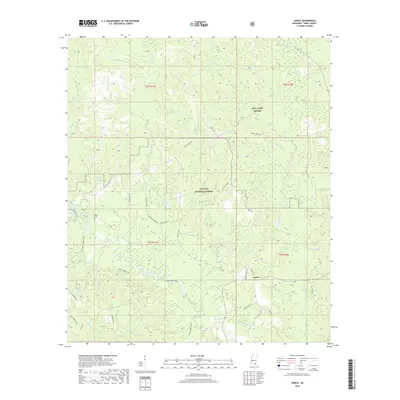
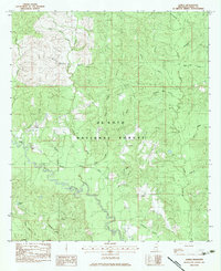 1983 Janice1983 Print · USGSPerry County's pine forests and winding waterways are captured here in the early eighties. Genealogists and local historians can locate rural landmarks like Mixon Cem, St John Ch, and the creek-side settlement of Janice.
 - 1984 Map of Hattiesburg
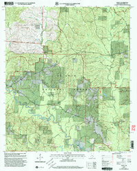
 1984 Hattiesburg1984 Print · USGSSouth Mississippi’s Pine Belt is seen here in the mid-eighties, showing the region as a hub of timber production and petroleum extraction. Trace the rail lines of the Illinois Central Gulf RR through old settlements like Richton or the energy developments at the Heidelberg Oil Field.2 unique versions available
 - 1984 Map of Hattiesburg
 1984 Hattiesburg1984 Print · USGSSouth Mississippi’s timber and military heartland comes into focus during the mid-eighties, centering on the hub of Hattiesburg and the winding Pearl River. Researchers can trace the rail lines of the Illinois Central Gulf through old towns like Bassfield and Sumrall, or locate rural landmarks like Society Hill Ch.
 - 1994 Map of Hattiesburg, 1995 Print
 1994 Hattiesburg1995 Print · USGSSouth-central Mississippi's river valleys and timberlands are seen here in the mid-1990s as the region's transport network matured. Researchers can trace rural lineages through sites like Old Pioneer Cem and Spring Cottage or explore the vast Camp Shelby Military Reservation.
 - 2000 Map of Janice, 2003 Print
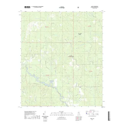
 2000 Janice2003 Print · USGSSoutheast Mississippi's pine forests and river bottoms are shown at the turn of the century as the De Soto National Forest and military training grounds expanded. Genealogists and historians can locate Janice, Oak Grove Ch, and Mixon Cem along the winding Black Creek.
 - 2012 Map of Janice, 2012 Print
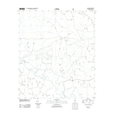 2012 Janice2012 Print · USGSCovers Janice, including Perry County, United States, and other nearby areas
 - 2015 Map of Janice, 2015 Print
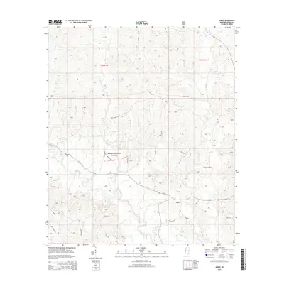 2015 Janice2015 Print · USGSCovers Janice, including Perry County, United States, and other nearby areas
 - 2018 Map of Janice, 2018 Print
 2018 Janice2018 Print · USGSCovers Janice, including Perry County, United States, and other nearby areas
 - 2021 Map of Janice, 2021 Print
 2021 Janice2021 Print · USGSCovers Janice, including Perry County, United States, and other nearby areas
 - 2024 Map of Janice, 2024 Print
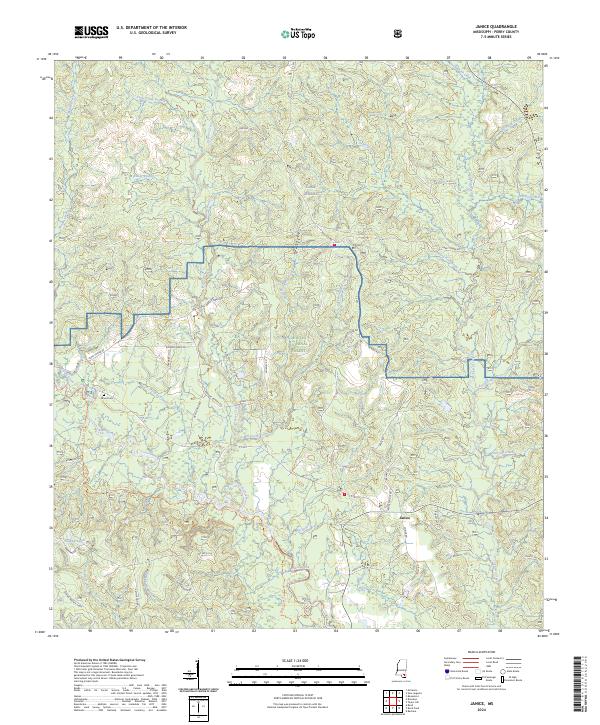 2024 Janice2024 Print · USGSPerry County's piney woods and bottomlands come into focus in this recent survey of the area around Janice. Local historians can trace family-named roads like Roland Hayes Rd or locate the Mixon Cem near the banks of Black Creek.
End of results
Showing maps 1-14 of 14
Top cities near Janice
- Hattiesburg historical maps
- Wiggins historical maps
- Beaumont historical maps
- New Augusta historical maps
- McLain historical maps
Frequently asked questions
- What are the different types of historical maps available for Janice?
- What is the oldest map of Janice?
- Where can I purchase historical maps of Janice for my home or office?
- Where can I download high-res historical maps of Janice?
- Are there historical topographic maps available for Janice?
- Is there historical aerial imagery available for Janice?
- Where are historical maps of Janice sourced from?