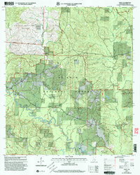
2000 Map of Janice
USGS Topo · Published 2003About this map
The winding course of Black Creek anchors this landscape at the turn of the millennium, flowing through the heart of the De Soto National Forest and the protected Black Creek Wilderness. The small community of Janice serves as a local focal point, supported by established landmarks like Janice Cem and nearby St John Ch. The map reveals a fascinating overlap of public land uses, ranging from recreational spaces to the strictly controlled Dedicated Impact Area (Danger) and military zones in the northwest.
Find a feature on this map
42 named features on this map. Tap any name to fly to it.
Don’t see what you’re looking for? This feature index may not catch every label — zoom into the map to look around manually.
Map Details
Editions of this 2000 Janice Map
This is the sole edition of this map. No revisions or reprints were ever made.
Other maps of this area

1947 · Beaumont
USGS Topo · 1:62,500

1947 · Wiggins
USGS Topo · 1:62,500

1947 · New Augusta
USGS Topo · 1:62,500

1947 · Benndale
USGS Topo · 1:62,500

1949 · Wiggins
USGS Topo · 1:62,500

1949 · Beaumont
USGS Topo · 1:62,500

1949 · New Augusta
USGS Topo · 1:62,500

1949 · Benndale
USGS Topo · 1:62,500

1953 · Hattiesburg
USGS Topo · 1:250,000

1953 · Mobile
USGS Topo · 1:250,000