
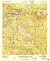
1949 Map of New Augusta
USGS Topo · Published 1949About this map
Camp Shelby dominates the landscape of this late-1940s survey, illustrating the military footprint in southern Mississippi alongside the De Soto National Forest. The map documents the relocation of the county seat from Old Augusta to the newer site of New Augusta along the Southern railroad line. The Leaf River and Black Creek wind through the region, supporting local industry and early transit points like McLaurin Landing Field.
Find a feature on this map
85 named features on this map. Tap any name to fly to it.
Don’t see what you’re looking for? This feature index may not catch every label — zoom into the map to look around manually.
Map Details
Editions of this 1949 New Augusta Map
2 editions found
Other maps of this area

1947 · Beaumont
USGS Topo · 1:62,500

1947 · Wiggins
USGS Topo · 1:62,500

1947 · New Augusta
USGS Topo · 1:62,500

1947 · Benndale
USGS Topo · 1:62,500

1949 · Wiggins
USGS Topo · 1:62,500

1949 · Beaumont
USGS Topo · 1:62,500

1949 · Benndale
USGS Topo · 1:62,500

1953 · Hattiesburg
USGS Topo · 1:250,000

1953 · Mobile
USGS Topo · 1:250,000

1957 · Mobile
USGS Topo · 1:250,000