Old Maps of Pike County, Mississippi for Metal Detecting
Plan your next treasure hunt with 80 historic maps of Pike County. Find old homesites, ghost towns, trails, and gathering spots that may be lost to time — perfect for identifying promising metal detecting locations.
- Locate forgotten sites: Uncover places like long-lost settlements, abandoned rail lines, or gathering spots.
- Plan better hunts: Use map overlays combined with LiDAR or satellite views to narrow in on historically rich areas.
- Made for detectorists: Thousands of hobbyists use these maps to discover relics, coins, and hidden history.
Use these historic maps to boost your research and find new opportunities beneath the surface of Pike County.
Pike County, MS maps
(80)- 1940 Map of Spring Creek
 1940 Spring Creek1940 Print · USGSTangipahoa Parish at the start of the 1940s is a landscape of creek-side farms and rural crossroads. Trace family roots and local landmarks like German Cem, Midway Sch, and the Illinois Central Railroad corridor.
 - 1950 Map of Kentwood
 1950 Kentwood1950 Print · USGSKentwood and Tangipahoa thrive along the Illinois Central rail corridor during the mid-century, marking a period of established rural settlement along the Mississippi state line. Researchers can locate numerous family burial sites and churches, including the Camp Moore Confederate Cem, Barnes Cem, and Bethel Ch.
 - 1953 Map of Natchez, 1966 Print
 1953 Natchez1966 Print · USGSSouthwest Mississippi and the Louisiana border country come alive in this mid-century survey of the river valley and forest lands. Researchers can trace the rail lines of the Illinois Central RR and locate rural hubs like Gloster and Ferriday.3 unique versions available
 - 1954 Map of Baton Rouge, 1974 Print
 1954 Baton Rouge1974 Print · USGSSoutheast Louisiana in the mid-fifties is captured here during a period of transition for its river and rail economies. Researchers can trace the path of the Mississippi River and find landmarks like the Bonnet Carre Spillway and Bayou Plaquemine.2 unique versions available
 - 1956 Map of Natchez
 1956 Natchez1956 Print · USGSThe Mississippi River borderlands and the Pine Hills come alive in this mid-fifties study of the Natchez region. Genealogists and historians can trace rail-era towns along the Illinois Central RR and explore the oxbows of Lake Bruin and Lake Concordia.
 - 1956 Map of Baton Rouge
 1956 Baton Rouge1956 Print · USGSSouth Louisiana at the height of the mid-century oil boom shows a landscape of river oxbows and rising industry. Researchers can trace family roots through river towns like Scotlandville or locate early industrial sites and Oil wells near Lake Maurepas.
 - 1958 Map of Kentwood, 1959 Print
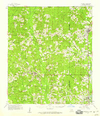 1958 Kentwood1959 Print · USGSThe Florida Parishes in the late fifties centered on the busy Illinois Central rail line and the growing timber towns of Kentwood and Roseland. Researchers can trace old family homesteads and landmarks like Camp Moore Cem, New Zion Sch, and Venable Ch.2 unique versions available
 - 1958 Map of Mount Hermon, 1959 Print
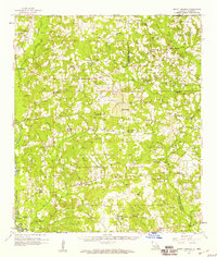 1958 Mount Hermon1959 Print · USGSIn the late fifties, the Florida Parishes remained a landscape of timbered hollows and rail-linked towns like Kentwood. Researchers can trace family sites from Mount Hermon Cem to the Sunny Hill Lookout Tower and James Chapel.3 unique versions available
 - 1959 Map of Natchez
 1959 Natchez1959 Print · USGSSouthwestern Mississippi and eastern Louisiana are captured in the late fifties, showing a landscape defined by the winding Mississippi River and the timbered Homochitto National Forest. Researchers can trace the sprawling Illinois Central RR and find rural landmarks like Union Church and Camp Van Dorn (Abandoned).
 - 1961 Map of Baton Rouge, 1966 Print
 1961 Baton Rouge1966 Print · USGSSoutheastern Louisiana in the early sixties remains a landscape of deep river bends and sprawling coastal lakes. Genealogists and historians can trace the rail-and-river economy through landmarks like Free-Nigger Point, Donaldsonville, and the Illinois Central Railroad.
 - 1962 Map of Baton Rouge
 1962 Baton Rouge1962 Print · USGSSouth Louisiana in the early sixties reveals a landscape of river-bend parishes and emerging interstate corridors. Genealogists and historians can trace family roots through historic river towns like Donaldsonville and Plaquemine, or follow the path of the Illinois Central Railroad through the swamp basins.
 - 1972 Map of Osyka, 1974 Print
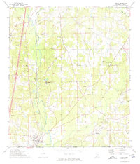 1972 Osyka1974 Print · USGSCrossing the Mississippi-Louisiana border in the early seventies, this area centers on the rail-driven growth of Osyka and the spiritual hub of Chatawa. Researchers can trace local lineage at St Mary of the Pines Academy or through family sites like Dickey Cem and Varnado Cem.
 - 1972 Map of Auburn, 1974 Print
 1972 Auburn1974 Print · USGSAmite and Lincoln Counties come into focus in the early seventies as the local oil industry expands across the landscape. Genealogists can trace family roots through numerous country sites like Johnston Chapel, Terrell Cem, and the Smithdale Oil Field.
 - 1972 Map of Pricedale, 1974 Print
 1972 Pricedale1974 Print · USGSPike and Lincoln Counties are captured in the early seventies, showcasing a rural landscape defined by oil production and creek-side settlements. Genealogists can locate family-named landmarks like McDavid Cem and McEwen Cem or local centers like Pricedale and Felders Campground.
 - 1972 Map of McComb South, 1974 Print
 1972 McComb South1974 Print · USGSPike County comes to life in the early seventies, showing the industrial and civic growth of McComb and Magnolia. Researchers can trace family roots at Hollywood Cem or locate old school sites like Alpha Center Sch and Kirkville.
 - 1972 Map of Lake Tangipahoa, 1974 Print
 1972 Lake Tangipahoa1974 Print · USGSSouthwest Mississippi during the early seventies is defined here by the waters of Lake Tangipahoa and the busy Mc Comb Oil Field. Genealogists and historians can trace rural family landmarks like Rose Bower Church, Pikemite Cemetery, and the Old Railroad Grade.
 - 1972 Map of Holmesville, 1974 Print
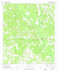 1972 Holmesville1974 Print · USGSPike and Walthall Counties come alive in this early 1970s survey of the Bogue Chitto river valley. Researchers can trace rural lineages through the numerous family cemeteries and churches, including Holmesville Cem, Pink Hill Ch, and Webb Cem.
 - 1972 Map of McComb North, 1974 Print
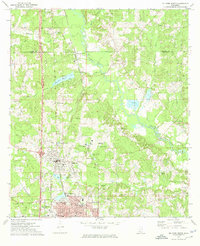 1972 McComb North1974 Print · USGSThe Pike County corridor in the early seventies shows the steady growth of Summit and Mc Comb along the Illinois Central Gulf rail line. Researchers can trace local roots at Johnstons Station or locate family plots in Woodlawn Cem and Rocky Point Cem.
 - 1972 Map of Progress, 1975 Print
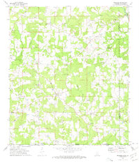 1972 Progress1975 Print · USGSSouthern Mississippi at the turn of the 1970s reveals a landscape of family farms and creek-side settlements. Genealogists can locate family landmarks like Brumfield Cem and Walker Cem or the Bala Chitto Ch near the Louisiana state line.2 unique versions available
 - 1972 Map of Terrys Creek, 1975 Print
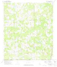 1972 Terrys Creek1975 Print · USGSThe Mississippi-Louisiana borderlands in the early seventies reveal a rural landscape defined by the Tickfaw River and local industry. Genealogists and historians can trace the Gillsburg Oil Field, family-named landmarks like Roberts Cem, and the Terrys Creek Ch.
 - 1980 Map of Kentwood, 1981 Print
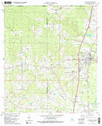 1980 Kentwood1981 Print · USGSKentwood and Tangipahoa appear during the early 1980s as the railroad and timber landscape of the Louisiana-Mississippi line remains firmly established. Researchers can find dozens of family burial sites like Westmoreland Cem and the Camp Moore Confederate Cem.2 unique versions available
 - 1983 Map of Amite
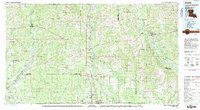 1983 Amite1983 Print · USGSThe Florida Parishes and southern Mississippi are captured here in the early 1980s, centered on the Illinois Central Gulf rail corridor. Genealogists and historians can trace family-named sites like the Camp Moore Confederate Cem, Magnolia Ch, and the Idlewild Plantation (State University).
 - 1983 Map of Spring Creek, 1984 Print
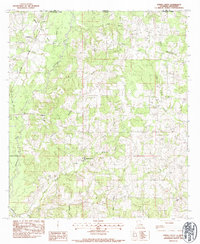 1983 Spring Creek1984 Print · USGSThe Louisiana-Mississippi border comes into focus in the early eighties as a network of creek-side settlements and family homesteads. Genealogists can trace local lineages at Masonic Cem and Conerly Cem or locate the site of Hagen Sch.
 - 1984 Map of McComb
 1984 McComb1984 Print · USGSSouth Mississippi in the mid-eighties was defined by the rail corridor connecting McComb and Magnolia to the surrounding timberlands. You can trace the rural network of Pike County through landmarks like Holmesville, Percy Quin State Park, and the winding Bogue Chitto.
 - 1994 Map of McComb
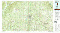 1994 McComb1994 Print · USGSSouthern Mississippi's rail-and-timber country is documented here in the early nineties as the region balanced its industrial corridors with vast forest preserves. Genealogists can trace hundreds of family-named rural landmarks, from Holmesville and Chatawa to the historic Zion Hill Ch.
Showing maps 1-25 of 80
Top cities of Pike County
Frequently asked questions
- What are the different types of historical maps available for Pike County?
- What is the oldest map of Pike County?
- Where can I purchase historical maps of Pike County for my home or office?
- Where can I download high-res historical maps of Pike County?
- Are there historical topographic maps available for Pike County?
- Is there historical aerial imagery available for Pike County?
- Where are historical maps of Pike County sourced from?