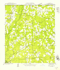
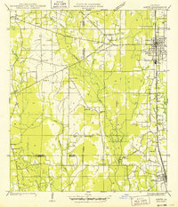
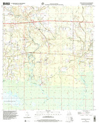
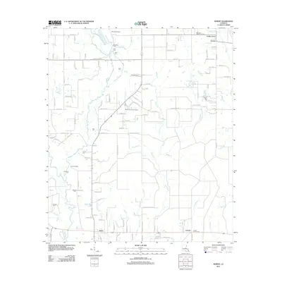
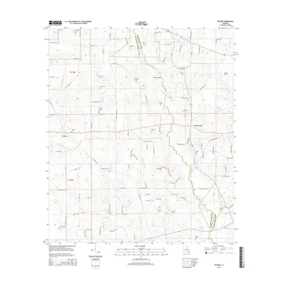
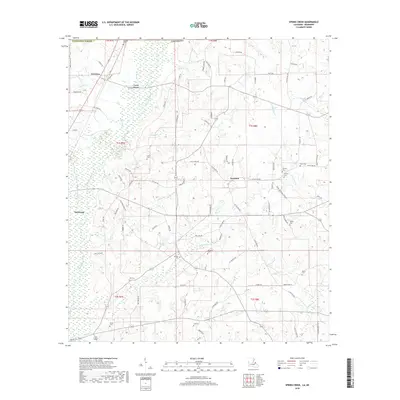
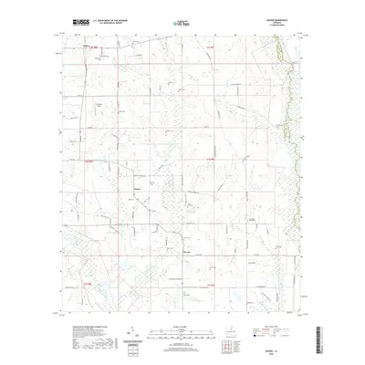
1940 Map of Spring Creek
USGS Topo · Published 1940About this map
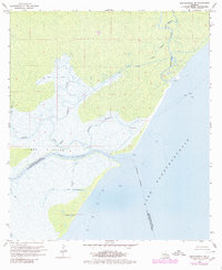
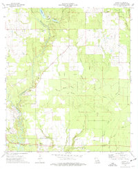
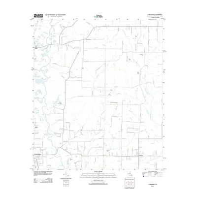
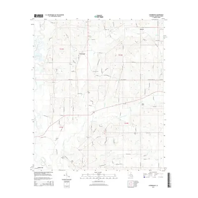
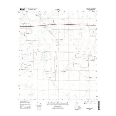
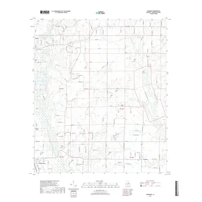
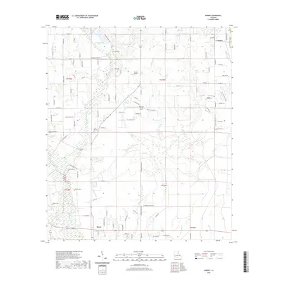
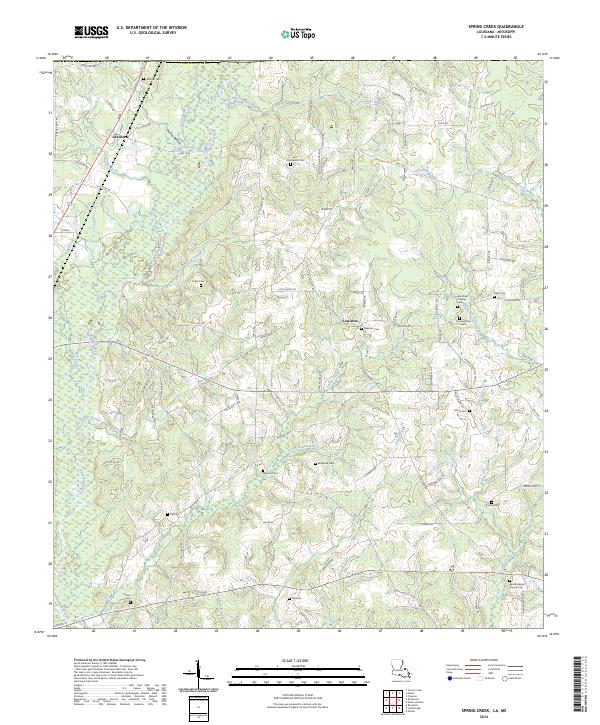
Illinois Central Railroad tracks cut through the western edge of this territory, passing through Greenlaw Ch as the landscape transitions toward the Tangipahoa River. The area is defined by a dense network of watercourses including Chubby Creek, Jeff McDaniel Creek, and Little Silver Creek, which support a dispersed rural community of family homesteads and farms. Local life in the early 1940s centered around small crossroads such as Lewiston and Spring Creek, anchored by institutions like Midway Sch and Ross Hill Ch. Genealogy researchers will find significant value in the numerous family-named burial grounds dotting the parish, including German Cem, Brumfield Cem, and Boutte Cem. The map also clearly delineates the Louisiana - Mississippi Boundary Line, showing how the political border interacts with the local drainage patterns near Tate.
Find a feature on this map
36 named features on this map. Tap any name to fly to it.
Don’t see what you’re looking for? This feature index may not catch every label — zoom into the map to look around manually.
Map Details
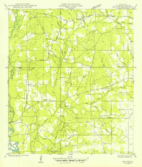
Editions of this 1940 Spring Creek Map
This is the sole edition of this map. No revisions or reprints were ever made.
Historical Maps of Kentwood Through Time
70 maps found
1940 Spring Creek
Tangipahoa Parish, LA

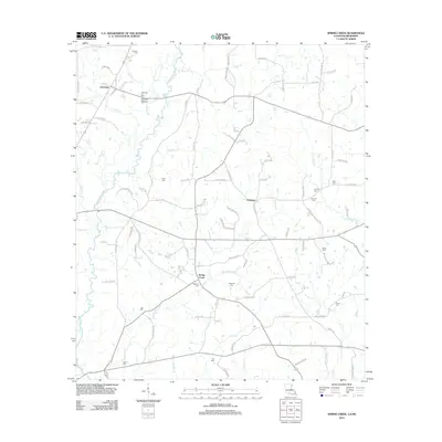
1942 Husser
Tangipahoa Parish, LA
1942 Loranger
Tangipahoa Parish, LA
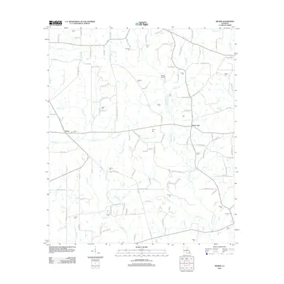
1942 Robert
Tangipahoa Parish, LA
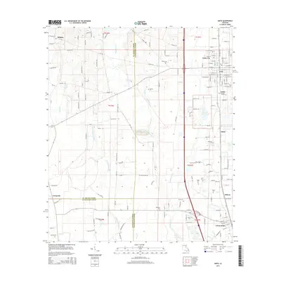
1942 Wilmer
Tangipahoa Parish, LA
1949 Amite
Tangipahoa Parish, LA
1949 Bolivar
Tangipahoa Parish, LA
1958 Mount Hermon
Tangipahoa Parish, LA

1968 Manchac
Tangipahoa Parish, LA
1968 Ponchatoula NE
Tangipahoa Parish, LA
1968 Ponchatoula SE
Tangipahoa Parish, LA
1974 Amite
Tangipahoa Parish, LA
1974 Husser
Tangipahoa Parish, LA
1974 Loranger
Tangipahoa Parish, LA
1974 Robert
Tangipahoa Parish, LA

1983 Amite
Tangipahoa Parish, LA
1983 Chesbrough
Tangipahoa Parish, LA
1983 Spring Creek
Tangipahoa Parish, LA
1983 Wilmer
Tangipahoa Parish, LA
1998 Ponchatoula NE
Tangipahoa Parish, LA
2012 Amite
Tangipahoa Parish, LA
2012 Chesbrough
Tangipahoa Parish, LA
2012 Husser
Tangipahoa Parish, LA
2012 Loranger
Tangipahoa Parish, LA
2012 Manchac
Tangipahoa Parish, LA
2012 Ponchatoula NE
Tangipahoa Parish, LA
2012 Ponchatoula SE
Tangipahoa Parish, LA
2012 Robert
Tangipahoa Parish, LA
2012 Spring Creek
Tangipahoa Parish, LA
2012 Wilmer
Tangipahoa Parish, LA
2015 Amite
Tangipahoa Parish, LA
2015 Chesbrough
Tangipahoa Parish, LA
2015 Husser
Tangipahoa Parish, LA
2015 Loranger
Tangipahoa Parish, LA
2015 Manchac
Tangipahoa Parish, LA
2015 Ponchatoula NE
Tangipahoa Parish, LA
2015 Ponchatoula SE
Tangipahoa Parish, LA
2015 Robert
Tangipahoa Parish, LA
2015 Spring Creek
Tangipahoa Parish, LA
2015 Wilmer
Tangipahoa Parish, LA
2018 Amite
Tangipahoa Parish, LA
2018 Chesbrough
Tangipahoa Parish, LA
2018 Husser
Tangipahoa Parish, LA
2018 Loranger
Tangipahoa Parish, LA
2018 Manchac
Tangipahoa Parish, LA
2018 Ponchatoula NE
Tangipahoa Parish, LA

2018 Ponchatoula SE
Tangipahoa Parish, LA
2018 Robert
Tangipahoa Parish, LA
2018 Spring Creek
Tangipahoa Parish, LA
2018 Wilmer
Tangipahoa Parish, LA
2020 Amite
Tangipahoa Parish, LA
2020 Chesbrough
Tangipahoa Parish, LA
2020 Husser
Tangipahoa Parish, LA
2020 Loranger
Tangipahoa Parish, LA
2020 Manchac
Tangipahoa Parish, LA
2020 Ponchatoula NE
Tangipahoa Parish, LA
2020 Ponchatoula SE
Tangipahoa Parish, LA
2020 Robert
Tangipahoa Parish, LA
2020 Spring Creek
Tangipahoa Parish, LA
2020 Wilmer
Tangipahoa Parish, LA
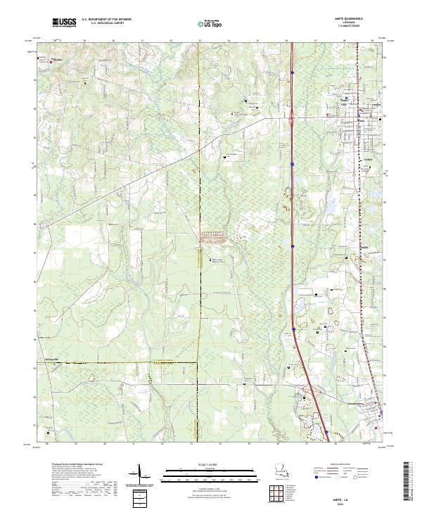
2024 Amite
Tangipahoa Parish, LA
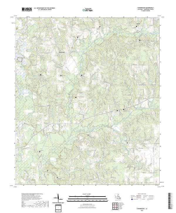
2024 Chesbrough
Tangipahoa Parish, LA
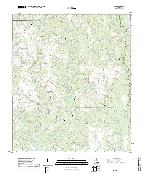
2024 Husser
Tangipahoa Parish, LA
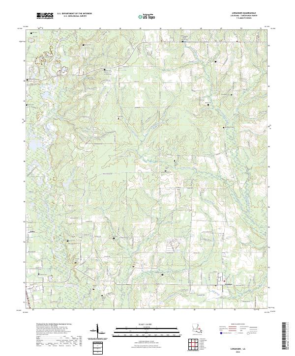
2024 Loranger
Tangipahoa Parish, LA
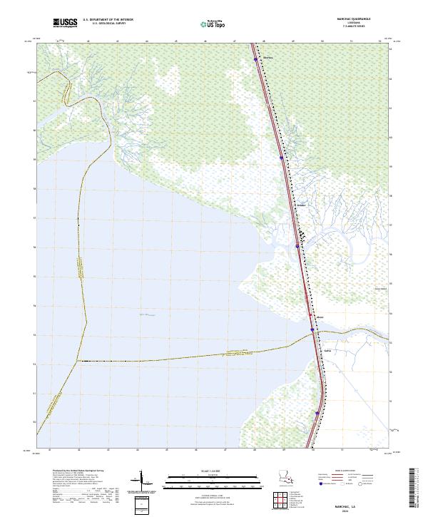
2024 Manchac
Tangipahoa Parish, LA
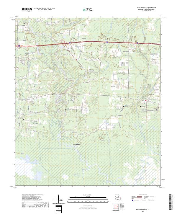
2024 Ponchatoula NE
Tangipahoa Parish, LA
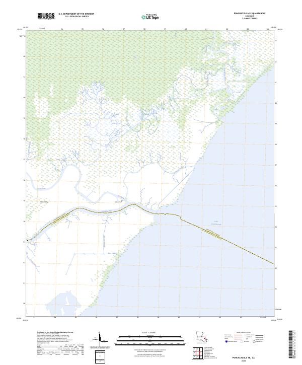
2024 Ponchatoula SE
Tangipahoa Parish, LA
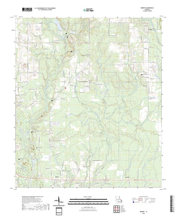
2024 Robert
Tangipahoa Parish, LA
2024 Spring Creek
Tangipahoa Parish, LA
2024 Wilmer
Tangipahoa Parish, LA