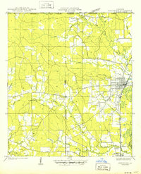
1950 Map of Kentwood
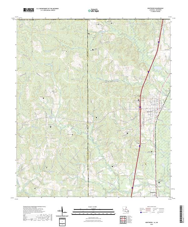
USGS Topo · Published 1950About this map
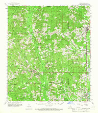
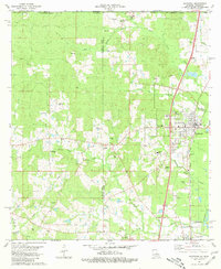
Kentwood serves as the primary hub of this 1940s landscape, situated along the Illinois Central Railroad and State Highway No 51. The surrounding rural parish lands at the Louisiana-Mississippi border are heavily defined by a grid of family homesteads and local heritage sites. Genealogists will find a high density of burial grounds, including the Camp Moore Confederate Cem near the town of Tangipahoa, as well as numerous family plots like Strickland Cem, Barnes Cem, and Varnado Cem. The topography is shaped by the Amite River and its many tributaries, such as Terrys Creek and Beaver Creek, which influenced early road placements and settlement patterns. Local spiritual life is anchored by small country churches including Pine Grove Ch and Browns Chapel, which remain vital landmarks in this post-war survey of the region.
Find a feature on this map
41 named features on this map. Tap any name to fly to it.
Don’t see what you’re looking for? This feature index may not catch every label — zoom into the map to look around manually.
Map Details
Editions of this 1950 Kentwood Map
This is the sole edition of this map. No revisions or reprints were ever made.
Historical Maps of Kentwood Through Time
8 maps found