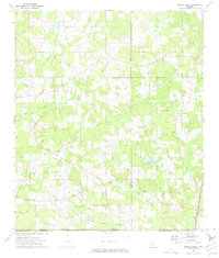
1972 Map of Terrys Creek
USGS Topo · Published 1975About this map
The Tickfaw River and its many tributaries, including Easley Branch and Friday Creek, define the landscape of this southern Mississippi territory in the early 1970s. Spanning the state line between Mississippi and Louisiana, the map reveals a rural economy shaped by natural resources and small community anchors. Industrial activity is visible in the Gillsburg Oil Field and scattered Gravel Pits, while local life centers on landmarks like the Terrys Creek Ch and several burial grounds, including Pilgrim Rest Cem and Roberts Cem. The presence of an Oil Well, a Fish Farm, and the Osyka Springs Campground indicates a multifaceted use of the land, ranging from extraction to recreation. A significant pipeline corridor cuts across the terrain, further illustrating the region's role in energy infrastructure during this era.
Find a feature on this map
25 named features on this map. Tap any name to fly to it.
Don’t see what you’re looking for? This feature index may not catch every label — zoom into the map to look around manually.
Map Details
Editions of this 1972 Terrys Creek Map
This is the sole edition of this map. No revisions or reprints were ever made.
Other maps of this area

1940 · Spring Creek
USGS Topo · 1:31,680

1942 · Liverpool
USGS Topo · 1:31,680

1950 · Kentwood
USGS Topo · 1:31,680

1953 · Natchez
USGS Topo · 1:250,000

1954 · Baton Rouge
USGS Topo · 1:250,000

1956 · Natchez
USGS Topo · 1:250,000

1956 · Baton Rouge
USGS Topo · 1:250,000
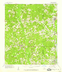
1958 · Kentwood
USGS Topo · 1:62,500
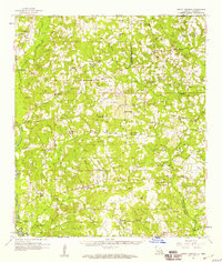
1958 · Mount Hermon
USGS Topo · 1:62,500

1959 · Natchez
USGS Topo · 1:250,000