1980s Maps of Pelahatchie, Mississippi
Explore 4 historic maps of Pelahatchie from the 1980s. These maps offer a rare glimpse into what life looked like during the 1980s — showing old roads, neighborhoods, homes, and landmarks that have changed or disappeared over time.
Whether you're researching your family's past, planning a metal detecting trip, or studying how Pelahatchie's landscape evolved across the 1980s, these high-resolution maps are a powerful tool for exploring the history of this region.
- Focus on a specific era: All maps on this page are from the 1980s, giving you a focused view of this time period.
- See what’s changed: Compare century-old streets, trails, and buildings to today's modern landscape using overlays and satellite layers.
- Research with precision: Use these maps for genealogy, historical research, land use analysis, or educational projects.
- View, download, or print: Maps are fully viewable online in high resolution, and can be downloaded or printed for your own records.
Start exploring Pelahatchie's history through authentic maps from the 1980s. This is your window into the past.
Pelahatchie, MS maps
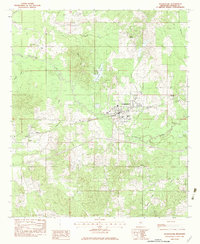
(4)- 1982 Map of Morton, 1983 Print
 1982 Morton1983 Print · USGSThe town of Morton and its surrounding timberlands are captured in the early eighties, showing a community defined by its rail access and proximity to the national forest. Trace local roots through a wealth of rural landmarks like Kracker Station, Walker Cem, and the Indian Treaty Boundary.2 unique versions available
 - 1982 Map of Pelahatchie, 1983 Print
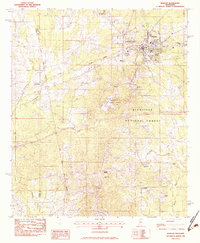
 1982 Pelahatchie1983 Print · USGSPelahatchie and the rural stretches of Rankin County are captured here in the early eighties as the railroad still anchored the local economy. Researchers can trace family roots through numerous country landmarks like Rawls Chapel, Reagan Cem, and the small settlement of Gulde.
 - 1982 Map of Brandon, 1983 Print
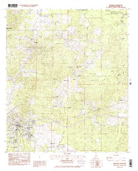 1982 Brandon1983 Print · USGSRankin County enters the early eighties with the bustling town of Brandon anchored by the Illinois Central Gulf rail line. Genealogists and researchers can trace numerous local landmarks including Langford, True Vine Ch, and Andrew Chapel Cem.
 - 1984 Map of Forest
 1984 Forest1984 Print · USGSCentral Mississippi in the mid-eighties centers on the timberlands and rail corridors of the Bienville National Forest. Genealogists and historians can trace old settlements like Conehatta and Hillsboro or follow the Illinois Central Gulf line through Morton and Newton.2 unique versions available
End of results
Showing maps 1-4 of 4
Top cities near Pelahatchie
- Brandon historical maps
- Flowood historical maps
- Morton historical maps
- Puckett historical maps
- Polkville historical maps
Frequently asked questions
- What are the different types of historical maps available for Pelahatchie?
- What is the oldest map of Pelahatchie?
- Where can I purchase historical maps of Pelahatchie for my home or office?
- Where can I download high-res historical maps of Pelahatchie?
- Are there historical topographic maps available for Pelahatchie?
- Is there historical aerial imagery available for Pelahatchie?
- Where are historical maps of Pelahatchie sourced from?