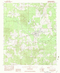
1982 Map of Pelahatchie
USGS Topo · Published 1983About this map
Pelahatchie serves as the focal point of this Rankin County landscape, situated where the Illinois Central Gulf railroad and the Gulf Central corridor intersect. The town's layout in the early 1980s reveals a community built around transit and agriculture, supported by local institutions like the Middle Sch. Surrounding the town, the terrain is defined by the winding paths of Pelahatchie Creek and Eutacutachee Creek, which drain the varied topography of Ware Hill.
Find a feature on this map
30 named features on this map. Tap any name to fly to it.
Don’t see what you’re looking for? This feature index may not catch every label — zoom into the map to look around manually.
Map Details
Editions of this 1982 Pelahatchie Map
This is the sole edition of this map. No revisions or reprints were ever made.
Other maps of this area

1922 · Morton
USGS Topo · 1:48,000

1922 · Pelahatchee
USGS Topo · 1:48,000

1924 · Pelahatchee
USGS Topo · 1:62,500

1924 · Morton
USGS Topo · 1:62,500

1950 · Pelahatchie
USGS Topo · 1:62,500

1951 · Morton
USGS Topo · 1:62,500

1952 · Pelahatchie
USGS Topo · 1:62,500

1953 · Meridian
USGS Topo · 1:250,000

1957 · Meridian
USGS Topo · 1:250,000

1965 · Meridian
USGS Topo · 1:250,000