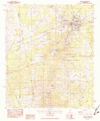
1982 Map of Morton
USGS Topo · Published 1983About this map
The town of Morton serves as the focal point of this 1980s Mississippi survey, where the Illinois Central Gulf railroad corridor cuts through the landscape. The infrastructure here reveals a small-town hub supported by the County Hospital and County Nursing Home, surrounded by a dense network of country churches including Mt Carmel Ch, Two Mile Ch, and Holy Hill Ch. Just south of the town center, the terrain transitions into the protected timberlands of the Bienville National Forest and the recreational waters of Roosevelt State Park, centered around Shadow Lake.
Find a feature on this map
39 named features on this map. Tap any name to fly to it.
Don’t see what you’re looking for? This feature index may not catch every label — zoom into the map to look around manually.
Map Details
Editions of this 1982 Morton Map
2 editions found
Other maps of this area

1922 · Morton
USGS Topo · 1:48,000

1922 · Pelahatchee
USGS Topo · 1:48,000

1924 · Pelahatchee
USGS Topo · 1:62,500

1924 · Morton
USGS Topo · 1:62,500

1950 · Pelahatchie
USGS Topo · 1:62,500

1951 · Morton
USGS Topo · 1:62,500

1952 · Pelahatchie
USGS Topo · 1:62,500

1953 · Meridian
USGS Topo · 1:250,000

1957 · Meridian
USGS Topo · 1:250,000

1965 · Meridian
USGS Topo · 1:250,000