Old Maps of Forest, Mississippi for Genealogy
Trace your family roots with 39 historic maps of Forest. These high-res maps reveal old neighborhoods, homesites, landmarks, and streets — helping you uncover where your ancestors lived and how the area evolved over time.
- Explore historic neighborhoods: Identify where your relatives may have lived in the 1800s or 1900s.
- Compare maps over time: Trace the changes in streets, buildings, and landmarks for multi-generational research.
- Perfect for genealogy & ancestry research: Used by family historians and researchers to map out lineage and migration.
These maps are an incredible resource for exploring your personal connection to Forest's past.
Forest, MS maps
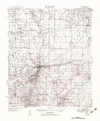
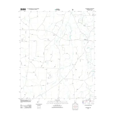
(39)- 1921 Map of Forest
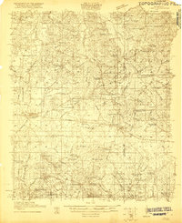 1921 Forest1921 Print · USGSThe Scott County landscape in the early 1920s is documented here through its rural schoolhouses and family settlements. Genealogists can locate long-standing community centers like the Patrons Union Camp Ground, Singleton Settlement, and Fikestown.
 - 1922 Map of Forest
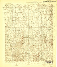
 1922 Forest1922 Print · USGSScott and Newton Counties are shown here in the early twenties, when timber and rails defined the landscape. You can trace the path of the Alabama and Vicksburg RR, locate family landmarks like Many Roads Hill, and find old meeting grounds like the Patrons Union Campground.2 unique versions available
 - 1922 Map of Morton
 1922 Morton1922 Print · USGSScott County in the early twenties is a landscape of rural schoolhouses and timber operations centered on the Morton rail line. Researchers can locate vanished community landmarks like the Scott County Fair Grounds, Lumber Camp, and several family-named churches.
 - 1924 Map of Morton
 1924 Morton1924 Print · USGSThe rail-and-timber landscape of Scott and Rankin counties is captured here in the early twenties. Researchers can trace rural life through dozens of named landmarks like Peagler Store, Morton, and the Sprous Cemetery.
 - 1950 Map of Forest, 1966 Print
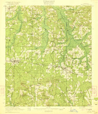
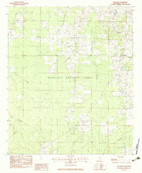
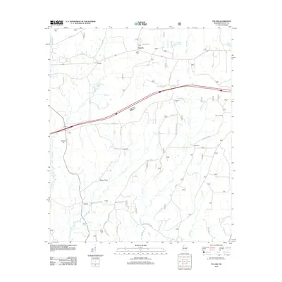
 1950 Forest1966 Print · USGSMid-century Scott County centers on the rail-driven growth of Forest and its surrounding timberlands. Local historians can trace family ties through Singleton Settlement, rural schools like Sylvester Sch, and the Patrons Union Campground.2 unique versions available
 - 1951 Map of Morton
 1951 Morton1951 Print · USGSMid-century Scott and Rankin counties are mapped here just as the modern highway system began to overshadow the rail era. Genealogists can locate family landmarks like Peagler Store and numerous rural sites such as Simmons Grove Ch and Latham Cem.3 unique versions available
 - 1952 Map of Forest
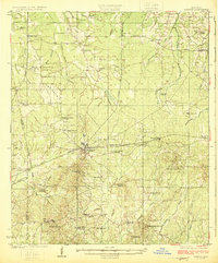
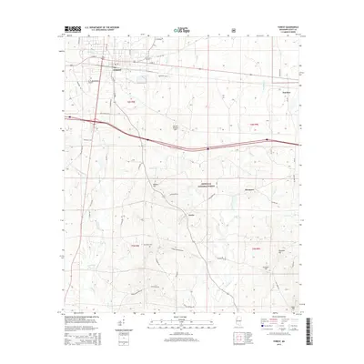
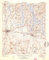 1952 Forest1952 Print · USGSCentral Mississippi in the early fifties shows a landscape of rail-side growth and established family settlements. You can trace early Scott County history through rural landmarks like the Patrons Union Campground, Singleton Settlement, and Gum Springs.2 unique versions available
 - 1953 Map of Meridian, 1966 Print
 1953 Meridian1966 Print · USGSEast Central Mississippi and the Alabama borderlands are captured here during a period of steady growth and infrastructure expansion. Genealogists and historians can trace rail-town development along the Gulf Mobile & Ohio Railroad and find early settlements like Scooba, Pelahatchie, and De Kalb.2 unique versions available
 - 1957 Map of Meridian
 1957 Meridian1957 Print · USGSEast Central Mississippi and parts of Western Alabama come alive in the mid-1950s, centered on the transit hub of Meridian. Researchers can trace old rail lines like the Illinois Central and find historic sites such as the Choctaw Indian Reservation and Roosevelt State Park.
 - 1965 Map of Meridian
 1965 Meridian1965 Print · USGSEast Mississippi and West Alabama are mapped here in the mid-sixties as the region's modern highway and reservoir systems began to take shape. Researchers can trace rural lineages through local landmarks like Prince Chapel and Tuscahoma Landing, or follow the historic Gulf Mobile & Ohio rail lines.
 - 1982 Map of Harperville, 1983 Print
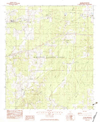
 1982 Harperville1983 Print · USGSScott County in the early eighties reveals a landscape of tight-knit rural communities and forest lands. Genealogists can trace family footprints through sites like Singleton Settlement, Old Union Cem, and numerous country churches including Ephesus Ch.
 - 1982 Map of Forest, 1983 Print
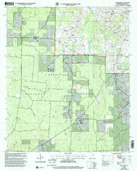
 1982 Forest1983 Print · USGSThe northern reaches of the BIENVILLE NATIONAL FOREST meet the growing town of FOREST in the early 1980s. Genealogists can trace rural roots through numerous churches and cemeteries like Eastern Cem, High Hill Ch, and Gatewood Cem.2 unique versions available
 - 1982 Map of Hillsboro, 1983 Print
 1982 Hillsboro1983 Print · USGSCentral Mississippi's timberlands and rural crossroads are captured here in the early eighties. Genealogists and historians can trace family sites at Old Duncan Cem or follow the Shockaloe Trail through Bienville National Forest.
 - 1982 Map of Pulaski, 1983 Print
 1982 Pulaski1983 Print · USGSCentral Mississippi timberlands and small rail-side settlements define this landscape in the early eighties. Genealogists can trace family names through landmarks like North Morton Cem, Raworth, and Hunter Town near the Strong River.
 - 1984 Map of Forest
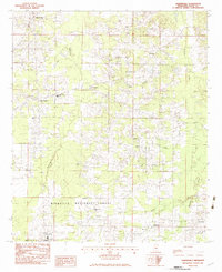
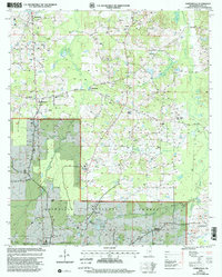
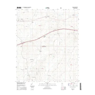
 1984 Forest1984 Print · USGSCentral Mississippi in the mid-eighties centers on the timberlands and rail corridors of the Bienville National Forest. Genealogists and historians can trace old settlements like Conehatta and Hillsboro or follow the Illinois Central Gulf line through Morton and Newton.2 unique versions available
 - 2000 Map of Pulaski, 2002 Print
 2000 Pulaski2002 Print · USGSThe woods of Scott County appear at the turn of the millennium, showing a landscape shaped by timber and tradition. Genealogists can trace family landmarks like North Morton Cem, Hunter Town, and the rural community of Pulaski.
 - 2000 Map of Forest, 2002 Print
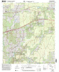
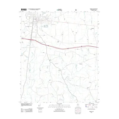
 2000 Forest2002 Print · USGSScott County at the turn of the millennium shows the intersection of deep timberlands and growing civic infrastructure around FOREST. Researchers can trace old family sites and rural congregations at Oak Grove Ch Cem, Fikestown, and the Eastern Cemetery.
 - 2000 Map of Hillsboro, 2002 Print
 2000 Hillsboro2002 Print · USGSScott County enters the new millennium as a mix of timberlands and rural communities within the Bienville National Forest. Genealogists and historians can trace local roots through landmarks like the Old Duncan Cem, Mt Zion Ch, and the settlement of Hillsboro.
 - 2000 Map of Harperville, 2002 Print
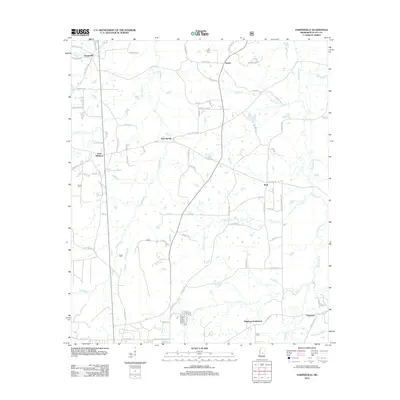
 2000 Harperville2002 Print · USGSThe rural heart of Scott County at the turn of the millennium is centered on the northern edge of the Bienville National Forest. Researchers can map out genealogy and local history through numerous landmarks like Singleton Settlement, Scott Central Sch, and Old Union Cem.
 - 2012 Map of Harperville, 2012 Print
 2012 Harperville2012 Print · USGSCovers Forest, including East Hillsboro, Wolf, and other nearby areas
 - 2012 Map of Forest, 2012 Print
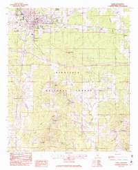
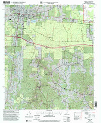
 2012 Forest2012 Print · USGSCovers Forest, including Norris, Fikestown, and other nearby areas
 - 2012 Map of Hillsboro, 2012 Print
 2012 Hillsboro2012 Print · USGSCovers Forest, including Clifton, Hillsboro, and other nearby areas
 - 2012 Map of Pulaski, 2012 Print
 2012 Pulaski2012 Print · USGSCovers Forest, including Morton, Frogtown, and other nearby areas
 - 2015 Map of Forest, 2015 Print
 2015 Forest2015 Print · USGSCovers Forest, including Norris, Fikestown, and other nearby areas
 - 2015 Map of Pulaski, 2015 Print
 2015 Pulaski2015 Print · USGSCovers Forest, including Morton, Frogtown, and other nearby areas
Showing maps 1-25 of 39
Top cities near Forest
Frequently asked questions
- What are the different types of historical maps available for Forest?
- What is the oldest map of Forest?
- Where can I purchase historical maps of Forest for my home or office?
- Where can I download high-res historical maps of Forest?
- Are there historical topographic maps available for Forest?
- Is there historical aerial imagery available for Forest?
- Where are historical maps of Forest sourced from?