
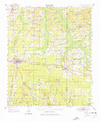
1950 Map of Forest
USGS Topo · Published 1966About this map
The Illinois Central Railroad serves as the industrial spine of this mid-century Mississippi landscape, connecting the established community of Forest with eastern neighbors like Lake and Muskegon. The map reveals a transition from the structured street grid of the county seat to the sprawling timber and agricultural lands of the Bienville National Forest. The rural hinterland is dotted with numerous small family-centered settlements and social anchors, including Singleton Settlement and Dennis Settlement. Genealogists will find a wealth of community landmarks, such as Hebron Ch, Antioch Ch, and several rural schools like Sylvester Sch and Piney Grove Sch. Significant local sites like the Patrons Union Campground and numerous family hills, including Mathes Hill and Sherman Hill, highlight a landscape defined by its high ridges and the headwaters of the Leaf River and Tallahala Creek.
Find a feature on this map
91 named features on this map. Tap any name to fly to it.
Don’t see what you’re looking for? This feature index may not catch every label — zoom into the map to look around manually.
Map Details
Editions of this 1950 Forest Map
2 editions found
Other maps of this area

1921 · Forest
USGS Topo · 1:48,000

1922 · Forest
USGS Topo · 1:62,500

1922 · Morton
USGS Topo · 1:48,000

1924 · Morton
USGS Topo · 1:62,500

1951 · Morton
USGS Topo · 1:62,500

1952 · Forest
USGS Topo · 1:62,500

1953 · Meridian
USGS Topo · 1:250,000

1957 · Meridian
USGS Topo · 1:250,000

1961 · Carthage
USGS Topo · 1:62,500

1965 · Meridian
USGS Topo · 1:250,000