Old Maps of Warren County, Mississippi for Academic Research
Study the evolution of Warren County with 163 high-resolution historic maps. Whether you're teaching, researching, or modeling changes in land use, these maps provide essential visual documentation of urban, environmental, and geographic change.
- Analyze long-term change: Track patterns in development, transportation, and natural features.
- Ideal for environmental or urban studies: Support academic projects with primary historical map data.
- Use in the classroom or lab: Educators and researchers rely on these maps to bring historical context to life.
These maps are a powerful tool for teaching, research, and visualizing how Warren County has changed over the decades.
Warren County, MS maps
(163)- 1909 Map of Millikens Bend
 1909 Millikens Bend1909 Print · USGSMadison Parish and the Mississippi River front are captured during the peak of the plantation era. Researchers can trace historic family lands like Sparta and Huon Plantation, or locate rural landmarks such as Paradise Church and Hews Store.3 unique versions available
 - 1909 Map of Mound
 1909 Mound1909 Print · USGSMadison Parish plantations and bayous are meticulously detailed in this 1909 survey as they appeared at the dawn of the twentieth century. Researchers can trace the legacy of the Vicksburg Shreveport and Pacific Railroad and locate ancestral sites like Solomon Temple Church or Mound.2 unique versions available
 - 1910 Map of Mound
 1910 Mound1910 Print · USGSMadison Parish in the early 1900s shows a landscape of productive riverbottom plantations and railroad commerce. Genealogists can trace family holdings and rural landmarks like California Plantation, Thomastown, and the Indian Mounds near the local rail siding.2 unique versions available
 - 1918 Map of Vicksburg
 1918 Vicksburg1918 Print · USGSVicksburg and the Mississippi River bluffs are shown in great detail during the early twentieth century. Researchers can locate Civil War landmarks like Grants Canal and Vicksburg National Military Park or trace family roots near Blakeley and Cedars.4 unique versions available
 - 1938 Map of Edwards
 1938 Edwards1938 Print · USGSIn the late 1930s, the Hinds County countryside around Edwards was a dense network of rural schools and uniquely named churches. Trace the oxbows of the Big Black River to find landmarks like Mt Beulah College, Little Kingdom Come Ch, and Tomcat Island.3 unique versions available
 - 1939 Map of Onward
 1939 Onward1939 Print · USGSThe Mississippi Delta in the late 1930s shows a landscape of river-bend settlements and bayou-side commerce before modern infrastructure took hold. You can trace the Illinois Central railroad through Smedes and Kelso or locate family landmarks like Haynes Bluff and the Lumber Yard at Valley Park.3 unique versions available
 - 1939 Map of Talla Bena, 1941 Print
 1939 Talla Bena1941 Print · USGSMadison Parish and the Mississippi River bank appear here just before the war, when the river was undergoing significant engineering. You can trace the rail lines through Tallulah, find family-named points like My Wifes (Or Paw Paw) Island, and locate historic river landings including Sparta Ldg.2 unique versions available
 - 1939 Map of Yokena, 1942 Print
 1939 Yokena1942 Print · USGSThe Mississippi riverfront south of Vicksburg was a complex landscape of engineering and rural community just before the Second World War. Researchers can trace the Yazoo and Mississippi Valley RR and find local landmarks like Rocky Springs and the Hardscrabble Sch.2 unique versions available
 - 1939 Map of Alsatia, 1953 Print
 1939 Alsatia1953 Print · USGSThe river-driven landscape of the Louisiana and Mississippi border is shown here during a period of massive hydraulic engineering. Researchers can trace the shifting river channel and rail-stop settlements like Alsatia, Fitler PO, and Sondheimer.2 unique versions available
 - 1940 Map of Mechanicsburg, 1947 Print
 1940 Mechanicsburg1947 Print · USGSThe Yazoo River Delta in the early 1940s reveals a landscape defined by steamboat landings and the edge of the Loess Bluffs. Researchers can trace historic river access points like Enola Ldg and Miller Ldg or locate the early footprints of Satartia and Mechanicsburg.2 unique versions available
 - 1941 Map of Vicksburg, 1946 Print
 1941 Vicksburg1946 Print · USGSVicksburg and its riverfront were entering the war years when this survey was updated, documenting a landscape of strategic waterway engineering. Genealogists can trace family roots at Redwood, Beechwood, or Culkin Academy and locate the National Cem.3 unique versions available
 - 1955 Map of Jackson
 1955 Jackson1955 Print · USGSThe Lower Mississippi Valley at the middle of the century reveals a landscape of deep river meanders and growing rail hubs. Genealogists and historians can trace the mid-century footprints of Vicksburg National Military Park, old river landings at Port Gibson, and the rail corridors of the Illinois Central Railroad.3 unique versions available
 - 1961 Map of Jackson
 1961 Jackson1961 Print · USGSThe Lower Mississippi Delta and the state capital area are captured here during the post-war era of infrastructure expansion. Researchers can trace the complex river oxbows and rail lines connecting Vicksburg, Yazoo City, and the Illinois Central Railroad network.
 - 1962 Map of Jackson
 1962 Jackson1962 Print · USGSThe Mississippi Delta and the state capital region are mapped here in the early sixties, showing a landscape defined by the great river and the growing city of JACKSON. Genealogists can trace family roots through numerous landmarks like Cedar Hill Cem, rural stops on the Illinois Central RR, and historic sites like Champion Hill.2 unique versions available
 - 1962 Map of Redwood, 1963 Print
 1962 Redwood1963 Print · USGSWarren County at the start of the 1960s shows a landscape of river-bottom commerce and Civil War history. Genealogists and historians can trace the Old Indian Treaty Boundary or locate St James Ch and the Site of Fort St Peter.3 unique versions available
 - 1962 Map of Vicksburg West, 1963 Print
 1962 Vicksburg West1963 Print · USGSVicksburg and the Mississippi River bluffs are seen here in the early sixties, as the river's shifting path reshaped the state line. Genealogists can locate family landmarks like Mt Pilgrim Ch, Glass-McIntyre Sch, and the rail junction at Delta.3 unique versions available
 - 1962 Map of Long Lake, 1963 Print
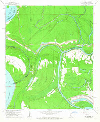 1962 Long Lake1963 Print · USGSThe riverlands of Warren County were undergoing a major industrial transformation in the early sixties. Genealogists and historians can trace the development of the Vicksburg Industrial Harbor and locate local landmarks like Pilgrims Rest Ch and Browns Point.3 unique versions available
 - 1962 Map of Vicksburg East, 1963 Print
 1962 Vicksburg East1963 Print · USGSVicksburg and its surrounding hill country are captured here in the early sixties, showing the city's growth alongside its preserved battlefields. Genealogists and historians can trace family sites like China Grove Ch, Culkin Academy, and Porters Chapel Cem.3 unique versions available
 - 1963 Map of Carlisle, 1964 Print
 1963 Carlisle1964 Print · USGSClaiborne County in the early sixties remains a landscape of deep creek bottoms and timbered ridges along the Natchez Trace Parkway. Genealogists and local historians can trace the Illinois Central line through Carlisle, or locate rural landmarks like Rocky Springs and Bethel Green Ch.2 unique versions available
 - 1963 Map of Grand Gulf, 1964 Print
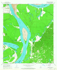 1963 Grand Gulf1964 Print · USGSThe Mississippi River borderlands in the early 1960s reveal a landscape of shifting channels and Civil War memory. Genealogists and historians can trace the Old Railroad grade near Grand Gulf or locate local landmarks like Spring Hill Ch and Point Pleasant.3 unique versions available
 - 1963 Map of Somerset, 1964 Print
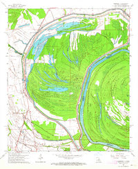 1963 Somerset1964 Print · USGSThe Mississippi River bottomlands in the early sixties reveal a landscape shaped by water and rail. Genealogists and local historians can trace family sites at Somerset Cem, find rural churches like St John Ch, or locate old river stops at Palmyra Landing.2 unique versions available
 - 1963 Map of Willows, 1964 Print
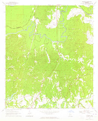 1963 Willows1964 Print · USGSThe Big Black River basin in the early sixties was a landscape of winding bayous and small rail-stop communities. Researchers can trace family history through sites like Allen (Nanachehaw) and Ingleside, or locate rural landmarks like Shiloh Ch Cem and the Warner YMCA Camp.3 unique versions available
 - 1963 Map of Bedford, 1964 Print
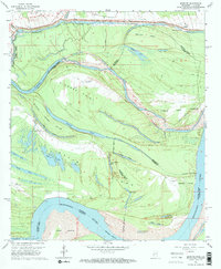 1963 Bedford1964 Print · USGSThe shifting Mississippi River floodplain comes into sharp focus in the early sixties at the border of Louisiana and Mississippi. Researchers can trace land changes across Diamond Island and locate family history at Crystal Springs Cem or Hodges Cem.2 unique versions available
 - 1963 Map of Yokena, 1964 Print
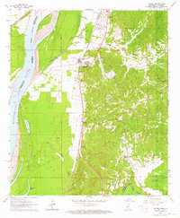 1963 Yokena1964 Print · USGSWarren County in the early 1960s reveals a landscape shaped by the Mississippi River and the busy Illinois Central rail line. Researchers can trace family sites at Glass Cem and Sadler Cem or locate old landmarks like Morning Star Ch.4 unique versions available
 - 1963 Map of Big Black, 1964 Print
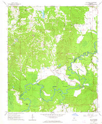 1963 Big Black1964 Print · USGSThe Big Black River bottomlands of Warren and Claiborne counties are captured here in the early sixties, showing a landscape shaped by shifting waters. Researchers can trace rural life through landmarks like Rose Hill Ch, the Indian Treaty Boundary, and Fishers Bridge.2 unique versions available
Showing maps 1-25 of 163
Top cities of Warren County
Frequently asked questions
- What are the different types of historical maps available for Warren County?
- What is the oldest map of Warren County?
- Where can I purchase historical maps of Warren County for my home or office?
- Where can I download high-res historical maps of Warren County?
- Are there historical topographic maps available for Warren County?
- Is there historical aerial imagery available for Warren County?
- Where are historical maps of Warren County sourced from?