1930s Maps of Atchison County, Missouri
Explore 6 historic maps of Atchison County from the 1930s. These maps offer a rare glimpse into what life looked like during the 1930s — showing old roads, neighborhoods, homes, and landmarks that have changed or disappeared over time.
Whether you're researching your family's past, planning a metal detecting trip, or studying how Atchison County's landscape evolved across the 1930s, these high-resolution maps are a powerful tool for exploring the history of this region.
- Focus on a specific era: All maps on this page are from the 1930s, giving you a focused view of this time period.
- See what’s changed: Compare century-old streets, trails, and buildings to today's modern landscape using overlays and satellite layers.
- Research with precision: Use these maps for genealogy, historical research, land use analysis, or educational projects.
- View, download, or print: Maps are fully viewable online in high resolution, and can be downloaded or printed for your own records.
Start exploring Atchison County's history through authentic maps from the 1930s. This is your window into the past.
Atchison County, MO maps
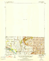
(6)- 1936 Map of Fairfax
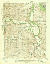 1936 Fairfax1936 Print · USGSBenton and Hickory counties are captured in the mid-1930s just as the Lake of the Ozarks was reshaping the Osage River valley. Trace family roots at Wisdom Cem or locate the old Hogles Creek Sch and the community at Fairfield.
 - 1939 Map of Tarkio
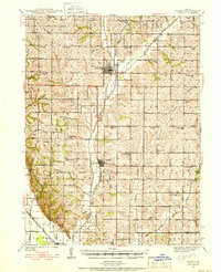 1939 Tarkio1939 Print · USGSNorthwest Missouri's farm country is captured here just before the mid-century, showing a landscape defined by the Tarkio River and a dense grid of rural schoolhouses. Researchers can trace family history through dozens of named landmarks like Tarkio College, Busch Cem, and the Chicago Burlington and Quincy rail line.
 - 1939 Map of Farragut
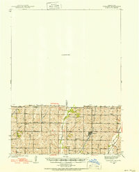 1939 Farragut1939 Print · USGSThe Iowa-Missouri borderlands come into focus in the late 1930s, showing a landscape of river-valley farms and rural schoolhouses. Genealogists can trace family roots through sites like Walden Grove Cem, Yale Sch, and the community at Westboro.
 - 1939 Map of Skidmore
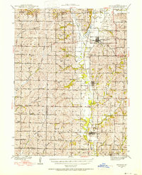 1939 Skidmore1939 Print · USGSNorthwest Missouri is captured here in the late thirties, when the river valleys were teeming with small school districts and active rail lines. Researchers can trace family history through dozens of rural schools like Evans Sch and churches including Centenary Ch.3 unique versions available
 - 1939 Map of Hamburg
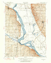
 1939 Hamburg1939 Print · USGSThe Missouri River lowlands at the triple-state border are captured here just before the mid-century. Genealogists can trace family footprints across a dense network of rural schoolhouses like Miller Sch and Star Sch, or locate the Stoner Cem and Lone Chapel.2 unique versions available
 - 1939 Map of Nemaha, 1954 Print
 1939 Nemaha1954 Print · USGSThe Missouri River floodplain and the bluffs of Nebraska and Missouri are captured here just before the mid-century. Researchers can trace the path of the Chicago Burlington and Quincy railroad and find vanished locations like St Deroin, Aspinwall, and McCandless Siding.
End of results
Showing maps 1-6 of 6
Top cities of Atchison County
- Tarkio historical maps
- Rock Port historical maps
- Fairfax historical maps
- Westboro historical maps
- Watson historical maps
Frequently asked questions
- What are the different types of historical maps available for Atchison County?
- What is the oldest map of Atchison County?
- Where can I purchase historical maps of Atchison County for my home or office?
- Where can I download high-res historical maps of Atchison County?
- Are there historical topographic maps available for Atchison County?
- Is there historical aerial imagery available for Atchison County?
- Where are historical maps of Atchison County sourced from?