Old Maps of Atchison County, Missouri for Genealogy
Trace your family roots with 112 historic maps of Atchison County. These high-res maps reveal old neighborhoods, homesites, landmarks, and streets — helping you uncover where your ancestors lived and how the area evolved over time.
- Explore historic neighborhoods: Identify where your relatives may have lived in the 1800s or 1900s.
- Compare maps over time: Trace the changes in streets, buildings, and landmarks for multi-generational research.
- Perfect for genealogy & ancestry research: Used by family historians and researchers to map out lineage and migration.
These maps are an incredible resource for exploring your personal connection to Atchison County's past.
Atchison County, MO maps
(112)- 1907 Map of Nebraska City
 1907 Nebraska City1907 Print · USGSNebraska City and its surrounding Missouri River bluffs are captured here in the first decade of the 1900s during a period of significant rail expansion. Genealogists can locate numerous rural schoolhouses and small settlements like Minersville, Wyoming, and the historic St Lukes Church.3 unique versions available
 - 1915 Map of Nemaha
 1915 Nemaha1915 Print · USGSThe Missouri River borderlands between Nebraska and Missouri are captured here in the years before major flood control altered the channel. Genealogists can trace family roots through dozens of rural landmarks, including Mt Vernon Cemetery, Antioch Church, and the river landing at St Deroin.2 unique versions available
 - 1936 Map of Fairfax
 1936 Fairfax1936 Print · USGSBenton and Hickory counties are captured in the mid-1930s just as the Lake of the Ozarks was reshaping the Osage River valley. Trace family roots at Wisdom Cem or locate the old Hogles Creek Sch and the community at Fairfield.
 - 1939 Map of Tarkio
 1939 Tarkio1939 Print · USGSNorthwest Missouri's farm country is captured here just before the mid-century, showing a landscape defined by the Tarkio River and a dense grid of rural schoolhouses. Researchers can trace family history through dozens of named landmarks like Tarkio College, Busch Cem, and the Chicago Burlington and Quincy rail line.
 - 1939 Map of Farragut
 1939 Farragut1939 Print · USGSThe Iowa-Missouri borderlands come into focus in the late 1930s, showing a landscape of river-valley farms and rural schoolhouses. Genealogists can trace family roots through sites like Walden Grove Cem, Yale Sch, and the community at Westboro.
 - 1939 Map of Skidmore
 1939 Skidmore1939 Print · USGSNorthwest Missouri is captured here in the late thirties, when the river valleys were teeming with small school districts and active rail lines. Researchers can trace family history through dozens of rural schools like Evans Sch and churches including Centenary Ch.3 unique versions available
 - 1939 Map of Hamburg
 1939 Hamburg1939 Print · USGSThe Missouri River lowlands at the triple-state border are captured here just before the mid-century. Genealogists can trace family footprints across a dense network of rural schoolhouses like Miller Sch and Star Sch, or locate the Stoner Cem and Lone Chapel.2 unique versions available
 - 1939 Map of Nemaha, 1954 Print
 1939 Nemaha1954 Print · USGSThe Missouri River floodplain and the bluffs of Nebraska and Missouri are captured here just before the mid-century. Researchers can trace the path of the Chicago Burlington and Quincy railroad and find vanished locations like St Deroin, Aspinwall, and McCandless Siding.
 - 1940 Map of Tarkio
 1940 Tarkio1940 Print · USGSAtchison County at the end of the Depression was a landscape of river-bottom farms and rural school districts. Genealogists can locate family-named landmarks and country parishes like English Grove Ch, Tarkio College, and Prairie Hill Cem.
 - 1940 Map of Farragut
 1940 Farragut1940 Print · USGSThe Iowa-Missouri state line serves as the anchor for this 1939 survey of Atchison, Fremont, and Page counties. Genealogists and local historians can trace the positions of vanished schoolhouses like Yale Sch and Emporia Sch, or locate family sites near Farmers City and Westboro.
 - 1940 Map of Coin, 1954 Print
 1940 Coin1954 Print · USGSThe borderlands of Iowa and Missouri come to life in this mid-century survey, showcasing the tight-knit farming communities across Page and Nodaway counties. Researchers can locate vanished rural landmarks like North Grove Sch and Six Corners Cem along the Wabash rail line.2 unique versions available
 - 1941 Map of Tarkio
 1941 Tarkio1941 Print · USGSNorthwest Missouri thrived as a region of productive townships and rail-connected towns just before the war. Researchers can locate dozens of country schoolhouses like Irish Grove Sch and family landmarks such as the English Grove Ch or Prairie Hill Cem.2 unique versions available
 - 1941 Map of Hamburg
 1941 Hamburg1941 Print · USGSThe Missouri-Iowa borderlands come alive in this pre-war survey of the river's winding oxbows and rural townships. Genealogists can trace family roots through a dense network of country schools and churches, from Mayflower Sch to the Stoner Cem.2 unique versions available
 - 1941 Map of Skidmore
 1941 Skidmore1941 Print · USGSNodaway County agriculture and transit thrive during the late thirties and early forties as major rail lines intersect. Genealogists can locate dozens of rural landmarks, including St Oswald Ch, Burlington Junction, and the Little Brick Sch.
 - 1942 Map of Skidmore
 1942 Skidmore1942 Print · USGSNodaway County is captured here in the early 1940s, showing a landscape defined by the Nodaway River and the Chicago Burlington and Quincy railroad. Researchers can trace dozens of country school sites like Little Brick Sch and Eudora Sch, or find family landmarks such as St Oswald Ch and London Cem.2 unique versions available
 - 1943 Map of Coin
 1943 Coin1943 Print · USGSThe rural borderlands of Iowa and Missouri were still defined by a dense network of country schools and rail lines in the early 1940s. Researchers can trace the exact locations of vanished rural anchors like White Chapel, Six Corners, and the High Prairie Cemetery.2 unique versions available
 - 1949 Map of Nemaha
 1949 Nemaha1949 Print · USGSThe Missouri River lowlands come alive in this post-war survey of the Nebraska-Missouri border. Genealogists can trace family roots through dozens of named country schools and small rail stops like McCandless Siding and the settlement of St Deroin.
 - 1955 Map of Nebraska City, 1967 Print
 1955 Nebraska City1967 Print · USGSThe four-state region surrounding the Missouri River valley appears here in the mid-1950s, a landscape of rail-dependent market towns and rural school districts. Genealogists can locate family landmarks like the Rock Bluff School, St Oswald Church, and the Clarinda State Hospital.3 unique versions available
 - 1957 Map of Nebraska City
 1957 Nebraska City1957 Print · USGSThe four-state junction of Nebraska, Iowa, Missouri, and Kansas comes alive in this mid-fifties survey of the Missouri River valley. Genealogists and historians can trace the rail-and-road networks connecting Nebraska City, Maryville, and the Squaw Creek National Wildlife Refuge.
 - 1958 Map of Nebraska City
 1958 Nebraska City1958 Print · USGSThe Missouri River Valley and its fertile four-state borderlands are captured here during the mid-century expansion of the regional highway and rail networks. Genealogists can trace family roots through numerous rural landmarks like Moulton School, Shady Grove Church, and the Clarinda State Hospital.
 - 1966 Map of Julian, 1968 Print
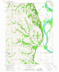 1966 Julian1968 Print · USGSThe Missouri River bottoms and Nebraska uplands are captured here in the mid-1960s as the river defines the borders of three states. Researchers can trace rural life through the locations of St Bernards Ch, Minersville, and several country schools like Hazel Dell Sch.2 unique versions available
 - 1966 Map of Nemaha, 1968 Print
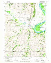 1966 Nemaha1968 Print · USGSSoutheast Nebraska and the Missouri River border are captured in the mid-sixties, showing the river’s winding course near Nemaha. Researchers can trace the Chicago Burlington and Quincy rail line, find the Maple Grove Sch, and locate the Pennwell Cem in the hills.2 unique versions available
 - 1966 Map of Langdon, 1968 Print
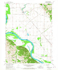 1966 Langdon1968 Print · USGSThe Missouri-Nebraska borderlands are captured here in the mid-sixties, where the Missouri River meets the Barada Hills. Genealogists and researchers can trace the rail lines of the Chicago Burlington and Quincy or locate rural sites like St Peters Ch and Hunter Cem.3 unique versions available
 - 1966 Map of Peru, 1968 Print
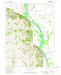 1966 Peru1968 Print · USGSThe Missouri River floodplain near the Nebraska-Missouri border comes to life in the mid-sixties, centered on the bluff-side town of Peru. Genealogists and historians can locate rural landmarks like Mt Vernon Cem, Locust Grove Sch, and the Peru State College campus.2 unique versions available
 - 1966 Map of Hamburg, 1968 Print
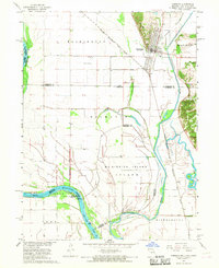 1966 Hamburg1968 Print · USGSSouthwest Fremont County is captured here in the late sixties at the three-state junction of Iowa, Missouri, and Nebraska. Genealogists and historians can trace the town of Hamburg, the Hamburg Cem, and the path of the Chicago Burlington and Quincy railroad.2 unique versions available
Showing maps 1-25 of 112
Top cities of Atchison County
- Tarkio historical maps
- Rock Port historical maps
- Fairfax historical maps
- Westboro historical maps
- Watson historical maps
Frequently asked questions
- What are the different types of historical maps available for Atchison County?
- What is the oldest map of Atchison County?
- Where can I purchase historical maps of Atchison County for my home or office?
- Where can I download high-res historical maps of Atchison County?
- Are there historical topographic maps available for Atchison County?
- Is there historical aerial imagery available for Atchison County?
- Where are historical maps of Atchison County sourced from?