1940s Maps of Butler County, Missouri
Explore 7 historic maps of Butler County from the 1940s. These maps offer a rare glimpse into what life looked like during the 1940s — showing old roads, neighborhoods, homes, and landmarks that have changed or disappeared over time.
Whether you're researching your family's past, planning a metal detecting trip, or studying how Butler County's landscape evolved across the 1940s, these high-resolution maps are a powerful tool for exploring the history of this region.
- Focus on a specific era: All maps on this page are from the 1940s, giving you a focused view of this time period.
- See what’s changed: Compare century-old streets, trails, and buildings to today's modern landscape using overlays and satellite layers.
- Research with precision: Use these maps for genealogy, historical research, land use analysis, or educational projects.
- View, download, or print: Maps are fully viewable online in high resolution, and can be downloaded or printed for your own records.
Start exploring Butler County's history through authentic maps from the 1940s. This is your window into the past.
Butler County, MO maps
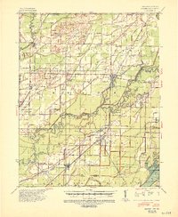
(7)- 1940 Map of Williamsville
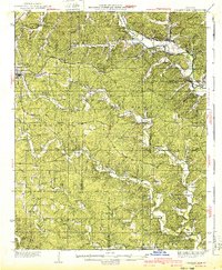 1940 Williamsville1940 Print · USGSThe eastern Ozarks at the start of the 1940s reveal a bustling rail-and-river economy centered on the junction of the Missouri Pacific and St Louis - San Francisco. Researchers can trace the unique immigrant history of Budapest or locate vanished landmarks like the Fire Tower CCC Camp and Barrett Mine.2 unique versions available
 - 1940 Map of Naylor
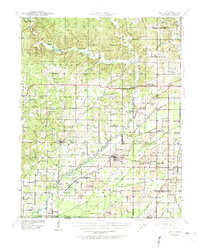 1940 Naylor1940 Print · USGSRipley and Butler counties are captured here just before the mid-century, showing a landscape defined by the Little Black River and a dense rail network. Genealogists can trace family roots through dozens of local sites like Sixteen to One Sch and the Military Cem.
 - 1940 Map of Valley Ridge, 1943 Print
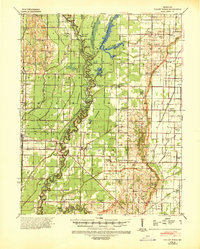 1940 Valley Ridge1943 Print · USGSDunklin and Butler counties come to life in the early 1940s, where the St Francis River winds through a landscape of new drainage ditches and high ridges. Researchers can locate family landmarks like Stephens Cem or trace old river crossings at Higginbothams Ferry.
 - 1940 Map of Piggott, 1945 Print
 1940 Piggott1945 Print · USGSNortheast Arkansas and the Missouri Bootheel meet along the winding St Francis River in the decade before the post-war era. Genealogists and local historians can locate numerous rural landmarks including Gravel Hill Ch & Cem, Pine City, and the St Louis Southwestern RR line.
 - 1941 Map of Knobel, 1946 Print
 1941 Knobel1946 Print · USGSClay County at the onset of the 1940s is defined by the winding Black River and the critical rail junctions that sustained its small towns. Researchers can trace family roots through numerous rural landmarks like Masterson Cem, Brazil Sch & Ch, and the river crossing at Bennetts Ferry Bridge.2 unique versions available
 - 1944 Map of Naylor
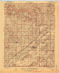 1944 Naylor1944 Print · USGSThe Missouri-Arkansas border region in the early 1940s reveals a landscape shaped by the St Louis San Francisco railroad and the historic Military Road. Researchers can trace old family-named sites like Cochran Cem, Sewell Sch, and the riverside settlement of Naylor.2 unique versions available
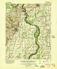
 - 1949 Map of Poplar Bluff, 1964 Print
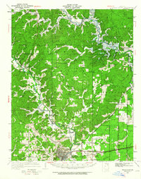 1949 Poplar Bluff1964 Print · USGSThe area surrounding Poplar Bluff is shown during a period of transition as the Ozark hills meet the engineered drainage canals of the lowlands. Researchers can trace the St Louis San Francisco railroad through rural stops like Chaonia and Taskee Sta.
End of results
Showing maps 1-7 of 7
Top cities of Butler County
Frequently asked questions
- What are the different types of historical maps available for Butler County?
- What is the oldest map of Butler County?
- Where can I purchase historical maps of Butler County for my home or office?
- Where can I download high-res historical maps of Butler County?
- Are there historical topographic maps available for Butler County?
- Is there historical aerial imagery available for Butler County?
- Where are historical maps of Butler County sourced from?