1900s (20th Century) Maps of Clark County, Missouri
Explore 35 historic maps of Clark County from the 1900s (20th Century). These maps offer a rare glimpse into what life looked like during the 1900s — showing old roads, neighborhoods, homes, and landmarks that have changed or disappeared over time.
Whether you're researching your family's past, planning a metal detecting trip, or studying how Clark County's landscape evolved across the 1900s, these high-resolution maps are a powerful tool for exploring the history of this region.
- Focus on a specific era: All maps on this page are from the 1900s, giving you a focused view of this time period.
- See what’s changed: Compare century-old streets, trails, and buildings to today's modern landscape using overlays and satellite layers.
- Research with precision: Use these maps for genealogy, historical research, land use analysis, or educational projects.
- View, download, or print: Maps are fully viewable online in high resolution, and can be downloaded or printed for your own records.
Start exploring Clark County's history through authentic maps from the 1900s. This is your window into the past.
Clark County, MO maps
(35)- 1903 Map of Kahoka
 1903 Kahoka1903 Print · USGSNortheast Missouri at the turn of the century shows a landscape defined by the convergence of major rivers and competing rail lines. Genealogists can trace family roots in early centers like Kahoka and Monticello, or locate riverfront crossings at St. Francisville and Canton.3 unique versions available
 - 1936 Map of Keokuk
 1936 Keokuk1936 Print · USGSHancock County and the Mississippi River transition into a new era of hydroelectric power and rail transit in the 1930s. Genealogists can locate dozens of country schools and churches, from Froggy Sch and Sylvanvale Sch to Sanobia Ch.3 unique versions available
 - 1946 Map of Mendon, 1958 Print
 1946 Mendon1958 Print · USGSThe fertile bottomlands of Adams County are seen here in the mid-1940s, as massive drainage projects reshaped the Mississippi River's eastern bank. Genealogists can locate family names and sites through numerous rural landmarks like Wesley Chapel Cem, Gentry Sch, and the Canton Ferry.
 - 1948 Map of Mendon
 1948 Mendon1948 Print · USGSUpper Adams County in the late 1940s reveals a landscape defined by Mississippi River engineering and tight-knit rural communities. Researchers can trace ancestral locations at New Providence Cem, several dozen one-room schoolhouses like Golden Sch, and the winding Bear Creek drainage.2 unique versions available
 - 1949 Map of Wayland, 1954 Print
 1949 Wayland1954 Print · USGSThe Des Moines River border between Missouri and Iowa comes alive in the late 1940s, showing the early rail and road networks of Clark and Lee Counties. Researchers can find St Francisville, trace the Chicago Burlington and Quincy tracks, or locate Oak Hill Cem.3 unique versions available
 - 1949 Map of Kahoka SE, 1963 Print
 1949 Kahoka SE1963 Print · USGSNortheastern Missouri farmland meets the winding Fox River in this mid-century survey of Clark and Lewis Counties. Genealogists and local historians can trace rural school districts like Lone Star Sch and locate family burial sites at Mt Zion Cem and St Patrick Cem.2 unique versions available
 - 1949 Map of Kahoka, 1977 Print
 1949 Kahoka1977 Print · USGSNortheast Missouri agriculture and rail history are well-preserved here in the years following the war. Genealogists and local historians can trace family roots through numerous country school sites like Little Fox Sch and old burial grounds including Clark City Cem.
 - 1949 Map of St. Patrick, 1977 Print
 1949 St. Patrick1977 Print · USGSNortheast Missouri’s rural landscape is captured here at mid-century, just as the network of one-room country schools began to fade. Genealogists can locate family landmarks like the Pride of the West Sch, Honey Creek Cem, and the village of St Patrick.
 - 1950 Map of Kahoka
 1950 Kahoka1950 Print · USGSKahoka and the surrounding Clark County townships are captured here at mid-century, defined by a landscape of small schools and dual rail lines. Genealogists and local historians can trace family locations near Lincoln College Sch, Grace Chapel, and the County Fairgrounds.3 unique versions available
 - 1950 Map of Saint Patrick
 1950 Saint Patrick1950 Print · USGSNortheast Missouri agriculture and rural life are preserved here just after the war, centered on the community of St Patrick. Researchers can locate numerous country schools and cemeteries, from Pride of the West Sch to Bash Cem and Higbee Cem.2 unique versions available
 - 1950 Map of Kahoka SE
 1950 Kahoka SE1950 Print · USGSNortheast Missouri agriculture and river life are captured here in the mid-century, before modern consolidation changed the rural landscape. Researchers can trace family history through numerous country schools like Gravel Hill Sch and local landmarks such as Bluff Springs Ch.2 unique versions available
 - 1950 Map of Wayland
 1950 Wayland1950 Print · USGSThe river border between Missouri and Iowa comes alive in the late 1940s, showing a landscape of rail-connected farming towns and river crossings. Genealogists can trace family footprints at St Francisville, Wayland, and rural landmarks like Oak Hill Cem or Independent Sch.
 - 1950 Map of Keokuk, 1954 Print
 1950 Keokuk1954 Print · USGSThe Mississippi River borderlands of Iowa and Illinois come alive in the mid-century as the Keokuk Dam reshapes the valley. Genealogists can trace a remarkable concentration of local landmarks, from Moss Cem to numerous rural schoolhouses like Rocky Run Sch and Eureka Sch.
 - 1950 Map of Neeper, 1956 Print
 1950 Neeper1956 Print · USGSNortheastern Missouri farmland around the Wyaconda River is shown here as it appeared in the mid-twentieth century. Family researchers can trace the locations of the Old German Cem, Foree, and several now-closed schools like Ballard Sch.
 - 1950 Map of Canton, 1967 Print
 1950 Canton1967 Print · USGSMissouri river life at mid-century centered on the busy transit hub of Canton and its surrounding rural school districts. Genealogists and historians can trace local landmarks like Culver-Stockton College, the Canton Ferry, and numerous country schools from Hardin Sch to Melrose Sch.3 unique versions available
 - 1950 Map of Medill, 1967 Print
 1950 Medill1967 Print · USGSMedill and its neighboring townships are shown here at a mid-century peak of rural rail connectivity and community life. You can trace the crossing of the Chicago Burlington and Quincy and Atchison Topeka and Santa Fe railroads alongside family landmarks like Zimmerman Cem and Happy Hill Sch.2 unique versions available
 - 1950 Map of Colony, 1976 Print
 1950 Colony1976 Print · USGSNortheast Missouri at the mid-century mark reveals a rural landscape defined by independent school districts and quiet creek valleys. Genealogists and historians can trace the foundations of local life at Sutter Cem, Fairmont, and the Arkansas Sch.
 - 1951 Map of Colony
 1951 Colony1951 Print · USGSNortheast Missouri agriculture and small-town life are captured here at mid-century, where the four corners of Clark, Scotland, Knox, and Lewis counties converge. Researchers can trace family roots through sites like Sutter Cem, Bear Creek Ch, and schools such as Price Sch.2 unique versions available
 - 1951 Map of Neeper
 1951 Neeper1951 Print · USGSNortheast Missouri at the start of the fifties shows a rural landscape in transition as consolidated education begins to replace old country schools. Genealogists can trace family names at Schuster Cem or locate the site of Neeper and Liberty Ch.2 unique versions available
 - 1951 Map of Canton
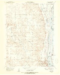 1951 Canton1951 Print · USGSThe Missouri-Illinois river border comes alive in the early fifties, showing the riverside economy of Canton and its connection to Meyer. Genealogists and historians can trace numerous country schools like Hazel Grove Sch and churches such as Shiloh Ch.2 unique versions available
 - 1951 Map of Medill
 1951 Medill1951 Print · USGSMid-century Clark County is defined here by its intersection of major rail lines and a thriving network of rural schools and churches. Genealogists can trace family footprints through sites like Zimmerman Cem, Happy Hill Sch, and Carmel Ch.
 - 1951 Map of Wyaconda
 1951 Wyaconda1951 Print · USGSNortheast Missouri’s rural character is captured here during the early fifties as railroads and river channels shaped the landscape. Genealogists can locate family-named sites and landmarks like Etna Cem, Flint Ridge Sch, and the rail junction at Wyaconda.2 unique versions available
 - 1958 Map of Burlington, 1968 Print
 1958 Burlington1968 Print · USGSThe tri-state river country of Iowa, Illinois, and Missouri is captured here in the mid-fifties, dominated by the Mississippi River and major rail lines. Genealogists and historians can trace the development of river towns like Keokuk or locate the sprawling Iowa Army Ammunition Plant.4 unique versions available
 - 1961 Map of Burlington
 1961 Burlington1961 Print · USGSThe tri-state borderlands along the Mississippi River are captured here during the late fifties and early sixties, showing the vital river-and-rail economy of Iowa, Illinois, and Missouri. Genealogists and historians can trace the development of major hubs like Galesburg and Macomb alongside landmark sites such as the Iowa Ordnance Plant and the historic river town of Nauvoo.
 - 1963 Map of Burlington
 1963 Burlington1963 Print · USGSThe tri-state river country of the Mississippi and Illinois valleys comes alive in this mid-century survey. Genealogists and historians can trace the industrial and academic growth of the region, from the Iowa Ordnance Plant to campuses like Knox College and Western Illinois University.
Showing maps 1-25 of 35
Top cities of Clark County
- Kahoka historical maps
- Wayland historical maps
- Wyaconda historical maps
- Alexandria historical maps
- Revere historical maps
- Luray historical maps
Frequently asked questions
- What are the different types of historical maps available for Clark County?
- What is the oldest map of Clark County?
- Where can I purchase historical maps of Clark County for my home or office?
- Where can I download high-res historical maps of Clark County?
- Are there historical topographic maps available for Clark County?
- Is there historical aerial imagery available for Clark County?
- Where are historical maps of Clark County sourced from?