2020s Maps of Taos, Missouri
Explore 2 historic maps of Taos from the 2020s. These maps offer a rare glimpse into what life looked like during the 2020s — showing old roads, neighborhoods, homes, and landmarks that have changed or disappeared over time.
Whether you're researching your family's past, planning a metal detecting trip, or studying how Taos's landscape evolved across the 2020s, these high-resolution maps are a powerful tool for exploring the history of this region.
- Focus on a specific era: All maps on this page are from the 2020s, giving you a focused view of this time period.
- See what’s changed: Compare century-old streets, trails, and buildings to today's modern landscape using overlays and satellite layers.
- Research with precision: Use these maps for genealogy, historical research, land use analysis, or educational projects.
- View, download, or print: Maps are fully viewable online in high resolution, and can be downloaded or printed for your own records.
Start exploring Taos's history through authentic maps from the 2020s. This is your window into the past.
Taos, MO maps
(2)- 2021 Map of Osage City, 2021 Print
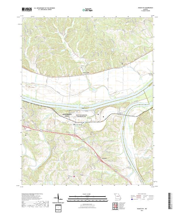 2021 Osage City2021 Print · USGSCentral Missouri's river heritage is on full display in the early 2020s where the Missouri River and Osage River converge near the state capital. Local researchers can trace family lands near Taos and Schubert or locate historic burial sites like Osage City Cem and Thorp Cem.
 - 2021 Map of Westphalia West, 2021 Print
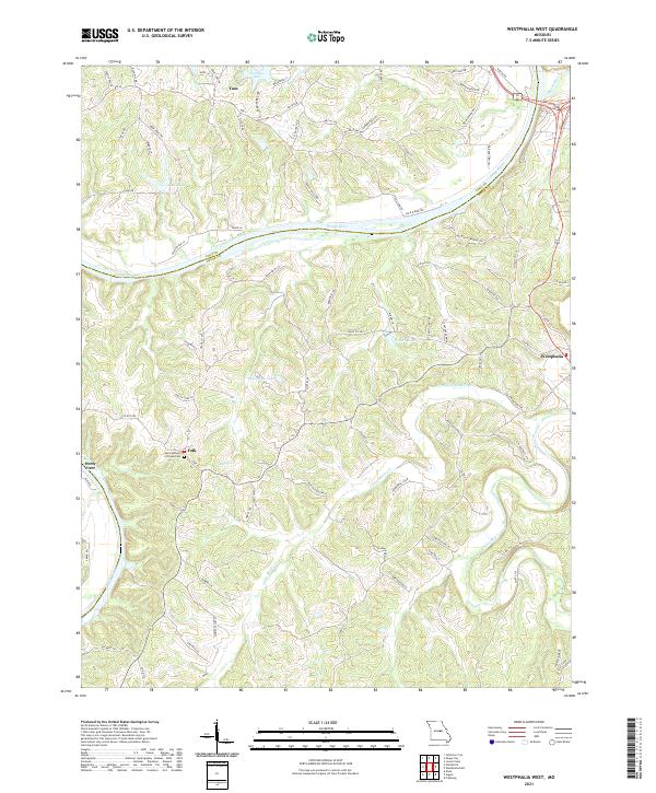 2021 Westphalia West2021 Print · USGSOsage and Cole counties are captured here in the early 2020s, centered on the river-bluff settlements and rural crossroads south of the state capital. Researchers can trace family history at Saint Anthony of Padua Cem and locate landmarks in Westphalia, Folk, and Taos.
End of results
Showing maps 1-2 of 2
Top cities near Taos
- Jefferson City historical maps
- Holts Summit historical maps
- Linn historical maps
- Wardsville historical maps
- New Bloomfield historical maps
- Freeburg historical maps
See more
Frequently asked questions
- What are the different types of historical maps available for Taos?
- What is the oldest map of Taos?
- Where can I purchase historical maps of Taos for my home or office?
- Where can I download high-res historical maps of Taos?
- Are there historical topographic maps available for Taos?
- Is there historical aerial imagery available for Taos?
- Where are historical maps of Taos sourced from?