1950s Maps of Douglas County, Missouri
Explore 13 historic maps of Douglas County from the 1950s. These maps offer a rare glimpse into what life looked like during the 1950s — showing old roads, neighborhoods, homes, and landmarks that have changed or disappeared over time.
Whether you're researching your family's past, planning a metal detecting trip, or studying how Douglas County's landscape evolved across the 1950s, these high-resolution maps are a powerful tool for exploring the history of this region.
- Focus on a specific era: All maps on this page are from the 1950s, giving you a focused view of this time period.
- See what’s changed: Compare century-old streets, trails, and buildings to today's modern landscape using overlays and satellite layers.
- Research with precision: Use these maps for genealogy, historical research, land use analysis, or educational projects.
- View, download, or print: Maps are fully viewable online in high resolution, and can be downloaded or printed for your own records.
Start exploring Douglas County's history through authentic maps from the 1950s. This is your window into the past.
Douglas County, MO maps
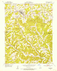
(13)- 1950 Map of Cabool SW, 1952 Print
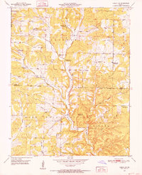 1950 Cabool SW1952 Print · USGSTexas and Douglas Counties in the early 1950s show a rugged Ozark landscape of national forest and family farms. Trace local history through numerous rural landmarks like Macedonia Cem, Onyx Cave, and several schools including Pine Flat Sch and Little Creek Sch.3 unique versions available
 - 1951 Map of Norwood, 1952 Print
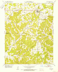 1951 Norwood1952 Print · USGSThe Missouri Ozarks are captured here just after the war, centered on the St Louis San Francisco rail corridor. Researchers can locate numerous rural schools and churches like Oak Forest Ch, Stony Point Sch, and Shiloh Cem.2 unique versions available
 - 1951 Map of Mountain Grove South, 1952 Print
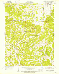 1951 Mountain Grove South1952 Print · USGSThe Missouri Ozarks south of Mountain Grove are shown here in the early 1950s as a landscape of rural schools and winding creek valleys. Researchers can locate family landmarks like Strunk Cem and old country schools including Oak Grove Sch and Fairmount Sch.3 unique versions available
 - 1951 Map of Cabool SE, 1952 Print
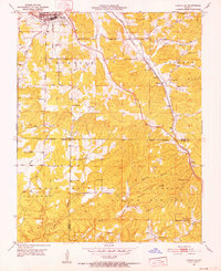 1951 Cabool SE1952 Print · USGSTexas and Howell counties in the early 1950s reveal a landscape divided between the busy rail town of Cabool and the deep woods of the Ozarks. Genealogists can trace rural life through sites like Pea Ridge Ch, the Jones Cem, and the now-abandoned Forest Flower Sch.6 unique versions available
 - 1951 Map of Mansfield, 1953 Print
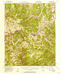
 1951 Mansfield1953 Print · USGSMansfield and the surrounding Ozark country are documented here in the early fifties, following the path of the ST Louis - San Francisco railroad. Genealogists can locate family landmarks such as Wallace Cem, Huffman Sch, and Olathia.3 unique versions available
 - 1951 Map of Cedar Gap, 1953 Print
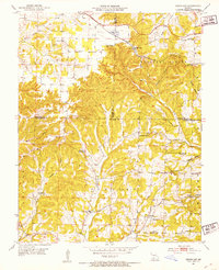 1951 Cedar Gap1953 Print · USGSThe Missouri Ozarks during the early fifties were defined by high-elevation rail stops and a fading network of rural school districts. Genealogists can trace family roots at Gentry Cem or locate the sites of Skylight Sch and the remote Mountain Side Sch.5 unique versions available
 - 1951 Map of Cabool, 1958 Print
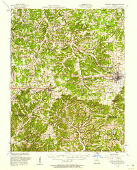
 1951 Cabool1958 Print · USGSThe Ozark Plateau near Cabool and Mountain Grove is shown here in the early fifties, centering on the St Louis-San Francisco RR corridor. Genealogists can trace family landmarks like Cedar Bluff Cem, Hamilton Creek Church, and several rural schools.2 unique versions available
 - 1951 Map of Mountain Grove, 1958 Print
 1951 Mountain Grove1958 Print · USGSWright and Douglas counties come alive in the early fifties, showing a landscape of small farmsteads and rural schoolhouses. Genealogists can locate specific family landmarks like Day Cem, Owens, and the St Louis San Francisco RR corridor.
 - 1954 Map of Harrison
 1954 Harrison1954 Print · USGSThe Ozarks and Boston Mountains meet during a period of massive river engineering in the mid-fifties. Researchers can trace the early shorelines of Bull Shoals Lake and Table Rock Reservoir or locate inland towns like Berryville and Harrison.
 - 1954 Map of Springfield
 1954 Springfield1954 Print · USGSThe Missouri Ozarks are captured here during the post-war era, showing the expansion of Springfield and the surrounding river valleys. Genealogists and historians can trace local landmarks like Mount Comfort Cemetery and the Fort Leonard Wood military grounds.6 unique versions available
 - 1958 Map of Springfield
 1958 Springfield1958 Print · USGSThe Missouri Ozarks are captured during the mid-century era of growth, centered on the bustling hub of Springfield. Genealogists and historians can trace family roots through numerous landmarks like Ebenezer Church, Stockton Cem, and the various county courthouses.
 - 1958 Map of Harrison, 1973 Print
 1958 Harrison1973 Print · USGSThe Ozark and Boston Mountains appear in this mid-century survey as the great White River impoundments were reshaping the region. Researchers can trace the rail lines of the St Louis-San Francisco Ry and locate early settlements like Berryville and Gainesville.
 - 1959 Map of Springfield
 1959 Springfield1959 Print · USGSThe Missouri Ozarks are captured here during a decade of postwar growth and increasing highway connectivity. Researchers can trace the legacy of the St Louis-San Francisco RR and locate early sites in Springfield, Lebanon, and Mountain Grove.
End of results
Showing maps 1-13 of 13
Top cities of Douglas County
Frequently asked questions
- What are the different types of historical maps available for Douglas County?
- What is the oldest map of Douglas County?
- Where can I purchase historical maps of Douglas County for my home or office?
- Where can I download high-res historical maps of Douglas County?
- Are there historical topographic maps available for Douglas County?
- Is there historical aerial imagery available for Douglas County?
- Where are historical maps of Douglas County sourced from?