Old Maps of Hickory County, Missouri for Metal Detecting
Plan your next treasure hunt with 106 historic maps of Hickory County. Find old homesites, ghost towns, trails, and gathering spots that may be lost to time — perfect for identifying promising metal detecting locations.
- Locate forgotten sites: Uncover places like long-lost settlements, abandoned rail lines, or gathering spots.
- Plan better hunts: Use map overlays combined with LiDAR or satellite views to narrow in on historically rich areas.
- Made for detectorists: Thousands of hobbyists use these maps to discover relics, coins, and hidden history.
Use these historic maps to boost your research and find new opportunities beneath the surface of Hickory County.
Hickory County, MO maps
(106)- 1884 Map of Bolivar
 1884 Bolivar1884 Print · USGSSouthwestern Missouri in the mid-1880s is documented here at a time when river drainage and ridge-top travel dictated the growth of local townships. Researchers can trace early rural post offices and communities like Hermitage, Half Way, and Parks Mill.
 - 1886 Map of Stockton
 1886 Stockton1886 Print · USGSSouthwest Missouri in the mid-1880s was a landscape of river-bottom farms and emerging rail towns along the Kansas City Clinton and Springfield R. R. Trace vanished post offices and local landmarks like Johnson's Mill, Dunnegan Springs, and the early streets of Stockton.3 unique versions available
 - 1887 Map of Clinton
 1887 Clinton1887 Print · USGSWest-Central Missouri is captured during a period of rapid railroad expansion in the 1880s, centered on the growing junction at Clinton. Researchers can trace early township developments and find established settlements like Chalk Level, Iconium, and Brownington along the winding Osage River.
 - 1887 Map of Warsaw
 1887 Warsaw1887 Print · USGSBenton County was a land of river junctions and railheads in the late 1880s. Local historians can trace the early footprints of Warsaw, the winding Missouri Pacific Railroad, and riverside settlements like Fairfield and Duroc.
 - 1892 Map of Bolivar, 1898 Print
 1892 Bolivar1898 Print · USGSMissouri's central Ozarks borderlands are captured here in the 1880s, showcasing the early layout of Polk and Hickory counties. Genealogists can trace family roots through localized sites like Parks Mill, the early street grids of Bolivar and Buffalo, and the settlement at Hermitage.5 unique versions available
 - 1894 Map of Warsaw
 1894 Warsaw1894 Print · USGSBenton County and its neighbors are shown here in the mid-1880s, centered on the river junctions that shaped early Missouri commerce. Genealogists can trace family roots through old rural centers like Fairfield, Boylers Mills, and Cross Timbers before the river valleys were transformed.4 unique versions available
 - 1894 Map of Clinton
 1894 Clinton1894 Print · USGSHenry County and St. Clair County thrive during the peak of the railroad era in the 1890s. Genealogists and historians can trace the early rail stops at Clinton and Brownington, or locate vanished post offices like Chalk Level and Huntingdale.4 unique versions available
 - 1940 Map of Weaubleau, 1954 Print
 1940 Weaubleau1954 Print · USGSThe St. Clair and Hickory county line area comes into focus in the 1940s, showing a landscape of rail-linked towns and local school districts. Trace family roots at Robinson Cem or explore the old routes through Gerster, Collins, and Weaubleau.2 unique versions available
 - 1940 Map of Iconium, 1963 Print
 1940 Iconium1963 Print · USGSNear the bend of the Osage River just before the war, this rural landscape reveals a network of Missouri hollows and prairie lands. Genealogists can trace early homesteads and community hubs like Iconium, Liberty Sch, and the Boy Scout Camp.2 unique versions available
 - 1942 Map of Elkton, 1982 Print
 1942 Elkton1982 Print · USGSHickory and Polk Counties are captured here during a period of transition as the river valley was reshaped by new infrastructure. Genealogists can trace family roots through the Round Tree Cem, Mission Chapel, and many rural schoolhouses like Elkton Sch.
 - 1944 Map of Humansville
 1944 Humansville1944 Print · USGSNear the intersection of three counties in the mid-1940s, this area centered on a thriving rail and agricultural landscape. Local historians can trace family roots through numerous country schoolhouses like Elm Grove Sch and cemeteries such as Richardson Cem.3 unique versions available
 - 1944 Map of Weaubleau
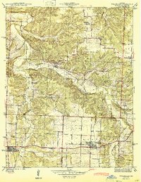 1944 Weaubleau1944 Print · USGSHickory and St. Clair Counties come into focus during the early 1940s as the railroad and rural school districts defined local life. Researchers can trace family-named landmarks and early homesteads near Weaubleau, Gerster, and Robinson Cem.2 unique versions available
 - 1944 Map of Iconium
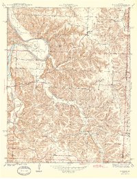 1944 Iconium1944 Print · USGSThe Osage River bends through the St. Clair County hills in the early 1940s, revealing a landscape of steep hollows and upland farms. Trace local family roots at Iconium, Corbin Ch, and several rural schoolhouses like Square Prairie Sch.2 unique versions available
 - 1945 Map of Fristoe
 1945 Fristoe1945 Print · USGSBenton and Hickory Counties appear here in the mid-1940s, showing a landscape of Ozark ridges and river bottomlands before major mid-century changes. Researchers can trace ancestral locations through numerous rural schools and river crossings like Evening Shade Sch and Little Mill Creek Ford.3 unique versions available
 - 1947 Map of Jefferson City, 1949 Print
 1947 Jefferson City1949 Print · USGSCentral Missouri and the northern Ozarks come into focus in this late 1940s survey of the river-and-rail landscape. Genealogists and historians can trace the growth of Jefferson City and Sedalia or locate family roots near Bagnell Dam and the Lake of the Ozarks.
 - 1949 Map of Elkton, 1969 Print
 1949 Elkton1969 Print · USGSMid-century Hickory and Polk counties are defined by the winding Pomme De Terre River and a quiet network of rural settlements. Genealogists can trace family footprints through a remarkable density of local schools like Royal Sch and churches including Durnell Chapel.2 unique versions available
 - 1949 Map of Sentinel, 1973 Print
 1949 Sentinel1973 Print · USGSThe Pomme de Terre River valley in Hickory and Polk Counties is shown here just after the war, before modern development altered the rural landscape. Researchers can locate numerous vanished landmarks and family sites like Pittsburg Ch, Stewart Cem, and the Rose Hill Sch.2 unique versions available
 - 1950 Map of Elkton
 1950 Elkton1950 Print · USGSHickory County's rural townships are captured here at mid-century, just before large-scale reservoir projects altered the regional landscape. Researchers can trace family history through a remarkable density of local sites, from Round Tree Cem and McCracken Cem to a dozen neighborhood schools like Mashburn Sch and Royal Sch.2 unique versions available
 - 1950 Map of Sentinel
 1950 Sentinel1950 Print · USGSHickory and Polk counties are shown here at the start of the 1950s, a period when the river valley remained a landscape of rural schools and creek-side settlements. Genealogists can trace family roots at Chamberlain Cem or locate lost landmarks like Mohawk Corner and Rose Hill Sch.2 unique versions available
 - 1950 Map of Urbana, 1967 Print
 1950 Urbana1967 Print · USGSThe crossroads of Hickory, Dallas, and Polk counties come alive in the mid-1950s around the settlements of Urbana and Louisburg. Genealogists and historians can trace the foundations of this rural community through Star Ridge Sch, Bower Chapel, and Rimby.2 unique versions available
 - 1951 Map of Urbana
 1951 Urbana1951 Print · USGSMid-century Dallas and Hickory Counties are captured here as a network of small farm towns and country parishes. Genealogists can trace family footprints near Urbana, Rimby, and the Star Ridge Sch, or locate the Cussington Cem near Louisburg.2 unique versions available
 - 1951 Map of Hermitage, 1952 Print
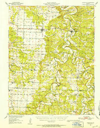 1951 Hermitage1952 Print · USGSMid-century Hickory County is defined here by the winding Pomme de Terre River and a landscape of isolated farmsteads and rural schools. Genealogists and historians can trace family locations at McCracken Cemetery or study vanished community hubs like Elkton Sch and Rondo.3 unique versions available
 - 1954 Map of Jefferson City
 1954 Jefferson City1954 Print · USGSCentral Missouri in the early postwar years showcases a landscape defined by the winding Lake of the Ozarks and the state capital at Jefferson City. Researchers can trace the mid-century rail networks of the Missouri Pacific RR and locate rural communities like Tuscumbia, St Elizabeth, and St Anthony.2 unique versions available
 - 1954 Map of Springfield
 1954 Springfield1954 Print · USGSThe Missouri Ozarks are captured here during the post-war era, showing the expansion of Springfield and the surrounding river valleys. Genealogists and historians can trace local landmarks like Mount Comfort Cemetery and the Fort Leonard Wood military grounds.6 unique versions available
 - 1955 Map of Jefferson City, 1967 Print
 1955 Jefferson City1967 Print · USGSCentral Missouri in the mid-fifties is defined by the winding Missouri River and the expanding reach of Lake of the Ozarks. Researchers can trace the rail corridors of the Missouri Pacific or locate the early footprint of Whiteman AFB and Jefferson City.4 unique versions available
Showing maps 1-25 of 106
Top cities of Hickory County
- Weaubleau historical maps
- Hermitage historical maps
- Wheatland historical maps
- Cross Timbers historical maps
- Preston historical maps
Frequently asked questions
- What are the different types of historical maps available for Hickory County?
- What is the oldest map of Hickory County?
- Where can I purchase historical maps of Hickory County for my home or office?
- Where can I download high-res historical maps of Hickory County?
- Are there historical topographic maps available for Hickory County?
- Is there historical aerial imagery available for Hickory County?
- Where are historical maps of Hickory County sourced from?