1980s Maps of Holt County, Missouri
Explore 13 historic maps of Holt County from the 1980s. These maps offer a rare glimpse into what life looked like during the 1980s — showing old roads, neighborhoods, homes, and landmarks that have changed or disappeared over time.
Whether you're researching your family's past, planning a metal detecting trip, or studying how Holt County's landscape evolved across the 1980s, these high-resolution maps are a powerful tool for exploring the history of this region.
- Focus on a specific era: All maps on this page are from the 1980s, giving you a focused view of this time period.
- See what’s changed: Compare century-old streets, trails, and buildings to today's modern landscape using overlays and satellite layers.
- Research with precision: Use these maps for genealogy, historical research, land use analysis, or educational projects.
- View, download, or print: Maps are fully viewable online in high resolution, and can be downloaded or printed for your own records.
Start exploring Holt County's history through authentic maps from the 1980s. This is your window into the past.
Holt County, MO maps
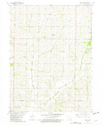
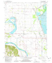
(13)- 1981 Map of Mound City, 1982 Print
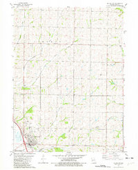 1981 Mound City1982 Print · USGSMound City and the surrounding loess hills of Holt County are captured here in the early eighties as the town expanded near the river bluffs. Genealogists and local historians can trace the foundations of rural communities at Bethel Ch, Mt Hope Cem, and the Center District Cem.
 - 1981 Map of New Point, 1982 Print
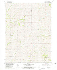
 1981 New Point1982 Print · USGSHolt and Andrew counties appear as a network of rural townships and winding river bottoms in the early eighties. Genealogists can trace family lines through numerous local burial sites like Nodaway Cemetery and Cowan Cemetery near the village of New Point.
 - 1981 Map of Maitland, 1982 Print
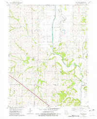
 1981 Maitland1982 Print · USGSMaitland and Graham thrive along the Nodaway River valley in the early eighties as rail and river dictate the local geography. Genealogists and historians can locate family plots at Prairie Home Cem or Schooler Cem and trace the old Burlington Northern rail corridor.
 - 1981 Map of Craig, 1982 Print
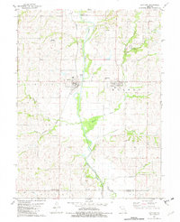
 1981 Craig1982 Print · USGSMissouri's Missouri River valley bottomlands come into focus in the early eighties as the rail lines and river channels define the Holt County countryside. Researchers can trace the Burlington Northern tracks or locate family sites like Caton Cem and Pleasant View Ch.
 - 1981 Map of Tarkio SE, 1982 Print
 1981 Tarkio SE1982 Print · USGSNorthwest Missouri is captured here in the late seventies, showing the rolling creek valleys along the Atchison Co Holt Co border. Genealogists can trace family names and local landmarks like Sharps Grove Ch, Walkup Cem, and Tharp Cem.
 - 1981 Map of Dotham, 1982 Print
 1981 Dotham1982 Print · USGSAtchison and Nodaway counties in the late 1970s show a landscape shaped by agricultural tradition and numerous winding creek branches. Genealogists can locate family landmarks such as St Oswald Ch, Burr Oak Ch, and the community of Dotham.
 - 1981 Map of Fairfax, 1982 Print
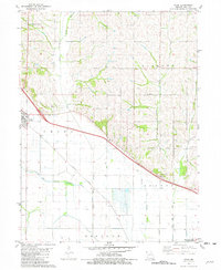
 1981 Fairfax1982 Print · USGSAgricultural life in northwest Missouri during the early eighties centered on the Tarkio River and the rails. Genealogists can locate family landmarks like English Grove Ch, Mount Hope Cem, and the old settlement of Milton.
 - 1981 Map of Kimsey Creek, 1982 Print
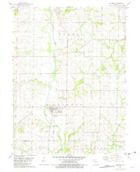
 1981 Kimsey Creek1982 Print · USGSHolt County's river-bluff landscape is captured here in the early eighties, showcasing the intersection of the Squaw Creek National Wildlife Refuge and the upland farm townships. Researchers can locate several rural burial grounds including Baldwin Cem and Boyd Cem along the Burlington Northern rail line.
 - 1981 Map of Big Lake, 1982 Print
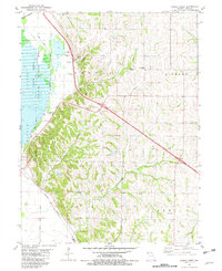
 1981 Big Lake1982 Print · USGSThe Missouri River floodplain comes to life in the early 1980s, documenting the vital wetlands and small rail towns along the Nebraska border. Genealogists can trace family names at Tarkio Chapel Cem and Laukemper Cem or locate the old Bigelow station.
 - 1981 Map of Skidmore, 1982 Print
 1981 Skidmore1982 Print · USGSNodaway County agricultural life and riverfront settlement are documented here in the early 1980s. Local researchers can trace the Burlington Northern Railroad Grade or locate family plots at Masonic Cem and Smith Cem.
 - 1985 Map of Atchison
 1985 Atchison1985 Print · USGSNortheast Kansas at the mid-eighties shows a landscape of river-bend towns and expansive tribal lands during a period of steady agricultural and rail activity. Local researchers can locate family sites at Mt Hope Cemetery, trace the grounds of Highland College, or explore the limits of the Kickapoo Indian Reservation.
 - 1986 Map of Falls City
 1986 Falls City1986 Print · USGSThe Missouri River borderlands of Nebraska and Missouri were a landscape of established colleges and river-bound railroads in the mid-1980s. Researchers can locate long-standing landmarks like Peru State College, the Iowa Indian Reservation, and St Johns Cem.2 unique versions available
 - 1986 Map of Saint Joseph
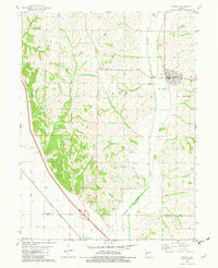
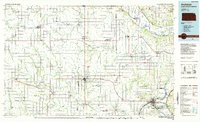
 1986 Saint Joseph1986 Print · USGSNorthwest Missouri thrived as a regional transportation and educational hub during the mid-eighties, centered on the historic river city of Saint Joseph. Researchers can locate specific local landmarks like Burlington Cemetery, Pigeon Hill Church, and the winding Pony Express Trail.2 unique versions available
End of results
Showing maps 1-13 of 13
Top cities of Holt County
- Mound City historical maps
- Oregon historical maps
- Forest City historical maps
- Maitland historical maps
- Craig historical maps
- Big Lake historical maps
See more
Frequently asked questions
- What are the different types of historical maps available for Holt County?
- What is the oldest map of Holt County?
- Where can I purchase historical maps of Holt County for my home or office?
- Where can I download high-res historical maps of Holt County?
- Are there historical topographic maps available for Holt County?
- Is there historical aerial imagery available for Holt County?
- Where are historical maps of Holt County sourced from?