Old Maps of Holt County, Missouri for Hiking & Exploration
Hike through history with 142 historic maps of Holt County. Explore old trails, ghost towns, and forgotten backroads — perfect for outdoor adventurers and local explorers.
- Rediscover forgotten places: Map out old mining camps, roads, and footpaths that no longer exist on modern maps.
- Layer with modern tools: Combine with LiDAR or satellite views to plan hikes through historical terrain.
- Made for exploration: Popular among hikers, overlanders, and local history lovers.
Use these maps to find adventure and explore the hidden past of Holt County.
Holt County, MO maps
(142)- 1885 Map of Atchison, 1954 Print
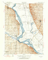
 1885 Atchison1954 Print · USGSNortheast Kansas and the Missouri border appear here in the late nineteenth century as a bustling corridor of river commerce and rail expansion. Genealogists can trace family roots through early settlements like Highland, Troy, and Everest, or locate the bounds of the Iowa Indian Reservation.
 - 1888 Map of Atchison
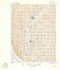
 1888 Atchison1888 Print · USGSThe Kansas-Missouri borderlands come alive in this late nineteenth-century record of a booming river and rail economy. Genealogists and historians can trace the early footprints of Atchison and Troy, or locate landmarks like the Iowa Indian Reservation and Sugar Lake.
 - 1893 Map of Atchison
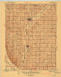
 1893 Atchison1893 Print · USGSNortheastern Kansas is captured here in the late nineteenth century as a bustling rail corridor along the Missouri River. Genealogists and historians can trace the early layout of the Iowa Indian Reservation and locate old trackside settlements like Severance and Effingham.5 unique versions available
 - 1915 Map of Falls City
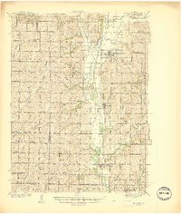
 1915 Falls City1915 Print · USGSRichardson County was a bustling corridor of rail lines and rural school districts during the early twentieth century. Genealogists can trace family footprints across dozens of local landmarks like Williamsville School, Straussville, and the Stone Quarry along the river.3 unique versions available
 - 1915 Map of Nemaha
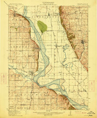 1915 Nemaha1915 Print · USGSThe Missouri River borderlands between Nebraska and Missouri are captured here in the years before major flood control altered the channel. Genealogists can trace family roots through dozens of rural landmarks, including Mt Vernon Cemetery, Antioch Church, and the river landing at St Deroin.2 unique versions available
 - 1920 Map of Craig
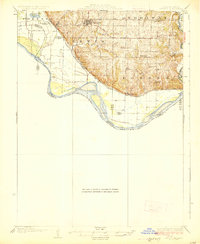
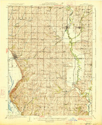
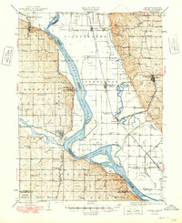
 1920 Craig1920 Print · USGSThe Missouri River bottoms and neighboring bluffs come alive in this post-war survey of the Nebraska-Missouri border. Researchers can trace dozens of rural landmarks, from the streets of Rulo and Bigelow to scattered schoolhouses like Brush College School and Idlewild School.5 unique versions available
 - 1924 Map of St. Joseph, 1960 Print
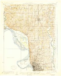
 1924 St. Joseph1960 Print · USGSNorthwest Missouri is captured in the mid-twenties as the Missouri River defines the landscape near St. Joseph. Genealogists and local historians can trace scores of rural institutions, from the State Hospital and County Farm to family-named landmarks like Old Union Cem and Gee School.2 unique versions available
 - 1926 Map of Saint Joseph
 1926 Saint Joseph1926 Print · USGSNorthwest Missouri thrived as a rail and river hub during the mid-twenties, centered on the growing industrial footprint of St. Joseph and Savannah. Researchers can trace early school districts like Liggett School, locate the historic Old Union Cem, and study the river-bottom landscape of French Bottom.3 unique versions available
 - 1926 Map of Oregon
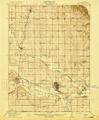
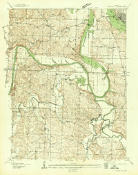
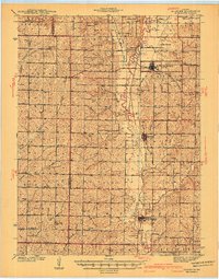
 1926 Oregon1926 Print · USGSHolt County's river bluffs and bottomlands are captured here in the mid-1920s, showing the early infrastructure of the Missouri valley. Genealogists can trace a wealth of rural landmarks including Mayflower School, the settlement of Richville, and the Chicago Burlington and Quincy rail line.3 unique versions available
 - 1926 Map of Maitland
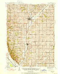
 1926 Maitland1926 Print · USGSNorthwest Missouri in the mid-1920s reveals a countryside of small farms and tightly packed rural school districts. Genealogists and historians can trace family roots through dozens of local landmarks like Triumph School, Bethel Church, and the village of Graham.3 unique versions available
 - 1936 Map of Fairfax
 1936 Fairfax1936 Print · USGSBenton and Hickory counties are captured in the mid-1930s just as the Lake of the Ozarks was reshaping the Osage River valley. Trace family roots at Wisdom Cem or locate the old Hogles Creek Sch and the community at Fairfield.
 - 1939 Map of Tarkio
 1939 Tarkio1939 Print · USGSNorthwest Missouri's farm country is captured here just before the mid-century, showing a landscape defined by the Tarkio River and a dense grid of rural schoolhouses. Researchers can trace family history through dozens of named landmarks like Tarkio College, Busch Cem, and the Chicago Burlington and Quincy rail line.
 - 1939 Map of Skidmore
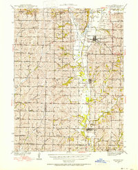 1939 Skidmore1939 Print · USGSNorthwest Missouri is captured here in the late thirties, when the river valleys were teeming with small school districts and active rail lines. Researchers can trace family history through dozens of rural schools like Evans Sch and churches including Centenary Ch.3 unique versions available
 - 1939 Map of Nemaha, 1954 Print
 1939 Nemaha1954 Print · USGSThe Missouri River floodplain and the bluffs of Nebraska and Missouri are captured here just before the mid-century. Researchers can trace the path of the Chicago Burlington and Quincy railroad and find vanished locations like St Deroin, Aspinwall, and McCandless Siding.
 - 1940 Map of Tarkio
 1940 Tarkio1940 Print · USGSAtchison County at the end of the Depression was a landscape of river-bottom farms and rural school districts. Genealogists can locate family-named landmarks and country parishes like English Grove Ch, Tarkio College, and Prairie Hill Cem.
 - 1941 Map of Tarkio
 1941 Tarkio1941 Print · USGSNorthwest Missouri thrived as a region of productive townships and rail-connected towns just before the war. Researchers can locate dozens of country schoolhouses like Irish Grove Sch and family landmarks such as the English Grove Ch or Prairie Hill Cem.2 unique versions available
 - 1941 Map of Skidmore
 1941 Skidmore1941 Print · USGSNodaway County agriculture and transit thrive during the late thirties and early forties as major rail lines intersect. Genealogists can locate dozens of rural landmarks, including St Oswald Ch, Burlington Junction, and the Little Brick Sch.
 - 1942 Map of Skidmore
 1942 Skidmore1942 Print · USGSNodaway County is captured here in the early 1940s, showing a landscape defined by the Nodaway River and the Chicago Burlington and Quincy railroad. Researchers can trace dozens of country school sites like Little Brick Sch and Eudora Sch, or find family landmarks such as St Oswald Ch and London Cem.2 unique versions available
 - 1949 Map of Nemaha
 1949 Nemaha1949 Print · USGSThe Missouri River lowlands come alive in this post-war survey of the Nebraska-Missouri border. Genealogists can trace family roots through dozens of named country schools and small rail stops like McCandless Siding and the settlement of St Deroin.
 - 1950 Map of Kansas City
 1950 Kansas City1950 Print · USGSMid-century Kansas and Missouri are captured here during a period of industrial growth and shifting transportation. Genealogists and historians can trace rail lines like the Wabash RR or locate ancestral homes near the Potawatomi Indian Reservation and Horton.
 - 1954 Map of Kansas City
 1954 Kansas City1954 Print · USGSThe Missouri-Kansas borderlands flourished in the post-war era as river commerce and rail networks converged at the Missouri River. Genealogists and historians can trace the foundations of Kansas City and smaller rural hubs like Hiawatha or Sabetha.
 - 1955 Map of Nebraska City, 1967 Print
 1955 Nebraska City1967 Print · USGSThe four-state region surrounding the Missouri River valley appears here in the mid-1950s, a landscape of rail-dependent market towns and rural school districts. Genealogists can locate family landmarks like the Rock Bluff School, St Oswald Church, and the Clarinda State Hospital.3 unique versions available
 - 1956 Map of Kansas City, 1967 Print
 1956 Kansas City1967 Print · USGSThe Kansas-Missouri border region thrived during the mid-fifties, centered on the growing metropolitan cores and the busy river valleys. Researchers can trace the layout of significant government sites like Fort Leavenworth and the Lake City Army Ammunition Plant.4 unique versions available
 - 1957 Map of Nebraska City
 1957 Nebraska City1957 Print · USGSThe four-state junction of Nebraska, Iowa, Missouri, and Kansas comes alive in this mid-fifties survey of the Missouri River valley. Genealogists and historians can trace the rail-and-road networks connecting Nebraska City, Maryville, and the Squaw Creek National Wildlife Refuge.
 - 1958 Map of Nebraska City
 1958 Nebraska City1958 Print · USGSThe Missouri River Valley and its fertile four-state borderlands are captured here during the mid-century expansion of the regional highway and rail networks. Genealogists can trace family roots through numerous rural landmarks like Moulton School, Shady Grove Church, and the Clarinda State Hospital.
Showing maps 1-25 of 142
Top cities of Holt County
- Mound City historical maps
- Oregon historical maps
- Forest City historical maps
- Maitland historical maps
- Craig historical maps
- Big Lake historical maps
See more
Frequently asked questions
- What are the different types of historical maps available for Holt County?
- What is the oldest map of Holt County?
- Where can I purchase historical maps of Holt County for my home or office?
- Where can I download high-res historical maps of Holt County?
- Are there historical topographic maps available for Holt County?
- Is there historical aerial imagery available for Holt County?
- Where are historical maps of Holt County sourced from?