Old Maps of Howell County, Missouri for Hiking & Exploration
Hike through history with 192 historic maps of Howell County. Explore old trails, ghost towns, and forgotten backroads — perfect for outdoor adventurers and local explorers.
- Rediscover forgotten places: Map out old mining camps, roads, and footpaths that no longer exist on modern maps.
- Layer with modern tools: Combine with LiDAR or satellite views to plan hikes through historical terrain.
- Made for exploration: Popular among hikers, overlanders, and local history lovers.
Use these maps to find adventure and explore the hidden past of Howell County.
Howell County, MO maps
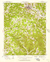
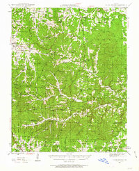
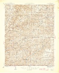
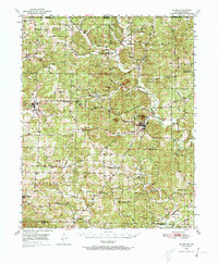
(192)- 1890 Map of Mountain Home, 1954 Print
 1890 Mountain Home1954 Print · USGSThe Ozark plateau in the late nineteenth century remains a rugged landscape of winding river valleys and isolated hilltop settlements. Genealogists can trace family footprints across Mountain Home, Buffalo City, and Calico Rock before modern dams reshaped the White River.
 - 1891 Map of Mountain Home
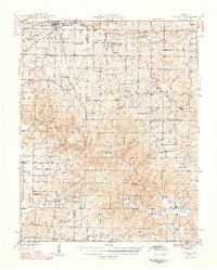
 1891 Mountain Home1891 Print · USGSThe Ozark wilderness around Mountain Home is shown here in the late nineteenth century, dominated by a wild river system. Researchers can trace the network of old river crossings like Traceys F'y and Nelsons F'y alongside early towns such as Buffalo City.
 - 1894 Map of Mountain Home
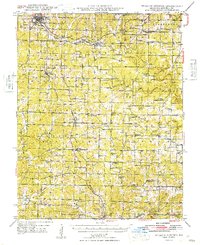
 1894 Mountain Home1894 Print · USGSNorthern Arkansas in the 1890s was a rugged territory defined by the winding White and Buffalo rivers. Genealogists and local historians can trace early river crossings and settlements like Traceys Fy & Fd, Ships Fy, Buffalo City, and Henderson.6 unique versions available
 - 1938 Map of West Plains, 1954 Print
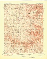
 1938 West Plains1954 Print · USGSWest Plains was a bustling Missouri rail town in the late 1930s, centered in the Howell Valley. Genealogists can locate family landmarks such as the County Cem, rural schools like Renfrow Sch, and the St Louis San Francisco rail corridor.3 unique versions available
 - 1939 Map of Topaz
 1939 Topaz1939 Print · USGSThe North Fork River valley in Douglas and Ozark counties is captured here in the late 1930s, showing a landscape defined by riverside mills and rural schools. Genealogists can trace family landmarks across Richville, Siloam Springs, and Hammonds Mill, or find remote sites like Mitts Cem and Little Zion Sch.3 unique versions available
 - 1940 Map of West Plains
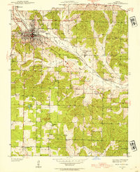
 1940 West Plains1940 Print · USGSWest Plains was a bustling Ozark rail hub just before the mid-century, surrounded by a landscape of family farms and valley schools. Genealogists can locate specific local landmarks like County Home, Smith Chapel, and the St Louis San Francisco rail corridor.
 - 1941 Map of Topaz
 1941 Topaz1941 Print · USGSThe Ozark plateau of the late thirties and early forties comes alive here, showing the river-bound communities of Douglas and Howell Counties. Researchers can locate vanished rural landmarks like Omba Store, Hammonds Mill, and numerous country schools such as New Jail Sch.
 - 1943 Map of Thayer, 1963 Print
 1943 Thayer1963 Print · USGSThayer and Koshkonong sit at the heart of the Ozark borderlands during the early 1940s, as the railroad drove local commerce. Researchers can locate dozens of country schools and family landmarks like Grand Gulf, Harbeston Sink, and Victory Mission Ch.2 unique versions available
 - 1944 Map of West Plains, 1957 Print
 1944 West Plains1957 Print · USGSThe West Plains region at the close of the Second World War remains a landscape of rail-connected commerce and scattered rural school districts. Genealogists can locate family names at Saddle Cem, Neubarger Sch, or the rural community of Lanton.2 unique versions available
 - 1944 Map of Cureall, 1962 Print
 1944 Cureall1962 Print · USGSThe Missouri-Arkansas borderlands come alive in this mid-century survey of the Ozarks during a time when rural life centered on local river crossings and country schoolhouses. Trace family history through the numerous sites like Alice Mine, Breakup Mill, and Cureall Cem.2 unique versions available
 - 1945 Map of Harrison
 1945 Harrison1945 Print · USGSThe Ozark and Boston Mountains straddle the Missouri-Arkansas border during the mid-forties, showing a landscape of forest ridges and river valleys. Genealogists and historians can trace rail-connected towns like Monett and West Plains or early lake developments at Bull Shoals Res and Norfork Lake.
 - 1945 Map of Willow Springs, 1954 Print
 1945 Willow Springs1954 Print · USGSThis Howell County survey captured the Missouri Ozarks at mid-century, when the railroad still linked small farming towns. Researchers can trace rural school locations like College Hill Sch and cemeteries such as Lone Pine Cem and Rowe Cem.3 unique versions available
 - 1945 Map of Montier, 1960 Print
 1945 Montier1960 Print · USGSThe Missouri Ozarks during the mid-1940s are documented here, showing a landscape of small settlements and river valleys just as the post-war era began. Local historians can trace dozens of country schools and churches, from Gravel Ridge Sch to the Hilltop Mission and the remote Sherwood Reese Ranch.2 unique versions available
 - 1945 Map of Clear Springs, 1963 Print
 1945 Clear Springs1963 Print · USGSTexas County in the mid-1940s was a network of highland farms and timbered hollows at the headwaters of the Jacks Fork. Researchers can trace rural life through numerous country sites like Steely Chapel, Dutch Ch, and the Rocky Mtn Ranch.2 unique versions available
 - 1946 Map of Thayer
 1946 Thayer1946 Print · USGSOregon and Howell Counties in the 1940s reveal a network of rail-dependent towns and rural school districts along the Arkansas line. Genealogists can trace family roots through numerous sites like Woodside Cem, Victory Mission Ch, and the many community schools like English Sch.2 unique versions available
 - 1946 Map of Summersville
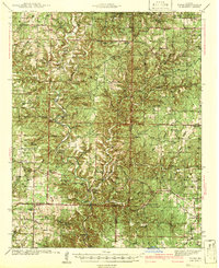
 1946 Summersville1946 Print · USGSThe Ozark plateau near the Texas and Shannon county lines appears in the late 1940s as a landscape of remote hollows and high ridges. Local historians can trace old community centers like Arroll or locate the numerous rural schoolhouses including Oak Ridge Sch and Welch Sch.2 unique versions available
 - 1946 Map of West Plains
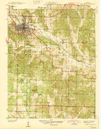
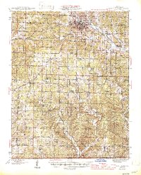 1946 West Plains1946 Print · USGSHowell County's rolling uplands and rural communities are captured here in the mid-1940s, centered on the growing hub of West Plains. Researchers can trace dozens of vanished country school sites and family-linked landmarks like Pleasant Hill Ch, Mc Elmery Cem, and Moody.2 unique versions available
 - 1946 Map of Cureall
 1946 Cureall1946 Print · USGSThe Missouri-Arkansas borderlands are captured here in the mid-forties, showing a rural landscape defined by ridge-top farms and deep river hollows. Genealogists can locate dozens of country schools and churches, including Hawkins Ridge School, Alice Mine, and Cold Springs Church.2 unique versions available
 - 1948 Map of Clear Springs
 1948 Clear Springs1948 Print · USGSTexas and Howell Counties in the mid-forties reveal a deeply dissected Ozark landscape of small farming communities and timbered hollows. Genealogists can trace family roots through numerous local landmarks like New Salem Cem, Grogan School, and Steely Chapel.2 unique versions available
 - 1948 Map of Montier
 1948 Montier1948 Print · USGSPost-war Howell, Shannon, and Oregon Counties come to life here, showing the ridge-and-hollow social network of the Missouri Ozarks. Genealogists can trace family names through dozens of rural landmarks like Marble Hill Sch, Bennett Chapel, and the Brown Cem.2 unique versions available
 - 1948 Map of Willow Springs
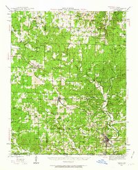
 1948 Willow Springs1948 Print · USGSHowell County's post-war landscape comes alive through this mid-century survey of the Ozark Plateau. Researchers can trace family history through dozens of rural landmarks, from Sky Haven Airport and Trask to the Simms Valley Sch and Walkers Chapel.
 - 1948 Map of Summersville
 1948 Summersville1948 Print · USGSSummersville and the surrounding Ozark plateau are captured here in the late 1940s, showing a landscape defined by small farms and karst geology. Genealogists can locate numerous rural landmarks like Heelstring Sch, Riley Cem, and the river-side Rymer Ranch.
 - 1949 Map of Harrison
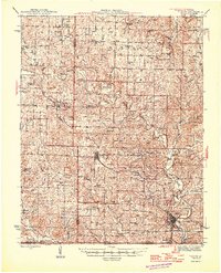
 1949 Harrison1949 Print · USGSThe Ozark highlands of northern Arkansas and southern Missouri are shown just after the war, when the White River still followed its original course. Genealogists and historians can trace rail lines like the Missouri & Arkansas RR and locate rural hubs like Harrison, Eureka Springs, and Mountain Home.
 - 1949 Map of Rolla, 1950 Print
 1949 Rolla1950 Print · USGSThe Missouri Ozarks are captured here just after the war, showing a landscape of deep river valleys and emerging reservoir projects. Genealogists and historians can trace the mining towns of Bonne Terre and Potosi or follow the early route of U.S. Highway 66.
 - 1950 Map of Salem, 1973 Print
 1950 Salem1973 Print · USGSFulton County and the surrounding Ozark borderlands are captured here in the mid-twentieth century, centered on the community of Salem. Local researchers can locate family homesteads near landmarks like Wesley Chapel, Bexar, and the Liberty Hill Ch.2 unique versions available
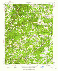
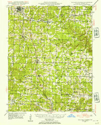
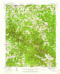
Showing maps 1-25 of 192
Top cities of Howell County
- West Plains historical maps
- Mountain View historical maps
- Willow Springs historical maps
- Brandsville historical maps
Frequently asked questions
- What are the different types of historical maps available for Howell County?
- What is the oldest map of Howell County?
- Where can I purchase historical maps of Howell County for my home or office?
- Where can I download high-res historical maps of Howell County?
- Are there historical topographic maps available for Howell County?
- Is there historical aerial imagery available for Howell County?
- Where are historical maps of Howell County sourced from?