Old Maps of Willow Springs, Missouri
Explore 23 old maps of Willow Springs, spanning from 1945 to today. These high-resolution historic maps reveal how streets, neighborhoods, landmarks, and natural features evolved over time — perfect for genealogy, metal detecting, research, and local history exploration.
What you can do with these maps:
- See how Willow Springs changed over time: Compare historical maps to modern-day views to trace roads, homesites, rail lines & more.
- View detailed metadata: Each map includes creators, publishers, year, scale, and archive source.
- Overlay maps with satellite & LiDAR: Visualize the past alongside modern tools to explore terrain & human change.
- Trusted historical sources: Maps sourced from the USGS, Library of Congress, and other archives.
- Access maps your way: View online, download high-res files, or order prints for personal or research use.
Start exploring old maps of Willow Springs to uncover forgotten places, hidden landmarks, and the deep history beneath your feet.
Willow Springs, MO maps
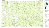
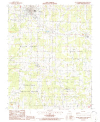
(23)- 1945 Map of Willow Springs, 1954 Print
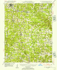 1945 Willow Springs1954 Print · USGSCovers Willow Springs, including West Plains, Olden, and other nearby areas3 unique versions available
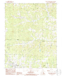
 - 1945 Map of Clear Springs, 1963 Print
 1945 Clear Springs1963 Print · USGSCovers Willow Springs, including Big Creek, Hattie, and other nearby areas2 unique versions available
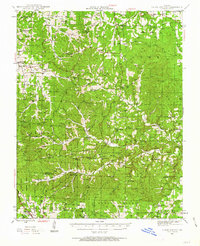
 - 1948 Map of Clear Springs
 1948 Clear Springs1948 Print · USGSCovers Willow Springs, including Big Creek, Hattie, and other nearby areas2 unique versions available
 - 1948 Map of Willow Springs
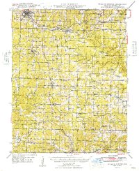 1948 Willow Springs1948 Print · USGSCovers Willow Springs, including West Plains, Olden, and other nearby areas
 - 1949 Map of Rolla, 1950 Print
 1949 Rolla1950 Print · USGSCovers Willow Springs, including Rolla, Farmington, and other nearby areas
 - 1953 Map of Rolla
 1953 Rolla1953 Print · USGSCovers Willow Springs, including Rolla, Farmington, and other nearby areas
 - 1954 Map of Rolla, 1970 Print
 1954 Rolla1970 Print · USGSCovers Willow Springs, including Rolla, Farmington, and other nearby areas2 unique versions available
 - 1957 Map of Poplar Bluff, 1968 Print
 1957 Poplar Bluff1968 Print · USGSCovers Willow Springs, including Paragould, Poplar Bluff, and other nearby areas3 unique versions available
 - 1958 Map of Rolla
 1958 Rolla1958 Print · USGSCovers Willow Springs, including Rolla, Farmington, and other nearby areas
 - 1959 Map of Poplar Bluff
 1959 Poplar Bluff1959 Print · USGSCovers Willow Springs, including Paragould, Poplar Bluff, and other nearby areas
 - 1959 Map of Rolla
 1959 Rolla1959 Print · USGSCovers Willow Springs, including Rolla, Farmington, and other nearby areas
 - 1960 Map of Poplar Bluff
 1960 Poplar Bluff1960 Print · USGSCovers Willow Springs, including Paragould, Poplar Bluff, and other nearby areas
 - 1960 Map of Rolla
 1960 Rolla1960 Print · USGSCovers Willow Springs, including Rolla, Farmington, and other nearby areas
 - 1966 Map of Rolla
 1966 Rolla1966 Print · USGSCovers Willow Springs, including Rolla, Farmington, and other nearby areas
 - 1971 Map of Rolla
 1971 Rolla1971 Print · USGSCovers Willow Springs, including Rolla, Farmington, and other nearby areas
 - 1976 Map of Willow Springs NW, 1977 Print
 1976 Willow Springs NW1977 Print · USGSCovers Willow Springs, including Hutton Valley, Burnham, and other nearby areas
 - 1984 Map of West Plains
 1984 West Plains1984 Print · USGSCovers Willow Springs, including West Plains, Mountain View, and other nearby areas2 unique versions available
 - 1986 Map of Spring Valley
 1986 Spring Valley1986 Print · USGSCovers Willow Springs, including Mountain View, Houston, and other nearby areas2 unique versions available
 - 1986 Map of Willow Springs South
 1986 Willow Springs South1986 Print · USGSCovers Willow Springs, including Hutton Valley, Burnham, and other nearby areas
 - 1987 Map of Willow Springs North
 1987 Willow Springs North1987 Print · USGSCovers Willow Springs, including Varvol, Howell County, and other nearby areas2 unique versions available
 - 1989 Map of Rolla
 1989 Rolla1989 Print · USGSCovers Willow Springs, including Rolla, Farmington, and other nearby areas
 - 2004 Map of Willow Springs South, 2006 Print
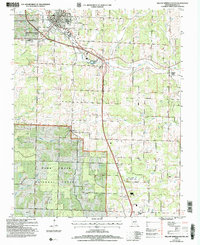 2004 Willow Springs South2006 Print · USGSCovers Willow Springs, including Hutton Valley, Burnham, and other nearby areas
 - 2004 Map of Willow Springs North, 2006 Print
 2004 Willow Springs North2006 Print · USGSCovers Willow Springs, including Varvol, Howell County, and other nearby areas
End of results
Showing maps 1-23 of 23
Top cities near Willow Springs
Frequently asked questions
- What are the different types of historical maps available for Willow Springs?
- What is the oldest map of Willow Springs?
- Where can I purchase historical maps of Willow Springs for my home or office?
- Where can I download high-res historical maps of Willow Springs?
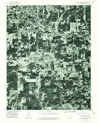
- Are there historical topographic maps available for Willow Springs?
- Is there historical aerial imagery available for Willow Springs?
- Where are historical maps of Willow Springs sourced from?