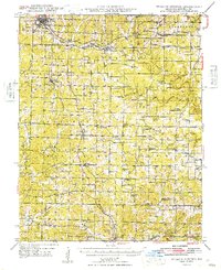
Old Maps of Willow Springs, Missouri for Genealogy
Trace your family roots with 31 historic maps of Willow Springs. These high-res maps reveal old neighborhoods, homesites, landmarks, and streets — helping you uncover where your ancestors lived and how the area evolved over time.
- Explore historic neighborhoods: Identify where your relatives may have lived in the 1800s or 1900s.
- Compare maps over time: Trace the changes in streets, buildings, and landmarks for multi-generational research.
- Perfect for genealogy & ancestry research: Used by family historians and researchers to map out lineage and migration.
These maps are an incredible resource for exploring your personal connection to Willow Springs's past.
Willow Springs, MO maps
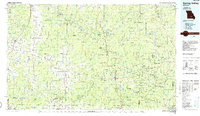
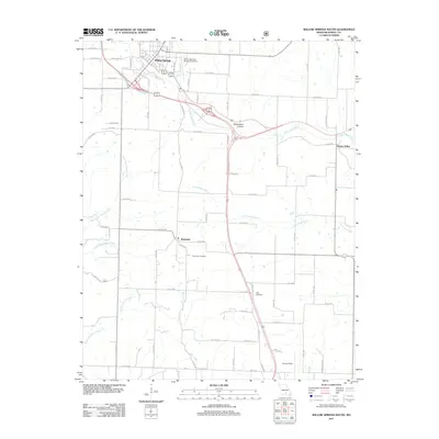
(31)- 1945 Map of Willow Springs, 1954 Print
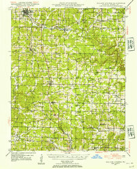 1945 Willow Springs1954 Print · USGSThis Howell County survey captured the Missouri Ozarks at mid-century, when the railroad still linked small farming towns. Researchers can trace rural school locations like College Hill Sch and cemeteries such as Lone Pine Cem and Rowe Cem.3 unique versions available
 - 1945 Map of Clear Springs, 1963 Print
 1945 Clear Springs1963 Print · USGSTexas County in the mid-1940s was a network of highland farms and timbered hollows at the headwaters of the Jacks Fork. Researchers can trace rural life through numerous country sites like Steely Chapel, Dutch Ch, and the Rocky Mtn Ranch.2 unique versions available
 - 1948 Map of Clear Springs
 1948 Clear Springs1948 Print · USGSTexas and Howell Counties in the mid-forties reveal a deeply dissected Ozark landscape of small farming communities and timbered hollows. Genealogists can trace family roots through numerous local landmarks like New Salem Cem, Grogan School, and Steely Chapel.2 unique versions available
 - 1948 Map of Willow Springs
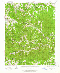
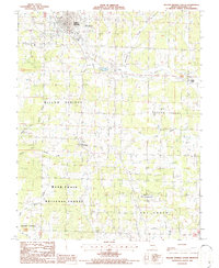
 1948 Willow Springs1948 Print · USGSHowell County's post-war landscape comes alive through this mid-century survey of the Ozark Plateau. Researchers can trace family history through dozens of rural landmarks, from Sky Haven Airport and Trask to the Simms Valley Sch and Walkers Chapel.
 - 1949 Map of Rolla, 1950 Print
 1949 Rolla1950 Print · USGSThe Missouri Ozarks are captured here just after the war, showing a landscape of deep river valleys and emerging reservoir projects. Genealogists and historians can trace the mining towns of Bonne Terre and Potosi or follow the early route of U.S. Highway 66.
 - 1953 Map of Rolla
 1953 Rolla1953 Print · USGSSoutheast Missouri’s mining towns and timberlands are seen here at the start of the 1950s. Genealogists and historians can trace the rail-and-river economy through local hubs like Fredericktown and the lead-mining heritage of Potosi and Desloge.
 - 1954 Map of Rolla, 1970 Print
 1954 Rolla1970 Print · USGSThe Missouri Ozarks and the historic Lead Belt are captured in the late sixties, showing a landscape of deep river hollows and industrial mines. Researchers can trace the routes of the Missouri Pacific RR to extraction sites like the Iron Mountain Mine or Pea Ridge Mine.2 unique versions available
 - 1957 Map of Poplar Bluff, 1968 Print
 1957 Poplar Bluff1968 Print · USGSThe Missouri-Arkansas border region is captured here as the timber and rail industries shaped the Ozark foothills. Genealogists and historians can trace the Missouri Pacific Railroad through river towns like Pocahontas, Greenville, and Van Buren.3 unique versions available
 - 1958 Map of Rolla
 1958 Rolla1958 Print · USGSThe Missouri Ozarks and the lead-rich hills of the southeast are captured here in the late fifties as timber and mining shaped the local economy. Researchers can locate family landmarks like the Rolla Cemetery or trace old rail lines including the Missouri-Illinois RR and St Louis-San Francisco RR.
 - 1959 Map of Poplar Bluff
 1959 Poplar Bluff1959 Print · USGSThe Missouri Ozarks and Arkansas borderlands meet in this late 1950s study of the region's diverse terrain and rail-fed towns. Researchers can trace the path of the Missouri Pacific Railroad through Poplar Bluff or locate smaller settlements like Birch Tree and Myrtle.
 - 1959 Map of Rolla
 1959 Rolla1959 Print · USGSMid-century Missouri is defined here by the deep forests of the Ozarks and the industrial peaks of the St Francois Mountains. Genealogists and historians can trace the development of towns like Potosi and Fredericktown or locate rural landmarks like Dry Fork Church and the Phelps County Courthouse.
 - 1960 Map of Poplar Bluff
 1960 Poplar Bluff1960 Print · USGSSoutheast Missouri and Northeast Arkansas are captured here during the post-war era, showing the transition from the Ozark highlands to the Delta. Genealogists and historians can trace rail corridors like the St. Louis Southwestern RR and remote settlements such as Birch Tree and Warm Springs.
 - 1960 Map of Rolla
 1960 Rolla1960 Print · USGSThe Ozark Highlands in the mid-twentieth century reveal a landscape of deep timber and heavy industry. Researchers can trace the rail-and-mine economy through the St Louis-San Francisco RR and the Iron Mountain Mine, alongside the growth of Fort Leonard Wood.
 - 1966 Map of Rolla
 1966 Rolla1966 Print · USGSThe Missouri Ozarks are revealed here in the mid-1960s, showing the intersection of heavy industry and sprawling national forests. Trace the development of the Lead Belt near Flat River or locate family roots in vanished hamlets like Enough and Howes Mill.
 - 1971 Map of Rolla
 1971 Rolla1971 Print · USGSThe Missouri Ozarks are captured here during the early seventies, showing a landscape of deep river valleys and industrial mining towns. Researchers can trace historic lead mining operations at St Joseph Mines and locate rural landmarks like Viburnum and the Galveston Trail.
 - 1976 Map of Willow Springs NW, 1977 Print
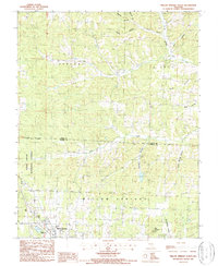
 1976 Willow Springs NW1977 Print · USGSHowell County's rural landscape is captured in the mid-1970s, showing the transition of farmland and Ozark woods near Willow Springs. Genealogists and local historians can trace the exact footprints of homes and fields around Hutton Valley and Burnham.
 - 1984 Map of West Plains
 1984 West Plains1984 Print · USGSThe Missouri Ozarks are mapped here in the mid-1980s, centered on the regional hub of West Plains and the river corridors of the Eleven Point River. Trace the old rail lines and timber towns of Willow Springs, Mountain View, and Birch Tree through the Mark Twain National Forest.2 unique versions available
 - 1986 Map of Spring Valley
 1986 Spring Valley1986 Print · USGSThe Missouri Ozarks are showcased in the mid-1980s, revealing a landscape defined by state forests and the protected waters of the Current River. Researchers can trace local heritage through landmarks like Oakside Ch, Fletcher Mine, and Summersville Cem.2 unique versions available
 - 1986 Map of Willow Springs South
 1986 Willow Springs South1986 Print · USGSHowell County's Ozark landscape is documented here in the mid-1980s, showcasing the expansion of Willow Springs into the surrounding timberlands. Researchers can find the old Iron Mine, the Drive-In Theatre, and the rural community of Burnham.
 - 1987 Map of Willow Springs North
 1987 Willow Springs North1987 Print · USGSWillow Springs and the surrounding Ozark foothills are captured here in the late eighties as the town borders the Mark Twain National Forest. Researchers can trace old family lands and water sources near South Prong Jacks Fork, King Mountain, and the Frisco Reservoir.2 unique versions available
 - 1989 Map of Rolla
 1989 Rolla1989 Print · USGSThe Missouri Ozarks are captured in the late eighties as a landscape of national forests and historic mining towns. Researchers can trace the rail lines of the Missouri Pacific RR or locate landmarks like Taum Sauk Mtn and Elephant Rocks State Park.
 - 2004 Map of Willow Springs South, 2006 Print
 2004 Willow Springs South2006 Print · USGSHowell County at the start of the millennium shows a landscape where Ozark timberland meets the infrastructure of Willow Springs. Researchers can trace old rural communities like Hutton Valley or locate local landmarks like the Iron Mine and White Church.
 - 2004 Map of Willow Springs North, 2006 Print
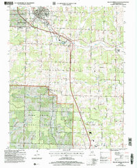
 2004 Willow Springs North2006 Print · USGSThe northern reaches of Willow Springs meet the Mark Twain National Forest at the turn of the twenty-first century. Researchers can trace rural lineages via Sargent Road, find the Covered Bridge on Elk Creek, or locate the Frisco Reservoir.
 - 2011 Map of Willow Springs South, 2011 Print
 2011 Willow Springs South2011 Print · USGSCovers Willow Springs, including Burnham, Hutton Valley, and other nearby areas
 - 2012 Map of Willow Springs North, 2012 Print
 2012 Willow Springs North2012 Print · USGSCovers Willow Springs, including Varvol, Howell County, and other nearby areas
Showing maps 1-25 of 31
Top cities near Willow Springs
Frequently asked questions
- What are the different types of historical maps available for Willow Springs?
- What is the oldest map of Willow Springs?
- Where can I purchase historical maps of Willow Springs for my home or office?
- Where can I download high-res historical maps of Willow Springs?
- Are there historical topographic maps available for Willow Springs?
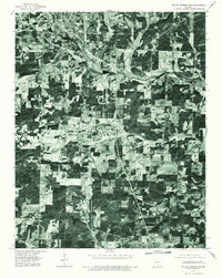
- Is there historical aerial imagery available for Willow Springs?
- Where are historical maps of Willow Springs sourced from?