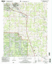
2004 Map of Willow Springs South
USGS Topo · Published 2006About this map
Willow Springs serves as the primary hub in this southern Missouri landscape, where the BNSF Railway corridor dictates the local geography of commerce and transit. To the south, the terrain transitions into the protected woodlands of the Mark Twain National Forest and the Dean Davis State Wildlife Area, reflecting a region defined by its conservation and timber resources. The map reveals a network of watercourses including the Eleven Point River and the complex drainage of Spring Creek, which are essential to the rural character of the area.
Find a feature on this map
22 named features on this map. Tap any name to fly to it.
Don’t see what you’re looking for? This feature index may not catch every label — zoom into the map to look around manually.
Map Details
Editions of this 2004 Willow Springs South Map
This is the sole edition of this map. No revisions or reprints were ever made.
Other maps of this area

1939 · Topaz
USGS Topo · 1:62,500

1941 · Topaz
USGS Topo · 1:62,500

1945 · Harrison
USGS Topo · 1:250,000

1945 · Willow Springs
USGS Topo · 1:62,500

1945 · Clear Springs
USGS Topo · 1:62,500

1948 · Clear Springs
USGS Topo · 1:62,500

1948 · Willow Springs
USGS Topo · 1:62,500

1949 · Harrison
USGS Topo · 1:250,000

1949 · Rolla
USGS Topo · 1:250,000

1951 · Cabool SE
USGS Topo · 1:24,000