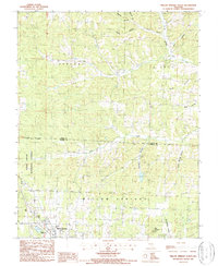
1987 Map of Willow Springs North
USGS Topo · Published 1987About this map
Willow Springs sits at the southern edge of this mid-1980s survey, marking the transition from the settled municipal area into the wooded topography of the Mark Twain National Forest. The landscape is defined by an intricate network of hollows and creek branches, including Esling Hollow, Rebel Hollow, and Spout Spring Hollow, which drain toward the South Prong Jacks Fork. To the southwest, the Frisco Reservoir serves as a notable water feature, while the Radio Tower (Kuku) stands as a modern landmark above the town. The terrain rises to distinct heights at King Mountain and Shuld, illustrating the characteristic Ozark relief. This era shows the established forest boundaries and local water sources like Piney Creek and Elk Cr before modern development shifted the rural character of northern Howell and southern Texas Counties.
Find a feature on this map
26 named features on this map. Tap any name to fly to it.
Don’t see what you’re looking for? This feature index may not catch every label — zoom into the map to look around manually.
Map Details
Editions of this 1987 Willow Springs North Map
2 editions found
Other maps of this area

1939 · Topaz
USGS Topo · 1:62,500

1941 · Topaz
USGS Topo · 1:62,500

1945 · Harrison
USGS Topo · 1:250,000

1945 · Willow Springs
USGS Topo · 1:62,500

1945 · Clear Springs
USGS Topo · 1:62,500

1948 · Clear Springs
USGS Topo · 1:62,500

1948 · Willow Springs
USGS Topo · 1:62,500

1949 · Harrison
USGS Topo · 1:250,000

1949 · Rolla
USGS Topo · 1:250,000

1951 · Cabool SE
USGS Topo · 1:24,000