1950s Maps of Lee's Summit, Missouri
Explore 10 historic maps of Lee's Summit from the 1950s. These maps offer a rare glimpse into what life looked like during the 1950s — showing old roads, neighborhoods, homes, and landmarks that have changed or disappeared over time.
Whether you're researching your family's past, planning a metal detecting trip, or studying how Lee's Summit's landscape evolved across the 1950s, these high-resolution maps are a powerful tool for exploring the history of this region.
- Focus on a specific era: All maps on this page are from the 1950s, giving you a focused view of this time period.
- See what’s changed: Compare century-old streets, trails, and buildings to today's modern landscape using overlays and satellite layers.
- Research with precision: Use these maps for genealogy, historical research, land use analysis, or educational projects.
- View, download, or print: Maps are fully viewable online in high resolution, and can be downloaded or printed for your own records.
Start exploring Lee's Summit's history through authentic maps from the 1950s. This is your window into the past.
Lee's Summit, MO maps
(10)- 1950 Map of Kansas City
 1950 Kansas City1950 Print · USGSMid-century Kansas and Missouri are captured here during a period of industrial growth and shifting transportation. Genealogists and historians can trace rail lines like the Wabash RR or locate ancestral homes near the Potawatomi Indian Reservation and Horton.
 - 1950 Map of Lawrence
 1950 Lawrence1950 Print · USGSMid-century Kansas and Missouri come alive in this map of the river-valley corridors just as the interstate era was beginning. Researchers can trace the legacy of major rail lines like the Union Pacific RR and locate ancestral roots in towns from Lawrence to Harrisonville.
 - 1954 Map of Kansas City
 1954 Kansas City1954 Print · USGSThe Missouri-Kansas borderlands flourished in the post-war era as river commerce and rail networks converged at the Missouri River. Genealogists and historians can trace the foundations of Kansas City and smaller rural hubs like Hiawatha or Sabetha.
 - 1954 Map of Raymore, 1955 Print
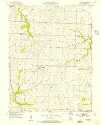 1954 Raymore1955 Print · USGSMid-century Cass County, Missouri, is revealed here just as the rural agricultural landscape began to meet the expanding influence of the Kansas City region. Genealogists and local historians can trace family locations near Raymore, find the Raymore Cem, or follow the St Louis San Francisco tracks through Harrelson.3 unique versions available
 - 1954 Map of Pleasant Hill, 1955 Print
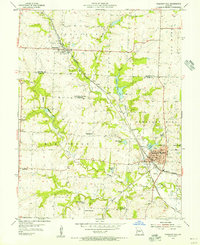 1954 Pleasant Hill1955 Print · USGSThe Cass County rail junction at Pleasant Hill is shown in the mid-fifties at a moment of transition for its rural school system. Genealogists and local historians can locate several decommissioned sites like Crossroads Sch alongside active landmarks like Union Cem and Loch Leonard.2 unique versions available
 - 1956 Map of Kansas City, 1967 Print
 1956 Kansas City1967 Print · USGSThe Kansas-Missouri border region thrived during the mid-fifties, centered on the growing metropolitan cores and the busy river valleys. Researchers can trace the layout of significant government sites like Fort Leavenworth and the Lake City Army Ammunition Plant.4 unique versions available
 - 1956 Map of Lawrence, 1967 Print
 1956 Lawrence1967 Print · USGSEastern Kansas and the Missouri border country are captured here during the mid-century transition to the interstate era. Genealogists and local historians can trace family-named terrain like Summers Mound and the footprint of Sunflower Ordnance Works near Baldwin City.4 unique versions available
 - 1957 Map of Independence, 1958 Print
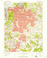 1957 Independence1958 Print · USGSIndependence and the eastern edge of Kansas City are shown here at a peak of mid-century development. Researchers can locate hundreds of local landmarks, from the Harry S Truman Memorial Library to the sprawling Oil Refinery and the Washington Cemetery.
 - 1957 Map of Woods Chapel, 1958 Print
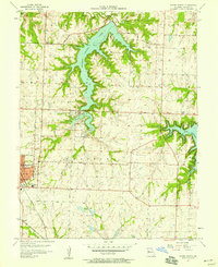 1957 Woods Chapel1958 Print · USGSJackson County is shown in a period of significant growth in the late fifties as suburban expansion met rural Missouri lakefronts. Researchers can trace family history at the Woods Chapel Cem or locate old school sites like Mason Sch and St Marys Sch.
 - 1957 Map of Lees Summit, 1958 Print
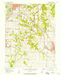 1957 Lees Summit1958 Print · USGSJackson County during the mid-fifties shows the suburban expansion of Kansas City toward the established community of Lees Summit. Genealogists and local historians can trace rural roots through the Flannery Cemetery, Basonia Church, and the many schools like Truman School that served these growing neighborhoods.
End of results
Showing maps 1-10 of 10
Top cities near Lee's Summit
- Kansas City historical maps
- Kansas City historical maps
- Independence historical maps
- Blue Springs historical maps
- Raytown historical maps
- Grandview historical maps
See more
Top neighborhoods of Lee's Summit
Frequently asked questions
- What are the different types of historical maps available for Lee's Summit?
- What is the oldest map of Lee's Summit?
- Where can I purchase historical maps of Lee's Summit for my home or office?
- Where can I download high-res historical maps of Lee's Summit?
- Are there historical topographic maps available for Lee's Summit?
- Is there historical aerial imagery available for Lee's Summit?
- Where are historical maps of Lee's Summit sourced from?