2020s Maps of Lewis County, Missouri
Explore 22 historic maps of Lewis County from the 2020s. These maps offer a rare glimpse into what life looked like during the 2020s — showing old roads, neighborhoods, homes, and landmarks that have changed or disappeared over time.
Whether you're researching your family's past, planning a metal detecting trip, or studying how Lewis County's landscape evolved across the 2020s, these high-resolution maps are a powerful tool for exploring the history of this region.
- Focus on a specific era: All maps on this page are from the 2020s, giving you a focused view of this time period.
- See what’s changed: Compare century-old streets, trails, and buildings to today's modern landscape using overlays and satellite layers.
- Research with precision: Use these maps for genealogy, historical research, land use analysis, or educational projects.
- View, download, or print: Maps are fully viewable online in high resolution, and can be downloaded or printed for your own records.
Start exploring Lewis County's history through authentic maps from the 2020s. This is your window into the past.
Lewis County, MO maps
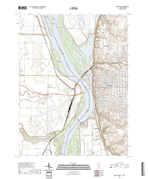
(22)- 2021 Map of Quincy West, 2021 Print
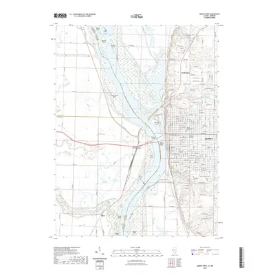 2021 Quincy West2021 Print · USGSCovers Lewis County, including Quincy, North Quincy, and other nearby areas
 - 2021 Map of Lima, 2021 Print
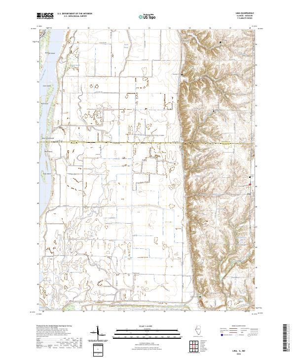
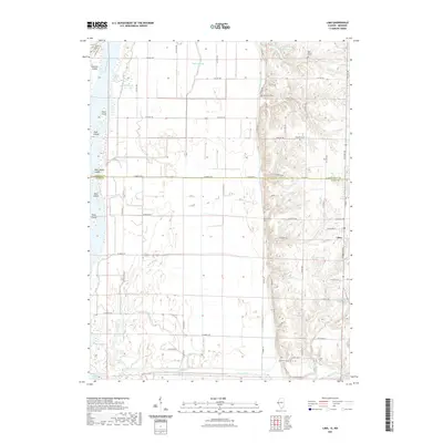 2021 Lima2021 Print · USGSCovers Lewis County, including Lima, Adams County, and other nearby areas
 - 2021 Map of Long Island, 2021 Print
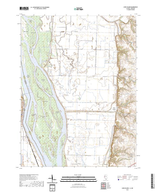
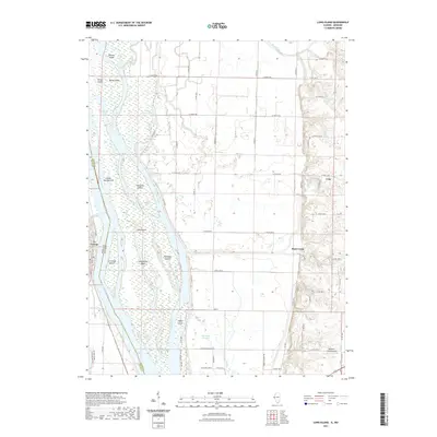 2021 Long Island2021 Print · USGSCovers Lewis County, including La Grange, Ursa, and other nearby areas
 - 2021 Map of Canton, 2021 Print
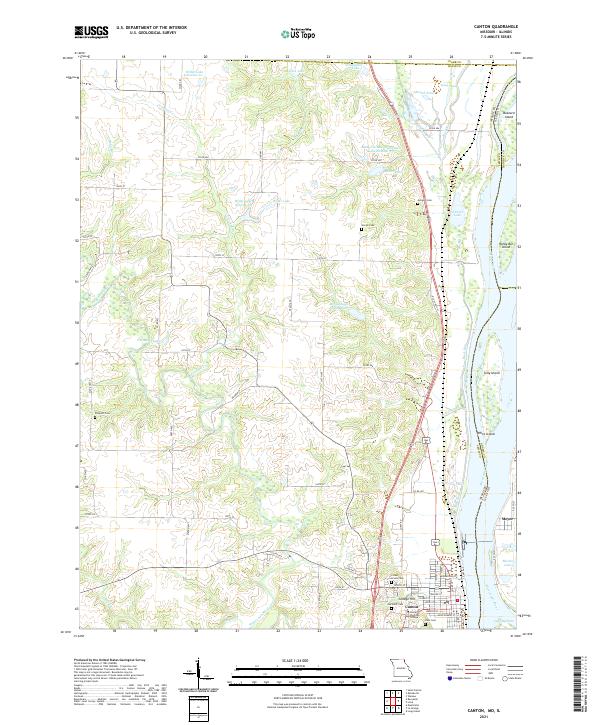 2021 Canton2021 Print · USGSThe riverfront town of Canton and its Illinois neighbor Meyer are shown here as they appeared in the early 2020s. Researchers can locate longstanding landmarks like Culver Stockton College and family burial sites at Gregory Cem or Hardin Cem.
 - 2021 Map of Colony, 2021 Print
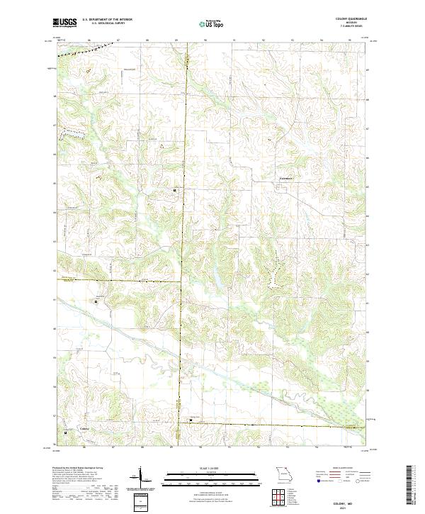 2021 Colony2021 Print · USGSNortheast Missouri agriculture and river drainages define this quiet landscape as it appeared in the early 2020s. Genealogists can locate several family and community burial sites, such as Standiford Cem and Sutter Cem, near Fairmont and Colony.
 - 2021 Map of Deer Ridge, 2021 Print
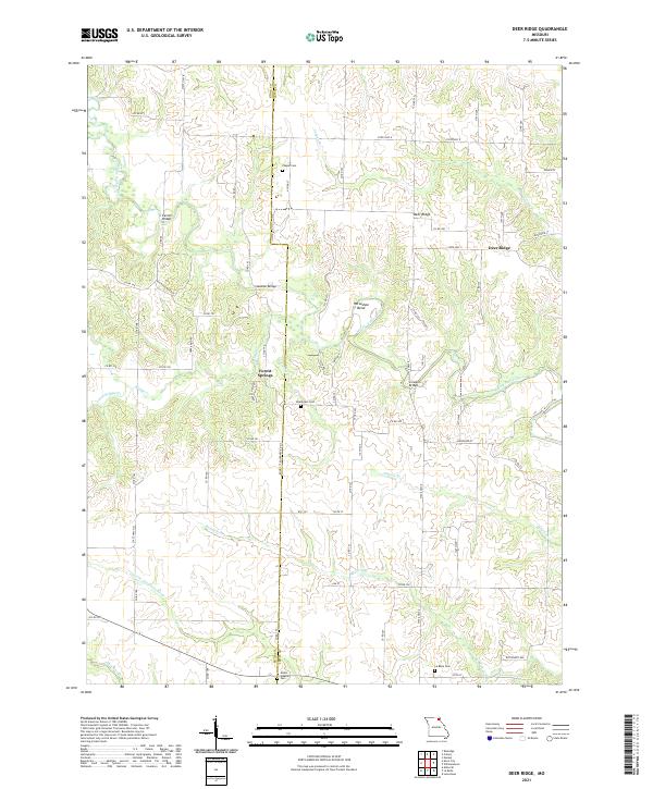 2021 Deer Ridge2021 Print · USGSNortheast Missouri agriculture and river geography are captured here in the early twenty-first century. Researchers can trace rural cemeteries and local river crossings like Bondurant Cem, Seaman Bridge, and the Middle Fabius River.
 - 2021 Map of Kahoka SE, 2021 Print
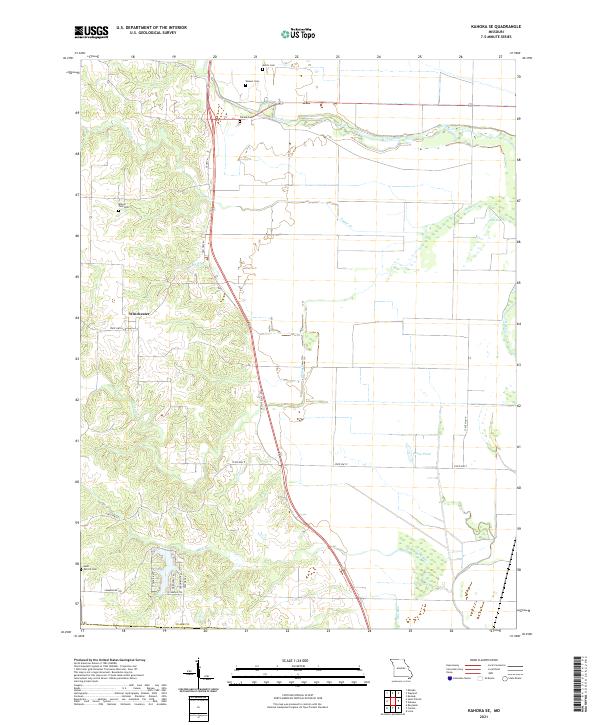 2021 Kahoka SE2021 Print · USGSNortheastern Missouri farmland and river bottoms are captured here in the early twenty-first century. Genealogists can locate several family landmarks such as Frazee Cem and Mount Zion Cem, or trace the winding course of the Fox River.
 - 2021 Map of Lewistown, 2021 Print
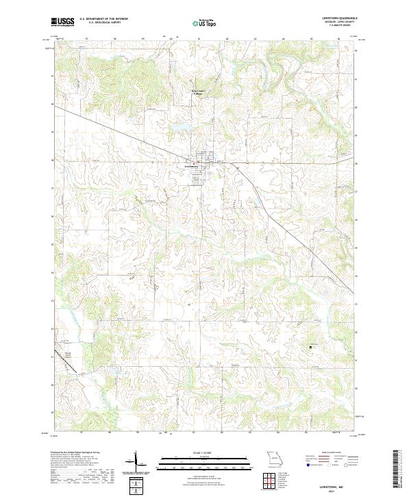 2021 Lewistown2021 Print · USGSLewistown and the surrounding Missouri countryside are captured here in the early twenty-first century as the agricultural landscape continues its long-standing patterns. Genealogists and historians can locate Prim Cem, the Sharpe Farms Airport, and the residential layouts of New Court Village.
 - 2021 Map of La Belle, 2021 Print
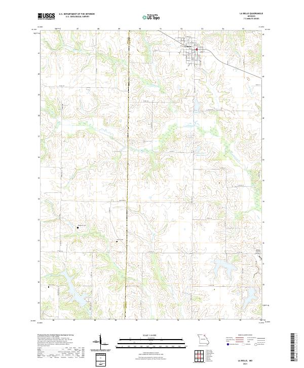 2021 La Belle2021 Print · USGSThe northern Missouri landscape surrounding La Belle comes into focus in this recent survey, showcasing the rural transition between Lewis and Knox counties. Genealogists and historians can trace family locations through Washburn Cemetery, Glover Cemetery, and the Sharpe Farms Airport.
 - 2021 Map of Neeper, 2021 Print
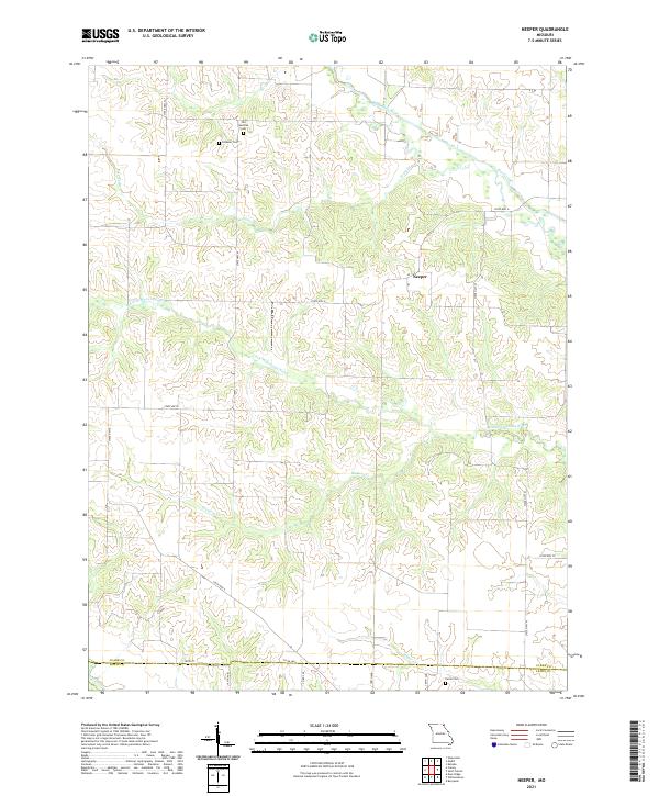 2021 Neeper2021 Print · USGSClark County at the start of the 2020s remains a landscape of river bends and quiet country roads. Researchers can locate family heritage sites like the Old German Cem, Schuster Cem, and Carlin Cem near the small settlement of Neeper.
 - 2021 Map of Benjamin, 2021 Print
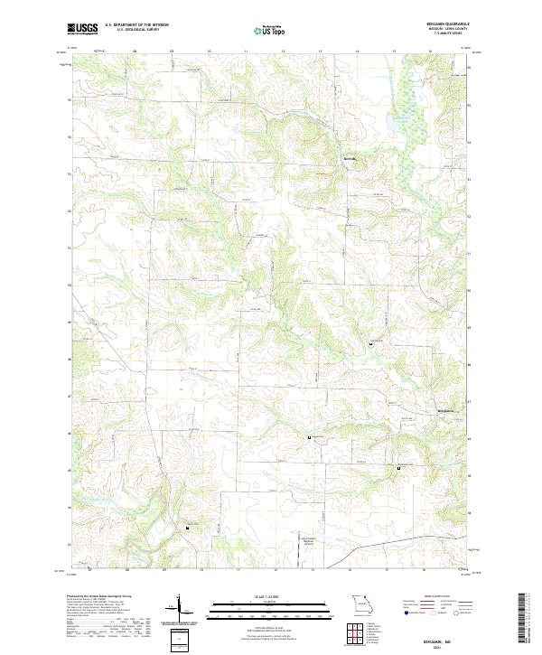 2021 Benjamin2021 Print · USGSLewis County at the turn of the decade is captured here through its network of river basins and rural family cemeteries. Genealogists can trace property lines near Derrahs or locate the Patterson Cem, Graves Cem, and Jarvis Cem.
 - 2021 Map of La Grange, 2021 Print
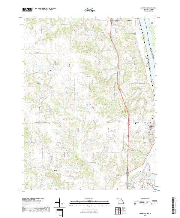 2021 La Grange2021 Print · USGSThe Mississippi River and BNSF Railway corridor shape these riverfront communities in the early twenty-first century. Researchers can trace family history through sites like Riverview Cem, the rural Dover settlement, and the landmark Wyaconda Church Bridge.
 - 2021 Map of Williamstown, 2021 Print
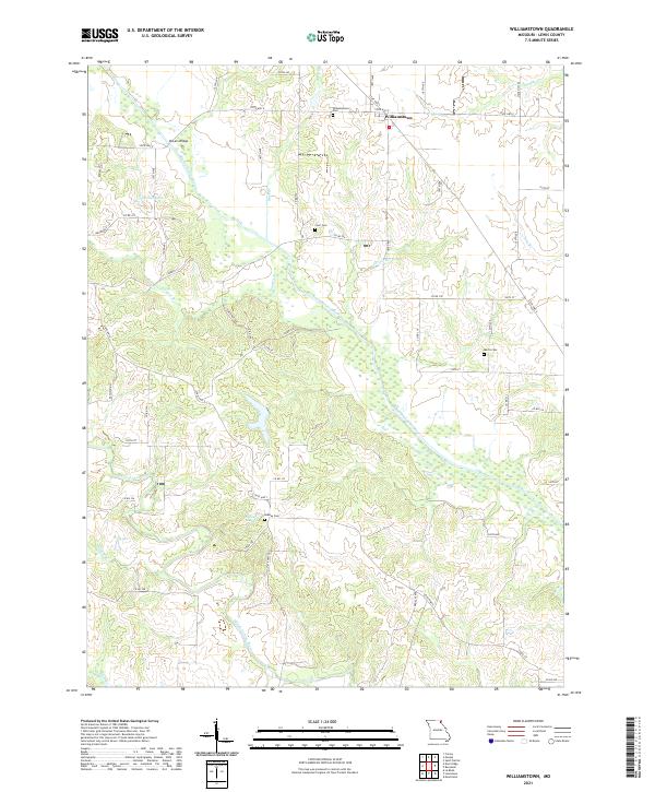 2021 Williamstown2021 Print · USGSLewis County at the start of the 2020s shows a landscape of river-fed agriculture centered on the settlement of Williamstown. Genealogists and local historians can trace family locations near landmarks like Cecil Cem, Midway Cem, and the banks of the Middle Fabius River.
 - 2021 Map of Saint Patrick, 2021 Print
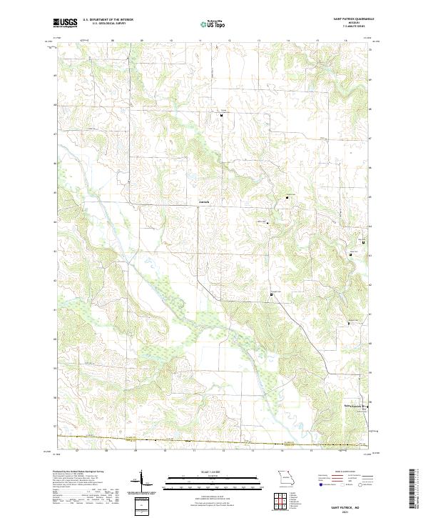 2021 Saint Patrick2021 Print · USGSNortheast Missouri agriculture and river drainage define this area near the Clark and Lewis county line in 2021. Genealogists can locate several historic burial sites like Sisson Cem, Higbee Cem, and Saint Patrick Cem near the Wyaconda River.
 - 2021 Map of Monticello, 2021 Print
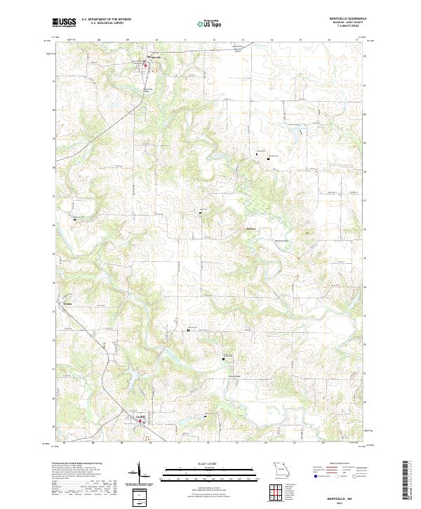 2021 Monticello2021 Print · USGSLewis County at the start of the 2020s remains centered on its river valleys and quiet rural crossroads. Genealogists and local historians can trace legacy landmarks including the Lewis County Courthouse, Bancert Cem, and the crossing at Steele Bridge.
 - 2021 Map of Durham, 2021 Print
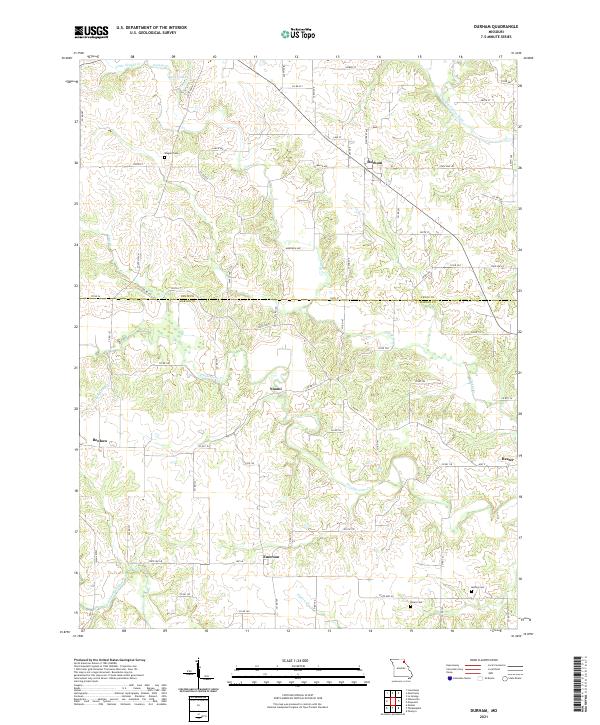 2021 Durham2021 Print · USGSThe Lewis and Marion county line divides this Missouri agricultural landscape in the early twenty-first century. Researchers can trace rural lineages through the locations of Wagner Cem, McPike Cem, and the crossroads settlements of Durham and Emerson.
 - 2021 Map of Nelsonville, 2021 Print
 2021 Nelsonville2021 Print · USGSMarion and Shelby Counties are shown in the early twenty-first century as a quiet mosaic of river valleys and rural crossroads. Genealogists and historians can trace the local landscape through the Methodist Cem and landmarks like Haycraft Bridge and Nelsonville.
 - 2021 Map of Maywood, 2021 Print
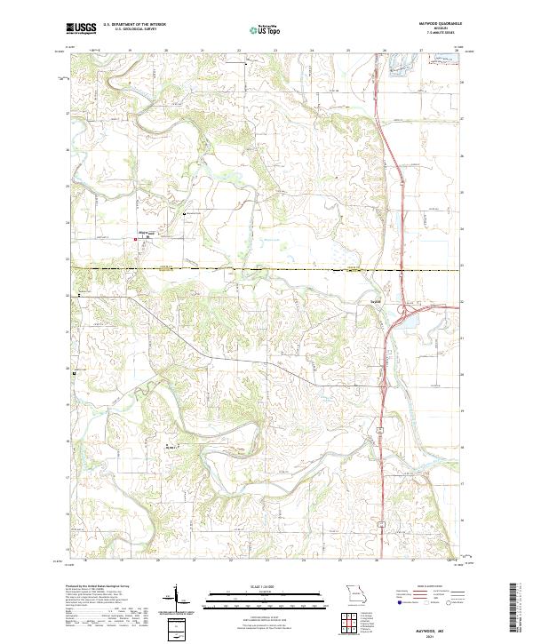 2021 Maywood2021 Print · USGSThe Lewis and Marion county border comes alive in this survey of the river valleys near the turn of the decade. Genealogists can locate family landmarks like Hebron Cemetery and Maywood Cemetery near the banks of the North Fabius River.
 - 2021 Map of Newark, 2021 Print
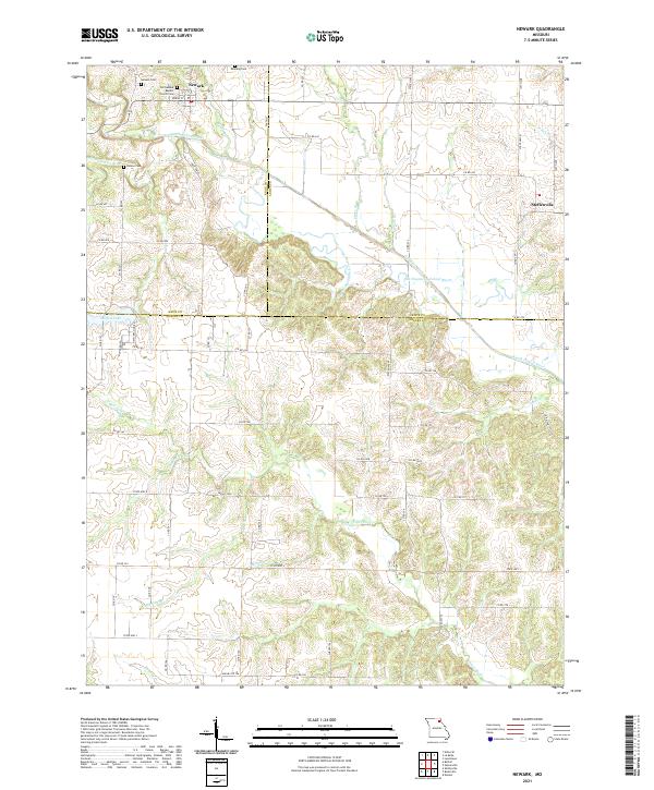 2021 Newark2021 Print · USGSNortheast Missouri’s river-carved farmland is captured here in the early twenty-first century, spanning the borders of Knox, Lewis, and Shelby counties. Genealogists can locate family landmarks like the Old Newark Baptist Church, Downing Cem, and the quiet village of Steffenville.
 - 2024 Map of Quincy West, 2024 Print
 2024 Quincy West2024 Print · USGSQuincy and the Mississippi River bluffs are documented here during the mid-2020s, showing the intersection of urban growth and river conservation. Researchers can locate civic landmarks like the Adams County Courthouse or trace historic burial grounds such as Woodland Cem and Sunset Veterans Cem.
 - 2024 Map of Lima, 2024 Print
 2024 Lima2024 Print · USGSWestern Illinois bottomlands meet the bluffs at the Adams and Hancock County line in this recent study of the river landscape. Researchers can locate family sites at Lima Cem and Fletcher Cem or trace the drainage of Lima Slough into the Mississippi River.
 - 2024 Map of Long Island, 2024 Print
 2024 Long Island2024 Print · USGSThe Mississippi River floodplain comes alive in this contemporary survey of the Illinois-Missouri borderlands. Researchers can trace the intricate river geography surrounding Long Island or locate specific river-access points like Blickhan Landing Area and the town of Ursa.
End of results
Showing maps 1-22 of 22
Top cities of Lewis County
- Canton historical maps
- La Grange historical maps
- La Belle historical maps
- Lewistown historical maps
- Ewing historical maps
- Monticello historical maps
Frequently asked questions
- What are the different types of historical maps available for Lewis County?
- What is the oldest map of Lewis County?
- Where can I purchase historical maps of Lewis County for my home or office?
- Where can I download high-res historical maps of Lewis County?
- Are there historical topographic maps available for Lewis County?
- Is there historical aerial imagery available for Lewis County?
- Where are historical maps of Lewis County sourced from?