Old Maps of Lewis County, Missouri for Genealogy
Trace your family roots with 127 historic maps of Lewis County. These high-res maps reveal old neighborhoods, homesites, landmarks, and streets — helping you uncover where your ancestors lived and how the area evolved over time.
- Explore historic neighborhoods: Identify where your relatives may have lived in the 1800s or 1900s.
- Compare maps over time: Trace the changes in streets, buildings, and landmarks for multi-generational research.
- Perfect for genealogy & ancestry research: Used by family historians and researchers to map out lineage and migration.
These maps are an incredible resource for exploring your personal connection to Lewis County's past.
Lewis County, MO maps
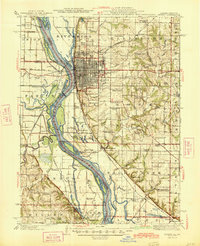
(127)- 1903 Map of Kahoka
 1903 Kahoka1903 Print · USGSNortheast Missouri at the turn of the century shows a landscape defined by the convergence of major rivers and competing rail lines. Genealogists can trace family roots in early centers like Kahoka and Monticello, or locate riverfront crossings at St. Francisville and Canton.3 unique versions available
 - 1903 Map of Palmyra
 1903 Palmyra1903 Print · USGSNortheast Missouri at the start of the twentieth century was a landscape of river-valley farming and critical rail junctions. Researchers can trace early rural life through features like Sharp Mills, St. Pauls Ch., and the crossing of the Hannibal and St. Joseph R. R.2 unique versions available
 - 1925 Map of Quincy
 1925 Quincy1925 Print · USGSQuincy and its Mississippi River hinterlands are captured in the mid-1920s, showing a landscape defined by river navigation and rail transport. Genealogists can locate dozens of country schools and churches, from St Ludgerus School to Zion Church and the Soldiers Home.2 unique versions available
 - 1944 Map of Quincy, 1954 Print
 1944 Quincy1954 Print · USGSQuincy and the Mississippi River valley are captured in the 1940s, showing a landscape defined by rail lines and rural parish schools. Researchers can trace the riverfront at Marion City, the grounds of the Soldiers Home, and historic sites like Zion Church.5 unique versions available
 - 1945 Map of Quincy
 1945 Quincy1945 Print · USGSQuincy and its Mississippi River crossings are captured here in the mid-1940s during a period of transition for its riverfront and rail lines. Genealogists can trace family roots at local landmarks like the Soldiers Home, Melrose Chapel, and numerous rural schoolhouses such as Hickory Grove School.2 unique versions available
 - 1946 Map of Mendon, 1958 Print
 1946 Mendon1958 Print · USGSThe fertile bottomlands of Adams County are seen here in the mid-1940s, as massive drainage projects reshaped the Mississippi River's eastern bank. Genealogists can locate family names and sites through numerous rural landmarks like Wesley Chapel Cem, Gentry Sch, and the Canton Ferry.
 - 1948 Map of Quincy
 1948 Quincy1948 Print · USGSThe Mississippi and Illinois River valleys are captured at a post-war crossroads as rail and river travel met the expanding highway system. Genealogists can trace family settlements from Quincy to Hannibal and smaller towns like Vandalia and Jerseyville.2 unique versions available
 - 1948 Map of Mendon
 1948 Mendon1948 Print · USGSUpper Adams County in the late 1940s reveals a landscape defined by Mississippi River engineering and tight-knit rural communities. Researchers can trace ancestral locations at New Providence Cem, several dozen one-room schoolhouses like Golden Sch, and the winding Bear Creek drainage.2 unique versions available
 - 1949 Map of Durham, 1956 Print
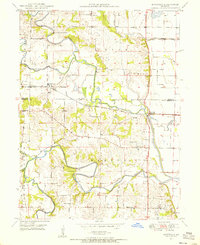
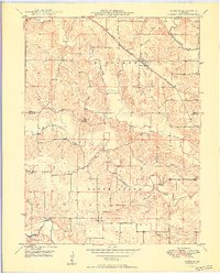
 1949 Durham1956 Print · USGSMarion and Lewis counties are captured here just after the war, showing the rural rail-and-river network of northern Missouri. Researchers can trace family sites near Emerson, find the Mount Sinai Ch, and locate family plots like Wagner Cem.2 unique versions available
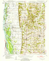
 - 1949 Map of Maywood, 1956 Print
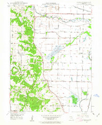
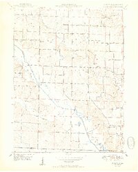
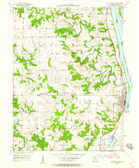
 1949 Maywood1956 Print · USGSNortheast Missouri’s river-bottom lands are shown here in the late 1940s as the rail and river networks shaped local life. Researchers can locate vanished landmarks like Shannon Sch, Olivet Ch, and family-named cemeteries including Maywood Cem.2 unique versions available
 - 1949 Map of Kahoka SE, 1963 Print
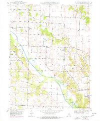
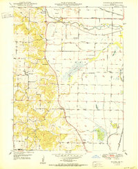
 1949 Kahoka SE1963 Print · USGSNortheastern Missouri farmland meets the winding Fox River in this mid-century survey of Clark and Lewis Counties. Genealogists and local historians can trace rural school districts like Lone Star Sch and locate family burial sites at Mt Zion Cem and St Patrick Cem.2 unique versions available
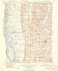
 - 1949 Map of St. Patrick, 1977 Print
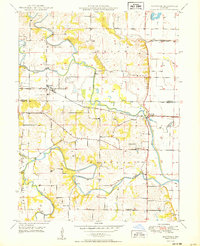
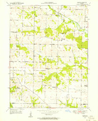
 1949 St. Patrick1977 Print · USGSNortheast Missouri’s rural landscape is captured here at mid-century, just as the network of one-room country schools began to fade. Genealogists can locate family landmarks like the Pride of the West Sch, Honey Creek Cem, and the village of St Patrick.
 - 1950 Map of Maywood
 1950 Maywood1950 Print · USGSNortheast Missouri farm country comes to life in the late 1940s as the railroad and river systems shape the landscape. Genealogists can locate family landmarks like Hebron Cem and Shannon Sch, or trace the tracks of the Chicago Burlington and Quincy through Maywood.
 - 1950 Map of Durham
 1950 Durham1950 Print · USGSMarion and Lewis County at the close of the 1940s show a landscape of rural townships and winding river bottoms. Genealogists can locate family landmarks like Wagner Cem and McPike Cem or trace the old Chicago Burlington and Quincy rail line.2 unique versions available
 - 1950 Map of Saint Patrick
 1950 Saint Patrick1950 Print · USGSNortheast Missouri agriculture and rural life are preserved here just after the war, centered on the community of St Patrick. Researchers can locate numerous country schools and cemeteries, from Pride of the West Sch to Bash Cem and Higbee Cem.2 unique versions available
 - 1950 Map of Kahoka SE
 1950 Kahoka SE1950 Print · USGSNortheast Missouri agriculture and river life are captured here in the mid-century, before modern consolidation changed the rural landscape. Researchers can trace family history through numerous country schools like Gravel Hill Sch and local landmarks such as Bluff Springs Ch.2 unique versions available
 - 1950 Map of Neeper, 1956 Print
 1950 Neeper1956 Print · USGSNortheastern Missouri farmland around the Wyaconda River is shown here as it appeared in the mid-twentieth century. Family researchers can trace the locations of the Old German Cem, Foree, and several now-closed schools like Ballard Sch.
 - 1950 Map of La Grange, 1959 Print
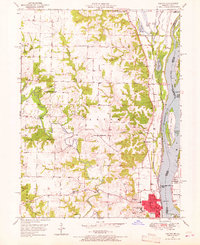
 1950 La Grange1959 Print · USGSLewis County river towns and rural townships thrive along the Mississippi in the early fifties. Genealogists can trace family roots through numerous country schools like Pink Prairie Sch and the Marks Memorial Cem near La Grange.2 unique versions available
 - 1950 Map of Benjamin, 1963 Print
 1950 Benjamin1963 Print · USGSMid-century Lewis County was a landscape of quiet rural districts and river-bottom agriculture. Researchers can trace ancestral locations through named schoolhouses like Boudreau Sch, several family cemeteries such as Jarvis Cem, and the community at Benjamin.
 - 1950 Map of Williamstown, 1967 Print
 1950 Williamstown1967 Print · USGSNortheastern Missouri's Lewis County reveals a landscape of small schoolhouses and family cemeteries in the mid-century. Genealogists can trace local roots at Williamstown Cem or follow the historic paths to Walker Sch and Providence Ch.2 unique versions available
 - 1950 Map of Canton, 1967 Print
 1950 Canton1967 Print · USGSMissouri river life at mid-century centered on the busy transit hub of Canton and its surrounding rural school districts. Genealogists and historians can trace local landmarks like Culver-Stockton College, the Canton Ferry, and numerous country schools from Hardin Sch to Melrose Sch.3 unique versions available
 - 1950 Map of Lewistown, 1968 Print
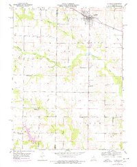
 1950 Lewistown1968 Print · USGSNortheastern Missouri's rural landscape is centered around Lewistown at the mid-century point, where the rail-and-river economy shaped local life. Genealogists can trace several inactive rural landmarks like Turner Sch, Oakland Sch, and the County Farm.2 unique versions available
 - 1950 Map of Colony, 1976 Print
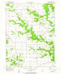
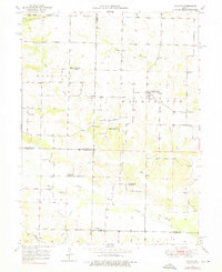 1950 Colony1976 Print · USGSNortheast Missouri at the mid-century mark reveals a rural landscape defined by independent school districts and quiet creek valleys. Genealogists and historians can trace the foundations of local life at Sutter Cem, Fairmont, and the Arkansas Sch.
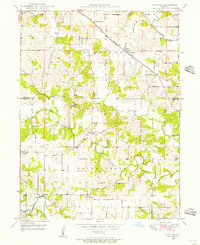
 - 1950 Map of Monticello, 1977 Print
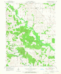
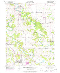 1950 Monticello1977 Print · USGSLewis County farming life is captured here at mid-century as the river-cut hills transition toward modern development. Genealogists can trace family names at Finley Cem and Nail Cem or locate community centers like Gilead Ch and Selton Sch.
 - 1950 Map of La Belle, 1977 Print
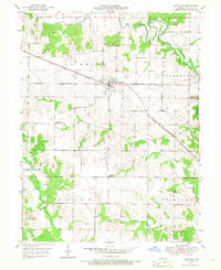
 1950 La Belle1977 Print · USGSThe town of La Belle and the surrounding Lewis County countryside are shown here at mid-century, just as the local rural school system was beginning to consolidate. Researchers can trace family sites near Washburn Cem or locate former schoolhouses like Sweet Oak Sch and Salem Sch.
Showing maps 1-25 of 127
Top cities of Lewis County
- Canton historical maps
- La Grange historical maps
- La Belle historical maps
- Lewistown historical maps
- Ewing historical maps
- Monticello historical maps
Frequently asked questions
- What are the different types of historical maps available for Lewis County?
- What is the oldest map of Lewis County?
- Where can I purchase historical maps of Lewis County for my home or office?
- Where can I download high-res historical maps of Lewis County?
- Are there historical topographic maps available for Lewis County?
- Is there historical aerial imagery available for Lewis County?
- Where are historical maps of Lewis County sourced from?