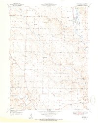
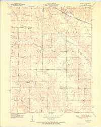
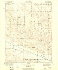
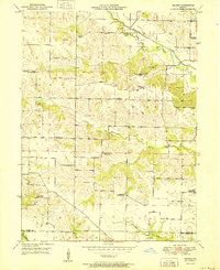
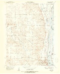
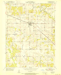
1950s Maps of Lewis County, Missouri
Explore 25 historic maps of Lewis County from the 1950s. These maps offer a rare glimpse into what life looked like during the 1950s — showing old roads, neighborhoods, homes, and landmarks that have changed or disappeared over time.
Whether you're researching your family's past, planning a metal detecting trip, or studying how Lewis County's landscape evolved across the 1950s, these high-resolution maps are a powerful tool for exploring the history of this region.
- Focus on a specific era: All maps on this page are from the 1950s, giving you a focused view of this time period.
- See what’s changed: Compare century-old streets, trails, and buildings to today's modern landscape using overlays and satellite layers.
- Research with precision: Use these maps for genealogy, historical research, land use analysis, or educational projects.
- View, download, or print: Maps are fully viewable online in high resolution, and can be downloaded or printed for your own records.
Start exploring Lewis County's history through authentic maps from the 1950s. This is your window into the past.
Lewis County, MO maps
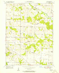
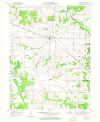
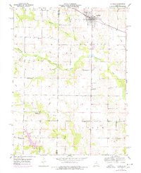
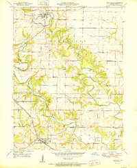
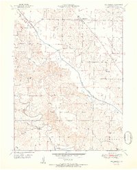
(25)- 1950 Map of Maywood
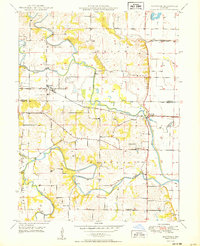 1950 Maywood1950 Print · USGSNortheast Missouri farm country comes to life in the late 1940s as the railroad and river systems shape the landscape. Genealogists can locate family landmarks like Hebron Cem and Shannon Sch, or trace the tracks of the Chicago Burlington and Quincy through Maywood.
 - 1950 Map of Durham
 1950 Durham1950 Print · USGSMarion and Lewis County at the close of the 1940s show a landscape of rural townships and winding river bottoms. Genealogists can locate family landmarks like Wagner Cem and McPike Cem or trace the old Chicago Burlington and Quincy rail line.2 unique versions available
 - 1950 Map of Saint Patrick
 1950 Saint Patrick1950 Print · USGSNortheast Missouri agriculture and rural life are preserved here just after the war, centered on the community of St Patrick. Researchers can locate numerous country schools and cemeteries, from Pride of the West Sch to Bash Cem and Higbee Cem.2 unique versions available
 - 1950 Map of Kahoka SE
 1950 Kahoka SE1950 Print · USGSNortheast Missouri agriculture and river life are captured here in the mid-century, before modern consolidation changed the rural landscape. Researchers can trace family history through numerous country schools like Gravel Hill Sch and local landmarks such as Bluff Springs Ch.2 unique versions available
 - 1950 Map of Neeper, 1956 Print
 1950 Neeper1956 Print · USGSNortheastern Missouri farmland around the Wyaconda River is shown here as it appeared in the mid-twentieth century. Family researchers can trace the locations of the Old German Cem, Foree, and several now-closed schools like Ballard Sch.
 - 1950 Map of La Grange, 1959 Print
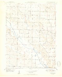
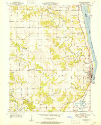
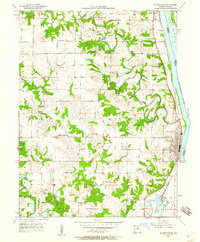 1950 La Grange1959 Print · USGSLewis County river towns and rural townships thrive along the Mississippi in the early fifties. Genealogists can trace family roots through numerous country schools like Pink Prairie Sch and the Marks Memorial Cem near La Grange.2 unique versions available
 - 1950 Map of Benjamin, 1963 Print
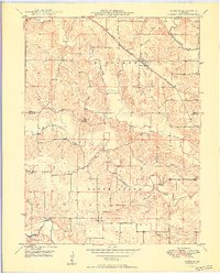
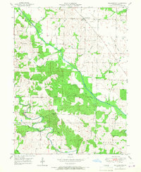
 1950 Benjamin1963 Print · USGSMid-century Lewis County was a landscape of quiet rural districts and river-bottom agriculture. Researchers can trace ancestral locations through named schoolhouses like Boudreau Sch, several family cemeteries such as Jarvis Cem, and the community at Benjamin.
 - 1950 Map of Williamstown, 1967 Print
 1950 Williamstown1967 Print · USGSNortheastern Missouri's Lewis County reveals a landscape of small schoolhouses and family cemeteries in the mid-century. Genealogists can trace local roots at Williamstown Cem or follow the historic paths to Walker Sch and Providence Ch.2 unique versions available
 - 1950 Map of Canton, 1967 Print
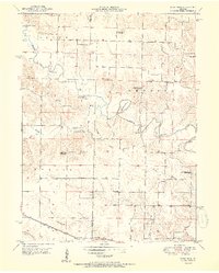
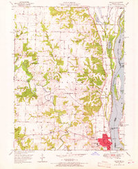 1950 Canton1967 Print · USGSMissouri river life at mid-century centered on the busy transit hub of Canton and its surrounding rural school districts. Genealogists and historians can trace local landmarks like Culver-Stockton College, the Canton Ferry, and numerous country schools from Hardin Sch to Melrose Sch.3 unique versions available
 - 1950 Map of Lewistown, 1968 Print
 1950 Lewistown1968 Print · USGSNortheastern Missouri's rural landscape is centered around Lewistown at the mid-century point, where the rail-and-river economy shaped local life. Genealogists can trace several inactive rural landmarks like Turner Sch, Oakland Sch, and the County Farm.2 unique versions available
 - 1950 Map of Colony, 1976 Print
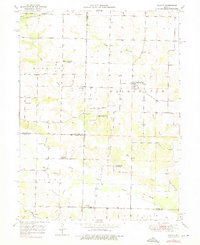 1950 Colony1976 Print · USGSNortheast Missouri at the mid-century mark reveals a rural landscape defined by independent school districts and quiet creek valleys. Genealogists and historians can trace the foundations of local life at Sutter Cem, Fairmont, and the Arkansas Sch.
 - 1950 Map of Monticello, 1977 Print
 1950 Monticello1977 Print · USGSLewis County farming life is captured here at mid-century as the river-cut hills transition toward modern development. Genealogists can trace family names at Finley Cem and Nail Cem or locate community centers like Gilead Ch and Selton Sch.
 - 1950 Map of La Belle, 1977 Print
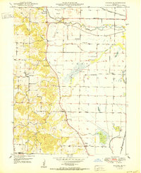
 1950 La Belle1977 Print · USGSThe town of La Belle and the surrounding Lewis County countryside are shown here at mid-century, just as the local rural school system was beginning to consolidate. Researchers can trace family sites near Washburn Cem or locate former schoolhouses like Sweet Oak Sch and Salem Sch.
 - 1951 Map of Benjamin
 1951 Benjamin1951 Print · USGSLewis County farm life and small-town Missouri are captured here just after the war. Family researchers can trace homesteads near Benjamin and find rural landmarks like Zion Hill Ch, Boudreau Sch, and Patterson Cem.2 unique versions available
 - 1951 Map of La Belle
 1951 La Belle1951 Print · USGSLa Belle and the surrounding Missouri countryside are captured here in the early fifties, just as the local rural school system was undergoing significant change. Genealogists and historians can trace family locations near the Chicago Burlington and Quincy tracks or locate family plots at Washburn Cem and Glover Cem.2 unique versions available
 - 1951 Map of Colony
 1951 Colony1951 Print · USGSNortheast Missouri agriculture and small-town life are captured here at mid-century, where the four corners of Clark, Scotland, Knox, and Lewis counties converge. Researchers can trace family roots through sites like Sutter Cem, Bear Creek Ch, and schools such as Price Sch.2 unique versions available
 - 1951 Map of Monticello
 1951 Monticello1951 Print · USGSNortheastern Missouri's river valleys and upland farms are captured here in the early fifties. Genealogists and historians can trace family roots through numerous country burial grounds like Nail Cem and rural school sites such as Selton Sch.
 - 1951 Map of Neeper
 1951 Neeper1951 Print · USGSNortheast Missouri at the start of the fifties shows a rural landscape in transition as consolidated education begins to replace old country schools. Genealogists can trace family names at Schuster Cem or locate the site of Neeper and Liberty Ch.2 unique versions available
 - 1951 Map of Canton
 1951 Canton1951 Print · USGSThe Missouri-Illinois river border comes alive in the early fifties, showing the riverside economy of Canton and its connection to Meyer. Genealogists and historians can trace numerous country schools like Hazel Grove Sch and churches such as Shiloh Ch.2 unique versions available
 - 1951 Map of Lewistown
 1951 Lewistown1951 Print · USGSNorthwest Missouri's rural landscape is captured here in the early fifties, centered on the railroad town of Lewistown. Genealogists can trace a changing community through its many former schoolhouses, including Turner Sch and Oakland Sch, along the Chicago Burlington and Quincy line.
 - 1951 Map of Williamstown
 1951 Williamstown1951 Print · USGSNortheast Missouri agriculture and rural education define this mid-century landscape in Lewis County. Genealogists can trace family footprints through several local schools and churches, including Turpin School, Walker School, and Providence Church.2 unique versions available
 - 1951 Map of La Grange
 1951 La Grange1951 Print · USGSLewis County's riverfront and rolling uplands are captured here in the early 1950s as rail and river commerce centered on Canton and La Grange. Genealogists and researchers can trace numerous rural landmarks, from Wyaconda Ch to a high density of country schools like Sunnyside Sch and Porter Sch.
 - 1951 Map of Deer Ridge
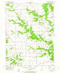
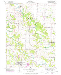
 1951 Deer Ridge1951 Print · USGSLewis County was transitioning away from its one-room schoolhouse era during the mid-century as seen in this detailed map. Researchers can trace the decline of rural districts through Union Sch and Banner Sch, or locate family sites near Forest Springs and Bondurant Cem.3 unique versions available
 - 1956 Map of Quincy, 1967 Print
 1956 Quincy1967 Print · USGSThe river and rail corridors of the Illinois-Missouri border are documented here during the mid-1950s. Researchers can trace historic river landings and regional transit hubs from Quincy and Hannibal to smaller settlements like Meredosia and Roodhouse.3 unique versions available
 - 1958 Map of Burlington, 1968 Print
 1958 Burlington1968 Print · USGSThe tri-state river country of Iowa, Illinois, and Missouri is captured here in the mid-fifties, dominated by the Mississippi River and major rail lines. Genealogists and historians can trace the development of river towns like Keokuk or locate the sprawling Iowa Army Ammunition Plant.4 unique versions available
End of results
Showing maps 1-25 of 25
Top cities of Lewis County
- Canton historical maps
- La Grange historical maps
- La Belle historical maps
- Lewistown historical maps
- Ewing historical maps
- Monticello historical maps
Frequently asked questions
- What are the different types of historical maps available for Lewis County?
- What is the oldest map of Lewis County?
- Where can I purchase historical maps of Lewis County for my home or office?
- Where can I download high-res historical maps of Lewis County?
- Are there historical topographic maps available for Lewis County?
- Is there historical aerial imagery available for Lewis County?
- Where are historical maps of Lewis County sourced from?