1970s Maps of Truxton, Missouri
Explore 2 historic maps of Truxton from the 1970s. These maps offer a rare glimpse into what life looked like during the 1970s — showing old roads, neighborhoods, homes, and landmarks that have changed or disappeared over time.
Whether you're researching your family's past, planning a metal detecting trip, or studying how Truxton's landscape evolved across the 1970s, these high-resolution maps are a powerful tool for exploring the history of this region.
- Focus on a specific era: All maps on this page are from the 1970s, giving you a focused view of this time period.
- See what’s changed: Compare century-old streets, trails, and buildings to today's modern landscape using overlays and satellite layers.
- Research with precision: Use these maps for genealogy, historical research, land use analysis, or educational projects.
- View, download, or print: Maps are fully viewable online in high resolution, and can be downloaded or printed for your own records.
Start exploring Truxton's history through authentic maps from the 1970s. This is your window into the past.
Truxton, MO maps
(2)- 1973 Map of Hawk Point, 1974 Print
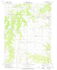 1973 Hawk Point1974 Print · USGSHawk Point and the surrounding Lincoln and Warren County borderlands are shown in the early seventies during a period of steady rural development. Researchers can trace family sites at Hawk Point Cem, follow the Burlington Northern rail line, or locate the Weeks Community Center.2 unique versions available
 - 1975 Map of Truxton, 1977 Print
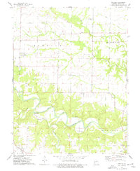 1975 Truxton1977 Print · USGSLincoln County in the 1970s reveals a quiet landscape of prairie rivers and established crossroads like Truxton and Olney. Genealogists and historians can locate rural burial grounds including Old Liberty Cem and trace early resource sites such as the Claypits.2 unique versions available
End of results
Showing maps 1-2 of 2
Top cities near Truxton
- Troy historical maps
- Warrenton historical maps
- Wright City historical maps
- New Florence historical maps
- Jonesburg historical maps
- Truesdale historical maps
See more
Frequently asked questions
- What are the different types of historical maps available for Truxton?
- What is the oldest map of Truxton?
- Where can I purchase historical maps of Truxton for my home or office?
- Where can I download high-res historical maps of Truxton?
- Are there historical topographic maps available for Truxton?
- Is there historical aerial imagery available for Truxton?
- Where are historical maps of Truxton sourced from?