Old Maps of Mississippi County, Missouri for Academic Research
Study the evolution of Mississippi County with 141 high-resolution historic maps. Whether you're teaching, researching, or modeling changes in land use, these maps provide essential visual documentation of urban, environmental, and geographic change.
- Analyze long-term change: Track patterns in development, transportation, and natural features.
- Ideal for environmental or urban studies: Support academic projects with primary historical map data.
- Use in the classroom or lab: Educators and researchers rely on these maps to bring historical context to life.
These maps are a powerful tool for teaching, research, and visualizing how Mississippi County has changed over the decades.
Mississippi County, MO maps
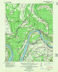
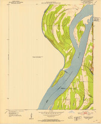
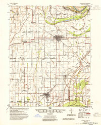
(141)- 1931 Map of Sikeston
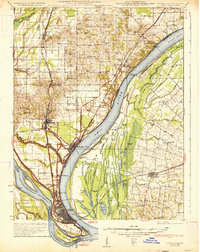
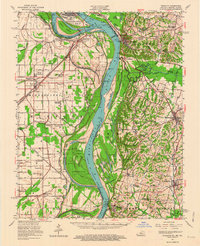
 1931 Sikeston1931 Print · USGSSikeston and the surrounding Bootheel lowlands are captured here in the early 1930s as a massive drainage network transformed the landscape into fertile farmland. Researchers can trace the development of small rail towns like Morehouse and Canalou alongside old country schools like Stringer Sch and Hale Sch.2 unique versions available
 - 1931 Map of Cairo, 1954 Print
 1931 Cairo1954 Print · USGSSouthern Illinois and western Kentucky meet at the great river confluence during the late 1920s and early 1930s. Genealogists can trace family footprints through numerous rural landmarks like Pleasant Hill Sch, the National Cem, and the riverfront at Mound City.2 unique versions available
 - 1933 Map of Cairo
 1933 Cairo1933 Print · USGSThe tri-state confluence of the Ohio and Mississippi rivers comes alive in the early 1930s, showing the vital rail and river hubs of Cairo and Mound City. Genealogists can pinpoint rural life through dozens of named sites like Bethlehem Ch, Rife Sch, and the National Cem.3 unique versions available
 - 1934 Map of Thebes
 1934 Thebes1934 Print · USGSThe Mississippi River corridor south of Thebes shows a landscape of rail junctions and bottomland farming in the 1930s. Genealogists can locate family landmarks like Pollard Cemetery, Mt Zion Ch, and schools such as Ownsby Sch or Lemon Sch.4 unique versions available
 - 1934 Map of Sikeston
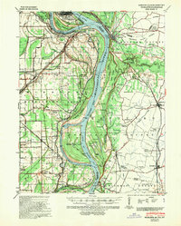
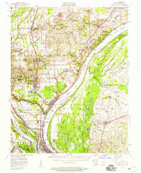
 1934 Sikeston1934 Print · USGSSikeston and the surrounding Scott County lowlands are captured here in the 1930s as a thriving rail and drainage network. Genealogists can trace family roots through dozens of rural sites like Carpenter Cem, Silent Hill Ch, and the Warner Sch.2 unique versions available
 - 1939 Map of Wickliffe
 1939 Wickliffe1939 Print · USGSThe confluence of the Ohio and Mississippi Rivers in the late 1930s reveals a landscape of river-bend settlements and early flood control. Genealogists can locate numerous rural landmarks such as St Pauls Ch & Sch, Cherry Geveden Sch, and the historic site of Fort Jefferson.2 unique versions available
 - 1939 Map of Sikeston
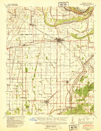
 1939 Sikeston1939 Print · USGSIn the 1930s, the Missouri Bootheel was a landscape defined by industrial-scale drainage and a dense rail network. Trace the legacy of rural education and faith at Silent Hill Ch, Landers Ridge Sch, and the community of Morehouse.
 - 1939 Map of Charleston, 1941 Print
 1939 Charleston1941 Print · USGSThe Missouri Bootheel near Charleston is shown here just as the modern levee and ditch systems were taking final shape. Researchers can trace the era's rural social fabric through numerous local landmarks like Pulltight Sch, Maynard Cem, and the St Louis Southwestern rail line.2 unique versions available
 - 1939 Map of Hickman, 1941 Print
 1939 Hickman1941 Print · USGSWestern Kentucky and the Missouri bootheel meet at the river in the late 1930s, showing a landscape of flood control and rural growth. Genealogists can locate family-named sites like Hubbard Cem, Stubbs Sch, and the riverside settlement of Dorena.4 unique versions available
 - 1939 Map of Bayouville, 1942 Print
 1939 Bayouville1942 Print · USGSThe Missouri bootheel and the winding Kentucky riverfront are shown here just before the war. Genealogists can trace family names and local hubs like Pinhook Ch & Sch, Sugar Tree Ridge Sch, and the St Louis Southwestern RR.2 unique versions available
 - 1939 Map of Cairo, 1945 Print
 1939 Cairo1945 Print · USGSThe confluence of the great American rivers in the late 1930s shows an era defined by massive levee engineering and rail-to-river commerce. Genealogists and historians can trace the footprint of riverfront communities like Mound City and Urbandale or locate family schools such as Valley Recluse Sch and Ohio Sch.
 - 1939 Map of Thebes, 1946 Print
 1939 Thebes1946 Print · USGSSouthern Illinois and the Mississippi River bottomlands are captured here just before the 1940s, showing a landscape defined by rail junctions and river islands. Genealogists can locate family landmarks like Pollard Cemetery, Unity Ch, and several rural schoolhouses including Powers Island Sch.
 - 1949 Map of Paducah
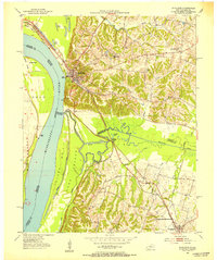
 1949 Paducah1949 Print · USGSThe confluence of the Ohio, Mississippi, Tennessee, and Cumberland rivers at the close of the 1940s reveals a region bound by water and rail. Researchers can trace historic river landings, timberlands in the Shawnee National Forest, and the coal-mining infrastructure around West Frankfort and Herrin.2 unique versions available
 - 1950 Map of Paducah
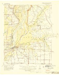
 1950 Paducah1950 Print · USGSThe confluence of the great midwestern rivers defines this mid-century landscape at the intersection of Illinois, Kentucky, and Missouri. Genealogists and historians can trace the rail-and-river economy through the hubs of Paducah, Cairo, and Metropolis or locate family roots near the Wildcat Hills.
 - 1951 Map of Bondurant, 1952 Print
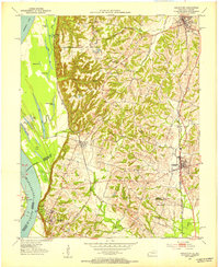
 1951 Bondurant1952 Print · USGSThe Kentucky-Tennessee borderlands and the Mississippi River bottoms are captured here during the early fifties. Genealogists and historians can trace the Illinois Central rail line through rural hubs like Bondurant, Sassafras Ridge, and Tyler.
 - 1951 Map of Hickman, 1953 Print
 1951 Hickman1953 Print · USGSThe river bluffs at Hickman overlook a complex tri-state landscape during the early 1950s. Genealogists and local historians can trace the foundations of rural Kentucky and Missouri life through landmarks like Dorena Sch, Poplar Grove Ch, and the Illinois Central railroad lines.
 - 1951 Map of Wolf Island, 1953 Print
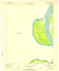
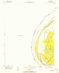
 1951 Wolf Island1953 Print · USGSThe Mississippi River floodplain at the Kentucky-Missouri border is captured here in the early fifties, showing a landscape shaped by shifting currents. Researchers can trace the mid-century channel and landforms like Wolf Island No 5, Medley Bar, and the banks near Chalk Bluff.2 unique versions available
 - 1951 Map of Wickliffe SW, 1953 Print
 1951 Wickliffe SW1953 Print · USGSThe Kentucky and Missouri borderlands along the Mississippi are captured here in the early fifties. River historians and researchers can trace the shifting banks of Lucas Bend and the precise boundaries of Islands Nos 2 3 & 4 and Wolf Island No 5.3 unique versions available
 - 1951 Map of Arlington, 1953 Print
 1951 Arlington1953 Print · USGSWestern Kentucky's river bluffs and bottomlands are frozen in time during the early fifties, showing the region's transition from the Mississippi floodplain to upland farms. Researchers can trace family history at Roselawn Cem, locate the Trevathan Sch, or explore the grounds of Columbus-Belmont State Park.2 unique versions available
 - 1951 Map of Wickliffe, 1953 Print
 1951 Wickliffe1953 Print · USGSThe river confluence at the Kentucky-Missouri border comes to life in the early fifties, showing the strategic rail and water hub around Wickliffe. Researchers can locate old family landmarks like Harrison Hughes Cem or trace the early paths of the Illinois Central railroad.2 unique versions available
 - 1952 Map of Wickliffe, 1964 Print
 1952 Wickliffe1964 Print · USGSThe confluence of the Ohio and Mississippi rivers in the early fifties shows a bustling network of river commerce and rail lines. You can trace family roots through numerous rural landmarks like North Ballard Ch & Cem, Birds Point Sch, and the rail junction at Winford Junction.
 - 1953 Map of Cairo, 1959 Print
 1953 Cairo1959 Print · USGSThe confluence of the Ohio and Mississippi Rivers is captured here in the mid-1950s, showing a landscape defined by floodgates and rail lines. Researchers can trace the layout of Cairo, find family plots at Hazelwood Cem, or locate landmarks like the National Cemetery and Cairo Airport.3 unique versions available
 - 1954 Map of Charleston
 1954 Charleston1954 Print · USGSSoutheastern Missouri's river country is captured here during the mid-1950s, showing the complex drainage systems of the Bootheel. Researchers can locate dozens of rural landmarks like Bridges Ch & Sch, Maynard Cem, and the Missouri Pacific line.2 unique versions available
 - 1954 Map of Paducah
 1954 Paducah1954 Print · USGSSouthern Illinois and Western Kentucky intersect at the great river confluences during this mid-century era of rail and river industry. Genealogists and historians can trace family roots and commerce through river towns like Cairo, Metropolis, and Golconda, or along the tracks of the Illinois Central Railroad.2 unique versions available
 - 1954 Map of Cairo, 1955 Print
 1954 Cairo1955 Print · USGSThe Kentucky side of the Ohio River in the mid-1950s reveals a landscape defined by the wetlands and sloughs of the BARLOW BOTTOMS. Genealogists and local historians can trace the paths of the GULF CENTRAL MOBILE AND OHIO RAILROAD near East Cairo and the unique topography of Twin Mounds.
Showing maps 1-25 of 141
Top cities of Mississippi County
- Charleston historical maps
- East Prairie historical maps
- Bertrand historical maps
- Wyatt historical maps
- Anniston historical maps
- Wilson City historical maps
See more
Frequently asked questions
- What are the different types of historical maps available for Mississippi County?
- What is the oldest map of Mississippi County?
- Where can I purchase historical maps of Mississippi County for my home or office?
- Where can I download high-res historical maps of Mississippi County?
- Are there historical topographic maps available for Mississippi County?
- Is there historical aerial imagery available for Mississippi County?
- Where are historical maps of Mississippi County sourced from?