2000s (21st Century) Maps of Doolittle, Missouri
Explore 10 historic maps of Doolittle from the 2000s (21st Century). These maps offer a rare glimpse into what life looked like during the 2000s — showing old roads, neighborhoods, homes, and landmarks that have changed or disappeared over time.
Whether you're researching your family's past, planning a metal detecting trip, or studying how Doolittle's landscape evolved across the 2000s, these high-resolution maps are a powerful tool for exploring the history of this region.
- Focus on a specific era: All maps on this page are from the 2000s, giving you a focused view of this time period.
- See what’s changed: Compare century-old streets, trails, and buildings to today's modern landscape using overlays and satellite layers.
- Research with precision: Use these maps for genealogy, historical research, land use analysis, or educational projects.
- View, download, or print: Maps are fully viewable online in high resolution, and can be downloaded or printed for your own records.
Start exploring Doolittle's history through authentic maps from the 2000s. This is your window into the past.
Doolittle, MO maps
(10)- 2004 Map of Newburg, 2006 Print
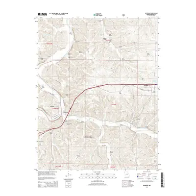
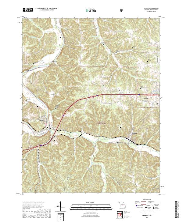
 2004 Newburg2006 Print · USGSThe rail-and-river corridor of Phelps County is captured here at the start of the 21st century. Researchers can trace family sites like Ramsey Cem or explore the riverfront history of Jerome and the railroad hub of Newburg.
 - 2004 Map of Rolla, 2006 Print
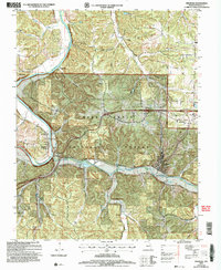
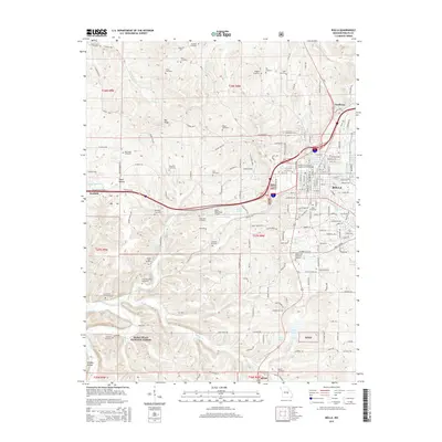
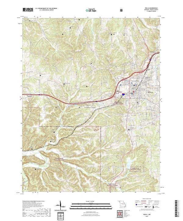
 2004 Rolla2006 Print · USGSMid-Missouri's landscape near the turn of the millennium shows the expansion of ROLLA alongside the iconic Historic Route 66. Researchers can trace rural family lineages through numerous local burial sites like Strawhun Cem and explore the rugged geology surrounding Little Beaver Cave.
 - 2012 Map of Newburg, 2012 Print
 2012 Newburg2012 Print · USGSCovers Doolittle, including Newburg, Jerome, and other nearby areas
 - 2013 Map of Rolla, 2013 Print
 2013 Rolla2013 Print · USGSCovers Doolittle, including Rolla, Northwye, and other nearby areas
 - 2015 Map of Newburg, 2015 Print
 2015 Newburg2015 Print · USGSCovers Doolittle, including Newburg, Jerome, and other nearby areas
 - 2015 Map of Rolla, 2015 Print
 2015 Rolla2015 Print · USGSCovers Doolittle, including Rolla, Northwye, and other nearby areas
 - 2017 Map of Newburg, 2017 Print
 2017 Newburg2017 Print · USGSCovers Doolittle, including Newburg, Jerome, and other nearby areas
 - 2017 Map of Rolla, 2017 Print
 2017 Rolla2017 Print · USGSCovers Doolittle, including Rolla, Northwye, and other nearby areas
 - 2021 Map of Newburg, 2021 Print
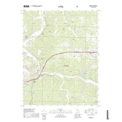
 2021 Newburg2021 Print · USGSThe river valleys of the Gasconade and Little Piney Creek meet the Ozark ridges in this 2021 study of Phelps County. Genealogists can locate numerous local landmarks like Harrison - Pillman Cem, Arlington, and Newburg Cem.
 - 2021 Map of Rolla, 2021 Print
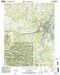
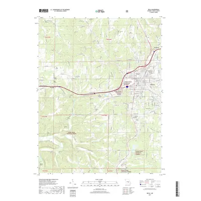
 2021 Rolla2021 Print · USGSThe Missouri Ozarks and the growing city of Rolla are shown in the early 2020s, highlighting the intersection of academic life and forest land. Trace family history at the Rolla Cem or explore the area around the Phelps County Courthouse.
End of results
Showing maps 1-10 of 10
Top cities near Doolittle
- Rolla historical maps
- Saint Robert historical maps
- St. James historical maps
- Dixon historical maps
- Newburg historical maps
- Powellville historical maps
Frequently asked questions
- What are the different types of historical maps available for Doolittle?
- What is the oldest map of Doolittle?
- Where can I purchase historical maps of Doolittle for my home or office?
- Where can I download high-res historical maps of Doolittle?
- Are there historical topographic maps available for Doolittle?
- Is there historical aerial imagery available for Doolittle?
- Where are historical maps of Doolittle sourced from?