2020s Maps of Platte City, Missouri
Explore 3 historic maps of Platte City from the 2020s. These maps offer a rare glimpse into what life looked like during the 2020s — showing old roads, neighborhoods, homes, and landmarks that have changed or disappeared over time.
Whether you're researching your family's past, planning a metal detecting trip, or studying how Platte City's landscape evolved across the 2020s, these high-resolution maps are a powerful tool for exploring the history of this region.
- Focus on a specific era: All maps on this page are from the 2020s, giving you a focused view of this time period.
- See what’s changed: Compare century-old streets, trails, and buildings to today's modern landscape using overlays and satellite layers.
- Research with precision: Use these maps for genealogy, historical research, land use analysis, or educational projects.
- View, download, or print: Maps are fully viewable online in high resolution, and can be downloaded or printed for your own records.
Start exploring Platte City's history through authentic maps from the 2020s. This is your window into the past.
Platte City, MO maps
(3)- 2021 Map of Tracy, 2021 Print
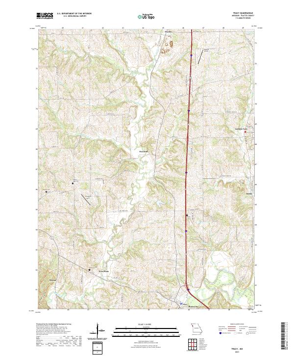 2021 Tracy2021 Print · USGSPlatte County at the start of the 2020s shows a landscape of established farmsteads and rural airfields. Genealogists can locate several local burial grounds including Wilkerson Cem and Kitchen Cem, while tracing the paths of Bee Creek and the Platte River.
 - 2021 Map of Ferrelview, 2021 Print
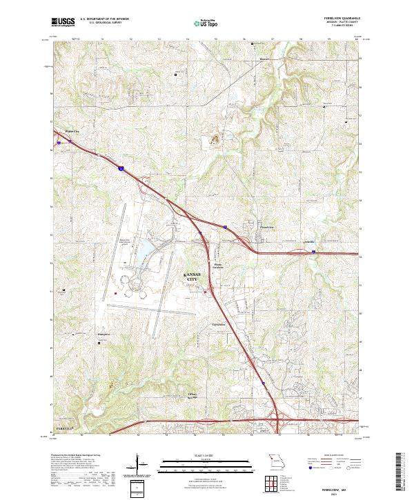 2021 Ferrelview2021 Print · USGSPlatte County at the start of the 2020s shows a landscape of modern aviation and deep-rooted local history. Researchers can trace family plots at Brasfield Cem and Dixon Cem or explore the growth of Ferrelview near the Kansas City International Airport.
 - 2021 Map of Platte City, 2021 Print
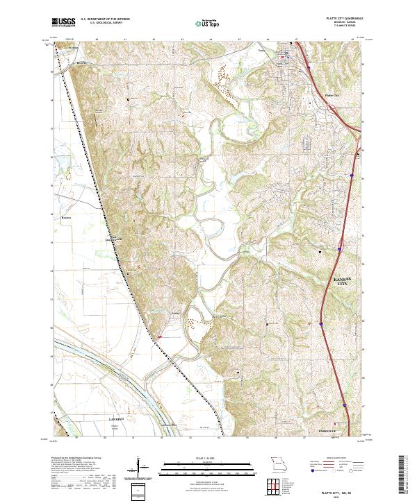 2021 Platte City2021 Print · USGSPlatte City and the surrounding river bluffs are captured here in the early 2020s, showing the meeting of historic rural landscapes and modern growth. Researchers can trace local heritage through numerous family-named sites like Todd Cem, Humphery Bridge, and the Platte County Courthouse.
End of results
Showing maps 1-3 of 3
Top cities near Platte City
- Kansas City historical maps
- Kansas City historical maps
- Leavenworth historical maps
- Gladstone historical maps
- Lansing historical maps
- Smithville historical maps
See more
Frequently asked questions
- What are the different types of historical maps available for Platte City?
- What is the oldest map of Platte City?
- Where can I purchase historical maps of Platte City for my home or office?
- Where can I download high-res historical maps of Platte City?
- Are there historical topographic maps available for Platte City?
- Is there historical aerial imagery available for Platte City?
- Where are historical maps of Platte City sourced from?