2020s Maps of Putnam County, Missouri
Explore 14 historic maps of Putnam County from the 2020s. These maps offer a rare glimpse into what life looked like during the 2020s — showing old roads, neighborhoods, homes, and landmarks that have changed or disappeared over time.
Whether you're researching your family's past, planning a metal detecting trip, or studying how Putnam County's landscape evolved across the 2020s, these high-resolution maps are a powerful tool for exploring the history of this region.
- Focus on a specific era: All maps on this page are from the 2020s, giving you a focused view of this time period.
- See what’s changed: Compare century-old streets, trails, and buildings to today's modern landscape using overlays and satellite layers.
- Research with precision: Use these maps for genealogy, historical research, land use analysis, or educational projects.
- View, download, or print: Maps are fully viewable online in high resolution, and can be downloaded or printed for your own records.
Start exploring Putnam County's history through authentic maps from the 2020s. This is your window into the past.
Putnam County, MO maps
(14)- 2021 Map of Unionville East, 2021 Print
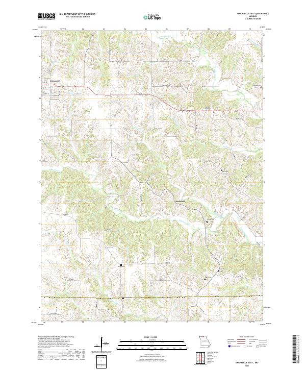 2021 Unionville East2021 Print · USGSThe eastern edges of Unionville meet the Missouri uplands in the early twenty-first century, revealing a landscape etched by the Blackbird Creek system. Researchers can trace numerous family-named burial sites like Thompson Cem and Pherigo Cem near the small settlement of Rosewood.
 - 2021 Map of Coatsville, 2021 Print
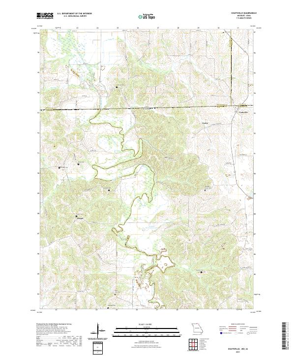 2021 Coatsville2021 Print · USGSThe Missouri-Iowa border comes to life in this survey of the northern Schuyler County countryside. Genealogists can trace family roots through a high concentration of burial sites, including Pleasant Grove Cem, Bratcher Cem, and Dean Cem.
 - 2021 Map of Powersville, 2021 Print
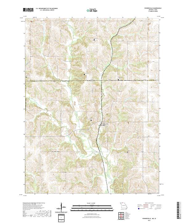 2021 Powersville2021 Print · USGSThe Missouri-Iowa borderlands near the start of the 2020s remain a landscape of quiet rural townships and winding creek forks. Local historians can trace family roots through numerous burial sites like Powersville Cemetery, Greer Cemetery, and the remote Wyreka Cemetery.
 - 2021 Map of Mendota, 2021 Print
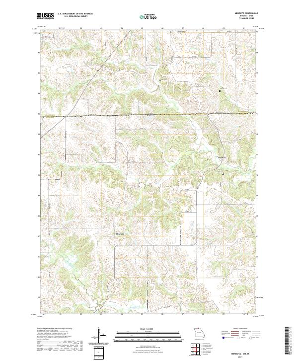 2021 Mendota2021 Print · USGSThe Missouri-Iowa border comes into focus in the early 2020s, revealing a landscape of ridge-top settlements and winding creek bottoms. Genealogists can locate Mendota, Howland, and several rural burial sites like Bozwell Cemetery and Baker Cemetery.
 - 2021 Map of Stahl, 2021 Print
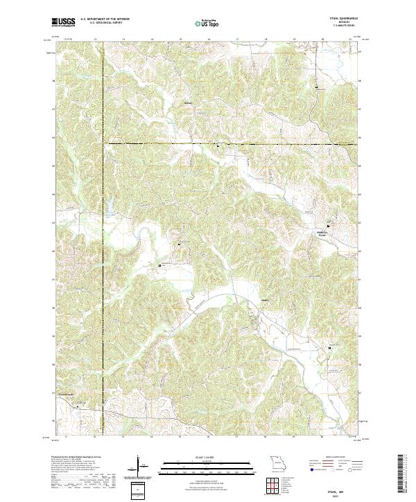 2021 Stahl2021 Print · USGSThe rural borders of Adair and Sullivan Counties come into focus in the early twenty-first century. Genealogists can trace family landmarks and burial sites across this landscape, including Husted Cem, Branstutter Cem, and the settlement of Sidney.
 - 2021 Map of Omaha, 2021 Print
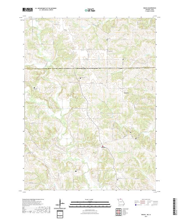 2021 Omaha2021 Print · USGSThe Missouri-Iowa border near the start of the 2020s remains a landscape of dispersed farmsteads and rural cemeteries. Researchers can trace family history through numerous local sites like Shoney Cem, Shipley Cem, and the small settlement at Omaha.
 - 2021 Map of Pollock NW, 2021 Print
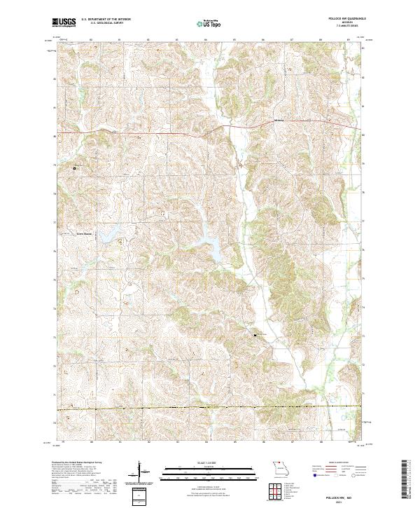 2021 Pollock NW2021 Print · USGSPutnam County, Missouri, is captured here in the early twenty-first century, showing a rural landscape shaped by the Locust Cr drainage system. Genealogists can locate family burial sites at Sprigg Cem and Parsons Cem or trace old routes through Midway and Terre Haute.
 - 2021 Map of Livonia, 2021 Print
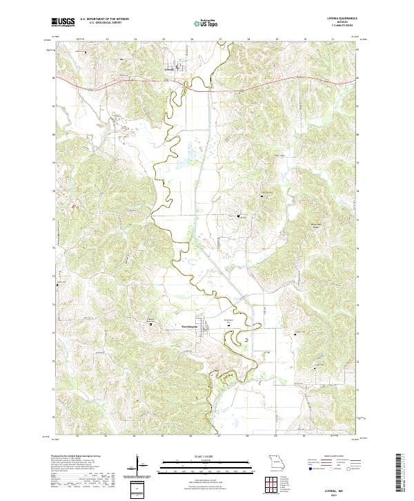 2021 Livonia2021 Print · USGSUpper Missouri's river hills are captured here in the early twenty-first century, centered on the historic settlements of Livonia and Worthington. Researchers can locate numerous local burial sites like Jimtown Cem and Gillespie Cem while tracing the winding path of the Chariton River.
 - 2021 Map of Connelsville, 2021 Print
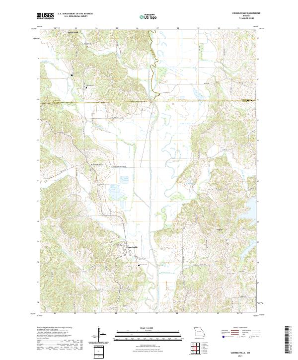 2021 Connelsville2021 Print · USGSThe Chariton River valley in northern Missouri is shown here in the contemporary era as it winds through Adair and Putnam counties. Researchers can trace rural lineages through the Nineveh Cem, Hatfield Cem, and the old settlement at Connelsville.
 - 2021 Map of Saint John, 2021 Print
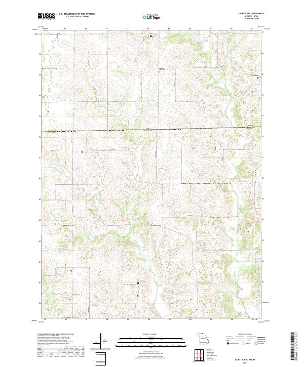 2021 Saint John2021 Print · USGSThe Missouri-Iowa borderlands come into focus in this recent survey of the Saint John area. Genealogists can locate family burial sites at Harris Cem, Genoa Cem, or Torrey Cem and trace the early road network near Locust Cr.
 - 2021 Map of Graysville, 2021 Print
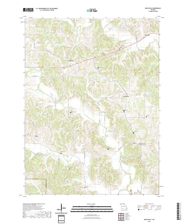 2021 Graysville2021 Print · USGSPutnam County's rural heartland is documented here in the early twenty-first century, showing a landscape of family farms and creek-carved valleys. Researchers can trace ancestral roots through numerous small burial grounds like McCune Cem, Hogg Cem, and the village of Martinstown.
 - 2021 Map of Lucerne, 2021 Print
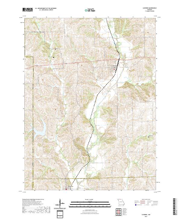 2021 Lucerne2021 Print · USGSNorth Missouri’s rolling creek valleys and rural crossroads are captured in this recent survey of the Putnam and Sullivan County border. Researchers can locate family sites and cemeteries like Old Busby Cemetery or trace the winding course of Medicine Creek.
 - 2021 Map of Unionville West, 2021 Print
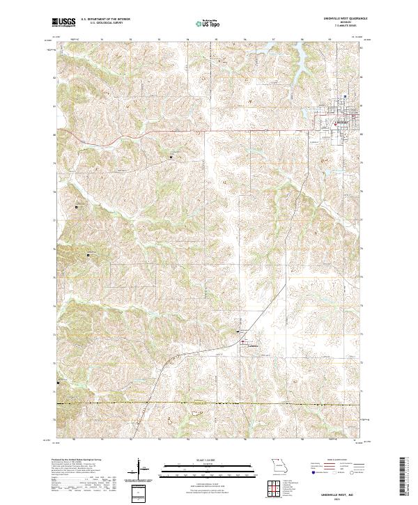 2021 Unionville West2021 Print · USGSThe northern Missouri highlands of Putnam County are captured here just as the modern era met historical rural roots. Researchers can trace ancestral sites through numerous country burial grounds like Cullor Cem and Dixon Cem, or explore the seat of local government at the Putnam County Courthouse in Unionville.
 - 2021 Map of Lake Thunderhead, 2021 Print
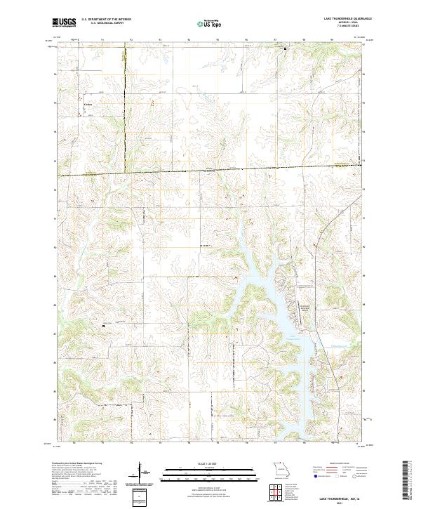 2021 Lake Thunderhead2021 Print · USGSThe Missouri-Iowa state line comes into focus in this recent survey of the lands around Lake Thunderhead and the village of Genoa. Genealogists and local historians can trace burial sites at Union Cem and Livingston Cem or locate the Unionville Municipal Airport.
End of results
Showing maps 1-14 of 14
Top cities of Putnam County
- Unionville historical maps
- Livonia historical maps
- Lucerne historical maps
- Worthington historical maps
- Powersville historical maps
Frequently asked questions
- What are the different types of historical maps available for Putnam County?
- What is the oldest map of Putnam County?
- Where can I purchase historical maps of Putnam County for my home or office?
- Where can I download high-res historical maps of Putnam County?
- Are there historical topographic maps available for Putnam County?
- Is there historical aerial imagery available for Putnam County?
- Where are historical maps of Putnam County sourced from?