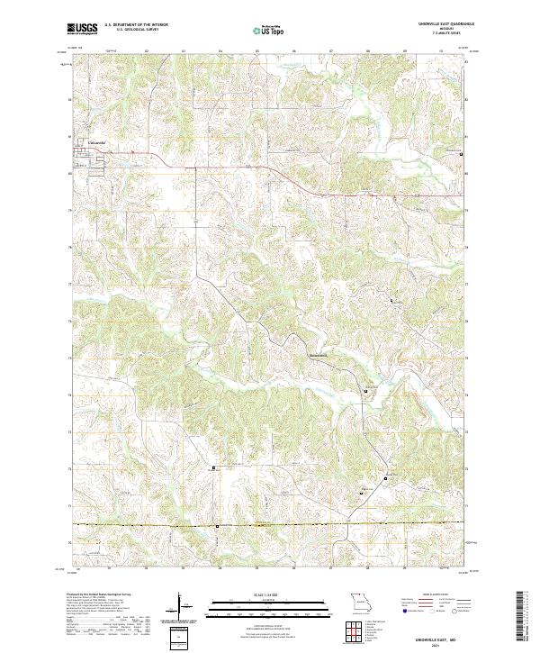
2021 Map of Unionville East
USGS Topo · Published 2021About this map
Rosewood and the eastern outskirts of Unionville anchor this northern Missouri landscape, where the rolling heights of High Prairie drop away into a complex network of stream valleys. The geography is defined by the branching waters of N Blackbird Cr and S Blackbird Cr, which have carved deep drainages across the terrain. These natural corridors are supplemented by smaller tributaries like Kinney Cr and Williams Br, creating a rugged physical pattern that historically dictated the placement of roads and homesteads.
Find a feature on this map
37 named features on this map. Tap any name to fly to it.
Don’t see what you’re looking for? This feature index may not catch every label — zoom into the map to look around manually.
Map Details
Editions of this 2021 Unionville East Map
This is the sole edition of this map. No revisions or reprints were ever made.
Other maps of this area

1912 · Green City
USGS Topo · 1:62,500

1914 · Green City
USGS Topo · 1:62,500

1939 · Centerville
USGS Topo · 1:62,500

1941 · Centerville
USGS Topo · 1:62,500

1942 · Seymour
USGS Topo · 1:62,500

1944 · Seymour
USGS Topo · 1:62,500

1954 · Centerville
USGS Topo · 1:250,000

1957 · Centerville
USGS Topo · 1:250,000

1958 · Centerville
USGS Topo · 1:250,000

1964 · Unionville West
USGS Topo · 1:24,000