Old Maps of Saint Charles County, Missouri for Academic Research
Study the evolution of Saint Charles County with 181 high-resolution historic maps. Whether you're teaching, researching, or modeling changes in land use, these maps provide essential visual documentation of urban, environmental, and geographic change.
- Analyze long-term change: Track patterns in development, transportation, and natural features.
- Ideal for environmental or urban studies: Support academic projects with primary historical map data.
- Use in the classroom or lab: Educators and researchers rely on these maps to bring historical context to life.
These maps are a powerful tool for teaching, research, and visualizing how Saint Charles County has changed over the decades.
Saint Charles County, MO maps
(181)- 1903 Map of O'Fallon
 1903 O'Fallon1903 Print · USGSSt. Charles County at the turn of the century is a labyrinth of river islands and rail lines at the confluence of the Missouri and Mississippi. Researchers can trace old river landings like Cap Au Gris Landing and family-named settlements from Moscow Mills to New Melle.5 unique versions available
 - 1924 Map of Robertson
 1924 Robertson1924 Print · USGSNorthwest St. Louis County emerges into the aviation age during the mid-thirties, bounded by the wide Missouri River. Genealogists and historians can locate the Lambert St Louis Landing Field, the National Guard Target Range, and schools like Garret.
 - 1927 Map of Alton
 1927 Alton1927 Print · USGSThe industrial and riverfront corridor of the Mississippi and Missouri confluence is captured here during a period of heavy rail and ferry traffic. Researchers can trace historic family locations through dozens of rural landmarks like Monticello Seminary, Greenwood Cem, and the City of St Louis Farms.
 - 1927 Map of St. Charles, 1955 Print
 1927 St. Charles1955 Print · USGSThe Missouri and Mississippi rivers meet in this mid-century survey, showcasing a landscape of fertile bottomlands and early aviation hubs. Genealogists can trace family footprints through dozens of rural landmarks like St Stanislaus Seminary, Orchard Farm, and Cul de Sac Sch.2 unique versions available
 - 1931 Map of Brussels
 1931 Brussels1931 Print · USGSThe peninsula between the Illinois and Mississippi Rivers is captured here in the early 1930s, showcasing a network of river landings and ridge-top settlements. Genealogists can trace family roots through numerous local landmarks like Golden Eagle, Point Pleasant, and Nichols Sch.2 unique versions available
 - 1932 Map of Manchester NE
 1932 Manchester NE1932 Print · USGSThe Missouri River floodplain and the rising bluffs of St. Louis County are captured here in the early 1930s. Genealogists and local historians can trace the foundations of Chesterfield and Bellefontaine alongside sites like Zion Sch and the St Louis City Water Works.
 - 1933 Map of Creve Coeur
 1933 Creve Coeur1933 Print · USGSSt. Louis County in the early thirties shows a landscape of growing suburbs and deep-rooted cemeteries. Trace family history at Fee Fee Cemetery and locate old landmarks like Chaminade College or the Zion Sch.
 - 1933 Map of Saint Charles
 1933 Saint Charles1933 Print · USGSThe confluence of the Missouri and Mississippi rivers in the early thirties reveals a landscape of fertile river bottoms and emerging suburban rail towns. Genealogists and researchers can trace old school districts like Cul de Sac Sch and historic sites such as St Stanislaus Seminary.3 unique versions available
 - 1934 Map of Alton
 1934 Alton1934 Print · USGSThe confluence of the Mississippi and Missouri rivers in the early 1930s shows a dense industrial and rail corridor centered on Alton. Genealogists and researchers can trace dozens of rural schools and landmarks like Monticello Seminary, Mt Olive Church, and the City of St Louis Farms.2 unique versions available
 - 1935 Map of Florissant
 1935 Florissant1935 Print · USGSSt. Louis County is captured during the mid-1930s as rural landscapes begin to integrate with early aviation and highway networks. Genealogists can trace family names at St Stanislaus Seminary, Halls Ferry, or the early Lambert St Louis Landing Field.
 - 1935 Map of Columbia Bottom
 1935 Columbia Bottom1935 Print · USGSSt. Louis County and the river confluence are captured here in the mid-1930s, showing a landscape of municipal farms and rural school districts. Genealogists can trace local roots through landmarks like Ruegg PO, Larimore, and the Vossenkemper School.
 - 1937 Map of Weldon Spring
 1937 Weldon Spring1937 Print · USGSThe Missouri River bottoms and the rising hills of St. Charles County are shown here in the late thirties, just as industrial and parkland developments began to reshape the region. Genealogists can locate several family burial grounds like Wolf Cem and Howell Cem, alongside rural centers such as Centaur Station and Toonerville.
 - 1939 Map of Brussels, 1955 Print
 1939 Brussels1955 Print · USGSThe confluence of the Illinois and Mississippi rivers defines this pre-war era, where river landings and ferries still anchored local life. Genealogists can trace family footprints at Old Rock Ch, numerous rural schools like Black Jack Sch, and the West Point Ferry.
 - 1940 Map of Eureka
 1940 Eureka1940 Print · USGSThe Missouri countryside west of St. Louis appears here just before the mid-century, defined by the twin river valleys of the Missouri and Meramec. You can trace the development of Eureka and Allenton along the St Louis San Francisco rail line, or find the CCC Camp and Wildhorse Creek Sch in the hills.
 - 1940 Map of Weldon Spring
 1940 Weldon Spring1940 Print · USGSThe Missouri River bottoms and St. Charles County uplands are captured here just before the Second World War. Researchers can trace family history through several rural landmarks, including Pitman Cem, Antioch Ch, and the lost river community of Hamburg.
 - 1940 Map of Creve Coeur
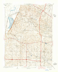 1940 Creve Coeur1940 Print · USGSWest of St. Louis in the late thirties, this area shows a transition from the Missouri River bottomlands to suburban townships and prestigious private clubs. Trace family roots at Fee Fee Cemetery or locate old school sites like Adams Sch and Spoede Sch.3 unique versions available
 - 1941 Map of Troy, 1964 Print
 1941 Troy1964 Print · USGSLincoln and St. Charles Counties are captured here in the early 1940s as the rail-and-river economy shaped local life. Researchers can trace dozens of rural schoolhouses and family landmarks like Pond Fort Sch, Shiloh Ch, and the Wabash RR junction at Wentzville.2 unique versions available
 - 1943 Map of Brussels
 1943 Brussels1943 Print · USGSThe river bottomlands near the Missouri and Illinois border come alive in the 1940s, showing a network of ferries, landings, and rail lines. Trace family history through local landmarks like Lone Tree Indian Mound, Boones Lick Road, and St Peters.2 unique versions available
 - 1944 Map of Eureka
 1944 Eureka1944 Print · USGSSouthwest St. Louis County remains a landscape of creek-bottom farms and wooded ridges during the early 1940s. Genealogists can trace family roots through sites like Bethany Ch, Melrose Sch, and the old rail stops at Glencoe and Allenton.3 unique versions available
 - 1945 Map of Troy
 1945 Troy1945 Print · USGSLincoln and St. Charles counties are shown in the 1940s, revealing a landscape of small farming hamlets and a high density of rural schoolhouses. Researchers can trace the paths of the Wabash RR and locate ancestral landmarks like Owen Station Sch or Oak Grove Cem.2 unique versions available
 - 1947 Map of Chesterfield
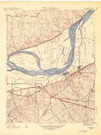 1947 Chesterfield1947 Print · USGSMid-century St. Louis County remains a landscape of river bottoms and rising bluffs as suburban expansion begins to reach westward. Genealogists can trace family footprints through rural sites like Gumbo, the Bellefontaine Sch, and Beeffee Ch.2 unique versions available
 - 1948 Map of Alton, 1954 Print
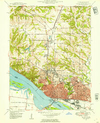 1948 Alton1954 Print · USGSAlton and the Mississippi River bluffs are captured here in the late Forties, showing a region defined by its heavy rail industry and prominent educational institutions. Genealogists and historians can locate Shurtleff College, the Confederate Cem, and the tracks of the Chicago and Alton railroad.
 - 1948 Map of Wood River, 1955 Print
 1948 Wood River1955 Print · USGSMadison County industrial hubs and river lowlands are captured here in the late 1940s as the regional energy sector expanded. Genealogists and historians can trace the foundations of Wood River refineries alongside local landmarks like St Paul Ch and the North Coal Mine.
 - 1948 Map of Augusta, 1963 Print
 1948 Augusta1963 Print · USGSEastern Missouri river country at mid-century shows a landscape of small farming hamlets and essential riverside industries. Genealogists and historians can locate rural landmarks like Emmaus Sanitarium, the Tavern Rock Quarry, and numerous local schools such as Wide Awake Sch.2 unique versions available
 - 1949 Map of Saint Louis
 1949 Saint Louis1949 Print · USGSGreater St. Louis and its surrounding river valleys are captured here just after the war, showing the metropolitan core and the rural Ozark fringe. Researchers can trace the sprawling rail network of the Wabash RR or locate landmarks like Meramec Caverns Airport and Scott Air Force Base.2 unique versions available
Showing maps 1-25 of 181
Top cities of Saint Charles County
- O'Fallon historical maps
- Saint Charles historical maps
- Saint Peters historical maps
- Wentzville historical maps
- Harvester historical maps
- Dardenne Prairie historical maps
See more
Frequently asked questions
- What are the different types of historical maps available for Saint Charles County?
- What is the oldest map of Saint Charles County?
- Where can I purchase historical maps of Saint Charles County for my home or office?
- Where can I download high-res historical maps of Saint Charles County?
- Are there historical topographic maps available for Saint Charles County?
- Is there historical aerial imagery available for Saint Charles County?
- Where are historical maps of Saint Charles County sourced from?