1930s Maps of Town and Country, Missouri
Explore 4 historic maps of Town and Country from the 1930s. These maps offer a rare glimpse into what life looked like during the 1930s — showing old roads, neighborhoods, homes, and landmarks that have changed or disappeared over time.
Whether you're researching your family's past, planning a metal detecting trip, or studying how Town and Country's landscape evolved across the 1930s, these high-resolution maps are a powerful tool for exploring the history of this region.
- Focus on a specific era: All maps on this page are from the 1930s, giving you a focused view of this time period.
- See what’s changed: Compare century-old streets, trails, and buildings to today's modern landscape using overlays and satellite layers.
- Research with precision: Use these maps for genealogy, historical research, land use analysis, or educational projects.
- View, download, or print: Maps are fully viewable online in high resolution, and can be downloaded or printed for your own records.
Start exploring Town and Country's history through authentic maps from the 1930s. This is your window into the past.
Town and Country, MO maps
(4)- 1931 Map of Manchester SE
 1931 Manchester SE1931 Print · USGSSt. Louis County and Jefferson County were still largely defined by the river and rail lines during the early 1930s. Researchers can trace the early layout of Times Beach or locate family-history landmarks like the Rankin Cem and Oak Ridge Sch.
 - 1932 Map of Manchester NE
 1932 Manchester NE1932 Print · USGSThe Missouri River floodplain and the rising bluffs of St. Louis County are captured here in the early 1930s. Genealogists and local historians can trace the foundations of Chesterfield and Bellefontaine alongside sites like Zion Sch and the St Louis City Water Works.
 - 1933 Map of Creve Coeur
 1933 Creve Coeur1933 Print · USGSSt. Louis County in the early thirties shows a landscape of growing suburbs and deep-rooted cemeteries. Trace family history at Fee Fee Cemetery and locate old landmarks like Chaminade College or the Zion Sch.
 - 1933 Map of Kirkwood
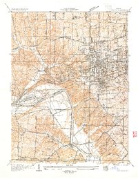 1933 Kirkwood1933 Print · USGSSt. Louis County is captured here during a period of rapid suburban and institutional expansion in the early thirties. Genealogists and local researchers can trace the footprint of Oakhill Cemetery, Meacham Park, and the grounds of Hartman College.
End of results
Showing maps 1-4 of 4
Top cities near Town and Country
- O'Fallon historical maps
- Saint Charles historical maps
- Saint Peters historical maps
- Florissant historical maps
- Chesterfield historical maps
- Oakville historical maps
See more
Frequently asked questions
- What are the different types of historical maps available for Town and Country?
- What is the oldest map of Town and Country?
- Where can I purchase historical maps of Town and Country for my home or office?
- Where can I download high-res historical maps of Town and Country?
- Are there historical topographic maps available for Town and Country?
- Is there historical aerial imagery available for Town and Country?
- Where are historical maps of Town and Country sourced from?