Old Maps of Stoddard County, Missouri for Academic Research
Study the evolution of Stoddard County with 172 high-resolution historic maps. Whether you're teaching, researching, or modeling changes in land use, these maps provide essential visual documentation of urban, environmental, and geographic change.
- Analyze long-term change: Track patterns in development, transportation, and natural features.
- Ideal for environmental or urban studies: Support academic projects with primary historical map data.
- Use in the classroom or lab: Educators and researchers rely on these maps to bring historical context to life.
These maps are a powerful tool for teaching, research, and visualizing how Stoddard County has changed over the decades.
Stoddard County, MO maps
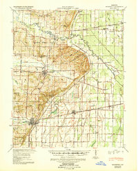
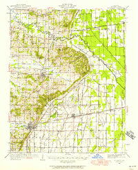
(172)- 1931 Map of Sikeston
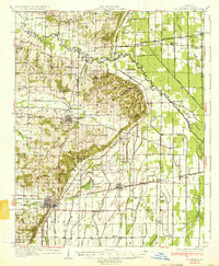
 1931 Sikeston1931 Print · USGSSikeston and the surrounding Bootheel lowlands are captured here in the early 1930s as a massive drainage network transformed the landscape into fertile farmland. Researchers can trace the development of small rail towns like Morehouse and Canalou alongside old country schools like Stringer Sch and Hale Sch.2 unique versions available
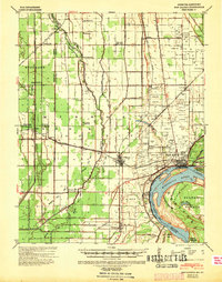
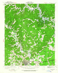
 - 1934 Map of Morley
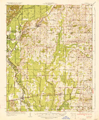
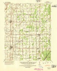
 1934 Morley1934 Print · USGSSoutheastern Missouri during the 1930s reveals a landscape being reshaped by massive drainage projects. Genealogists can trace family roots at Hunter Sch or locate ancestors in settlements like Morley, Benton, and the rail junction at Brooks Junction.3 unique versions available
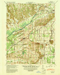
 - 1934 Map of Bloomfield
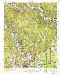
 1934 Bloomfield1934 Print · USGSStoddard County in the early 1930s shows a landscape defined by industrial drainage projects and a robust network of rural schools. Genealogists can trace family footprints at Dowdy Cem or identify old community centers like Walker Ch and Philadelphia Ch.3 unique versions available
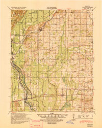
 - 1934 Map of Sikeston
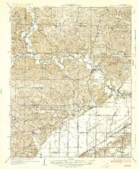
 1934 Sikeston1934 Print · USGSSikeston and the surrounding Scott County lowlands are captured here in the 1930s as a thriving rail and drainage network. Genealogists can trace family roots through dozens of rural sites like Carpenter Cem, Silent Hill Ch, and the Warner Sch.2 unique versions available
 - 1934 Map of Advance
 1934 Advance1934 Print · USGSSoutheast Missouri in the 1930s is mapped here during a period of major hydrological change and railroad activity. You can trace the Diversion Channel across the landscape or find rural schools and family burial sites like Toga No 2 Sch and St Joseph Cem.3 unique versions available
 - 1934 Map of Puxico
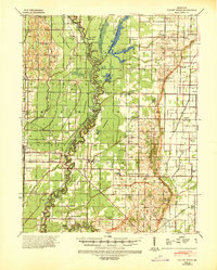
 1934 Puxico1934 Print · USGSThe Missouri Bootheel comes into focus during the 1930s as drainage projects and rail lines reshape the swampy lowlands. Genealogists can locate dozens of country schools like Wilkerson Sch and Zoll Sch, or trace the tracks of the St Louis San Francisco through Puxico.2 unique versions available
 - 1935 Map of Poplar Bluff
 1935 Poplar Bluff1935 Print · USGSSoutheast Missouri’s river-and-rail landscape is captured here in the mid-thirties as the timber and agricultural economy flourished. Trace family homesteads near Taskee Sta, identify old rural schools like Snyder Sch, and follow the original routes of the Missouri Pacific.3 unique versions available
 - 1935 Map of Zalma
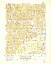
 1935 Zalma1935 Print · USGSSoutheast Missouri in the mid-1930s reveals a landscape undergoing transformation through massive drainage projects and the reach of the rail. Trace old schoolhouses like Patterson Sch, vanished landmarks like Sitzke Store, and the path of the St Louis San Francisco railroad.3 unique versions available
 - 1939 Map of Bloomfield
 1939 Bloomfield1939 Print · USGSBefore the full consolidation of modern school districts, this 1930s landscape was dotted with local anchors like Gravel Hill Sch and Beech Grove Sch. You can trace the complex drainage networks of Ditch No 33 and Panther Creek that transformed these Missouri bottomlands near Bloomfield.
 - 1939 Map of Sikeston
 1939 Sikeston1939 Print · USGSIn the 1930s, the Missouri Bootheel was a landscape defined by industrial-scale drainage and a dense rail network. Trace the legacy of rural education and faith at Silent Hill Ch, Landers Ridge Sch, and the community of Morehouse.
 - 1939 Map of New Madrid, 1941 Print
 1939 New Madrid1941 Print · USGSThe Missouri Bootheel is documented here during the late thirties, centered on the dramatic New Madrid Bend of the Mississippi River. Trace the early drainage networks and rail lines that shaped towns like New Madrid, Lilbourn, and Catron.
 - 1939 Map of Morley, 1942 Print
 1939 Morley1942 Print · USGSSoutheast Missouri was undergoing a massive hydrological transformation in the late 1930s as engineers redirected the Whitewater River. Genealogists and historians can trace rail-depot towns like Chaffee and Morley alongside vanished rural landmarks like Bryan Sch and Brooks Junction.2 unique versions available
 - 1939 Map of Advance, 1942 Print
 1939 Advance1942 Print · USGSSoutheast Missouri in the late thirties is defined here by its massive drainage projects and thriving rail towns. Researchers can trace the heritage of rural communities through dozens of local landmarks like Cruse Cem, Dongola Sch, and Union Grove Ch.
 - 1939 Map of Puxico, 1942 Print
 1939 Puxico1942 Print · USGSSoutheast Missouri's bootheel region comes to life in the late 1930s, showing a landscape defined by extensive drainage projects and burgeoning rail towns. Trace the locations of rural schoolhouses like Edmundson Sch and lost junctions along the St Louis - San Francisco Ry.
 - 1939 Map of Zalma, 1943 Print
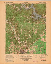
 1939 Zalma1943 Print · USGSSoutheast Missouri’s river hills and delta margins are captured here in the late thirties, as the region’s drainage and rail networks were undergoing significant change. Genealogists can trace family names through landmarks like the Buchanan Post Office, Bright Prospect Ch, and Snake Bluff School No 2.2 unique versions available
 - 1939 Map of Poplar Bluff, 1949 Print
 1939 Poplar Bluff1949 Print · USGSSoutheast Missouri’s river-and-rail hub is captured here during the transformative period when the Black River was being dammed. Genealogists can trace family names across a landscape of schools and churches like Baskey Sch, Butler Cem, and Taskee Sta.
 - 1940 Map of Malden, 1942 Print
 1940 Malden1942 Print · USGSIn the Missouri Bootheel during the early 1940s, a vast network of drainage ditches transformed the landscape for farming and rail commerce. Researchers can trace rural life through dozens of named landmarks like Sugar Tree Ch & Sch, Stephenson Cem, and Tallapoosa.
 - 1940 Map of Valley Ridge, 1943 Print
 1940 Valley Ridge1943 Print · USGSDunklin and Butler counties come to life in the early 1940s, where the St Francis River winds through a landscape of new drainage ditches and high ridges. Researchers can locate family landmarks like Stephens Cem or trace old river crossings at Higginbothams Ferry.
 - 1949 Map of Paducah
 1949 Paducah1949 Print · USGSThe confluence of the Ohio, Mississippi, Tennessee, and Cumberland rivers at the close of the 1940s reveals a region bound by water and rail. Researchers can trace historic river landings, timberlands in the Shawnee National Forest, and the coal-mining infrastructure around West Frankfort and Herrin.2 unique versions available
 - 1949 Map of Rolla, 1950 Print
 1949 Rolla1950 Print · USGSThe Missouri Ozarks are captured here just after the war, showing a landscape of deep river valleys and emerging reservoir projects. Genealogists and historians can trace the mining towns of Bonne Terre and Potosi or follow the early route of U.S. Highway 66.
 - 1949 Map of Bloomfield, 1958 Print
 1949 Bloomfield1958 Print · USGSStoddard County is documented here during the post-war years as its agricultural drainage systems and rail networks reached their peak. Local historians can trace family roots through numerous rural landmarks like Dowdy Cem, Holly Ch, and the Walnut Ridge Sch.
 - 1949 Map of Poplar Bluff, 1964 Print
 1949 Poplar Bluff1964 Print · USGSThe area surrounding Poplar Bluff is shown during a period of transition as the Ozark hills meet the engineered drainage canals of the lowlands. Researchers can trace the St Louis San Francisco railroad through rural stops like Chaonia and Taskee Sta.
 - 1950 Map of Paducah
 1950 Paducah1950 Print · USGSThe confluence of the great midwestern rivers defines this mid-century landscape at the intersection of Illinois, Kentucky, and Missouri. Genealogists and historians can trace the rail-and-river economy through the hubs of Paducah, Cairo, and Metropolis or locate family roots near the Wildcat Hills.
 - 1953 Map of Rolla
 1953 Rolla1953 Print · USGSSoutheast Missouri’s mining towns and timberlands are seen here at the start of the 1950s. Genealogists and historians can trace the rail-and-river economy through local hubs like Fredericktown and the lead-mining heritage of Potosi and Desloge.
 - 1954 Map of Paducah
 1954 Paducah1954 Print · USGSSouthern Illinois and Western Kentucky intersect at the great river confluences during this mid-century era of rail and river industry. Genealogists and historians can trace family roots and commerce through river towns like Cairo, Metropolis, and Golconda, or along the tracks of the Illinois Central Railroad.2 unique versions available
Showing maps 1-25 of 172
Top cities of Stoddard County
- Dexter historical maps
- Bloomfield historical maps
- Bernie historical maps
- Advance historical maps
- Puxico historical maps
- Essex historical maps
See more
Frequently asked questions
- What are the different types of historical maps available for Stoddard County?
- What is the oldest map of Stoddard County?
- Where can I purchase historical maps of Stoddard County for my home or office?
- Where can I download high-res historical maps of Stoddard County?
- Are there historical topographic maps available for Stoddard County?
- Is there historical aerial imagery available for Stoddard County?
- Where are historical maps of Stoddard County sourced from?