1960s Maps of Stoddard County, Missouri
Explore 28 historic maps of Stoddard County from the 1960s. These maps offer a rare glimpse into what life looked like during the 1960s — showing old roads, neighborhoods, homes, and landmarks that have changed or disappeared over time.
Whether you're researching your family's past, planning a metal detecting trip, or studying how Stoddard County's landscape evolved across the 1960s, these high-resolution maps are a powerful tool for exploring the history of this region.
- Focus on a specific era: All maps on this page are from the 1960s, giving you a focused view of this time period.
- See what’s changed: Compare century-old streets, trails, and buildings to today's modern landscape using overlays and satellite layers.
- Research with precision: Use these maps for genealogy, historical research, land use analysis, or educational projects.
- View, download, or print: Maps are fully viewable online in high resolution, and can be downloaded or printed for your own records.
Start exploring Stoddard County's history through authentic maps from the 1960s. This is your window into the past.
Stoddard County, MO maps
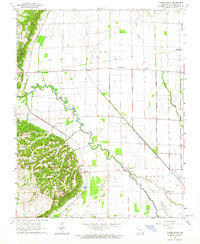
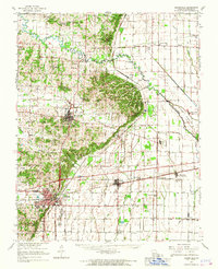
(28)- 1960 Map of Poplar Bluff
 1960 Poplar Bluff1960 Print · USGSSoutheast Missouri and Northeast Arkansas are captured here during the post-war era, showing the transition from the Ozark highlands to the Delta. Genealogists and historians can trace rail corridors like the St. Louis Southwestern RR and remote settlements such as Birch Tree and Warm Springs.
 - 1960 Map of Rolla
 1960 Rolla1960 Print · USGSThe Ozark Highlands in the mid-twentieth century reveal a landscape of deep timber and heavy industry. Researchers can trace the rail-and-mine economy through the St Louis-San Francisco RR and the Iron Mountain Mine, alongside the growth of Fort Leonard Wood.
 - 1961 Map of Paducah
 1961 Paducah1961 Print · USGSThe Lower Ohio Valley at mid-century is a landscape defined by its great rivers and newly formed reservoirs. Researchers can trace the riverfronts of Paducah and Metropolis, or locate smaller settlements like Old Shawneetown and Cave in Rock along the banks.2 unique versions available
 - 1962 Map of Fisk, 1963 Print
 1962 Fisk1963 Print · USGSFisk and the surrounding river bottomlands are captured here in the early sixties, as the local economy relied on the railroad and a vast network of drainage canals. Researchers can trace the Missouri Pacific rail corridor through Ash Hill and Ives, or locate rural landmarks like Owens Cem and Hobbe Chapel.2 unique versions available
 - 1962 Map of Puxico, 1963 Print
 1962 Puxico1963 Print · USGSThe southeast Missouri lowlands and the edge of the Ozarks are captured here during the early sixties, showing a landscape defined by drainage engineering and wildlife conservation. Genealogists and historians can trace family locations near Puxico, Asherville, and rural gathering places like Egypt Church or Gravel Hill Cemetery.3 unique versions available
 - 1962 Map of Dudley, 1963 Print
 1962 Dudley1963 Print · USGSIn the Missouri Bootheel during the early sixties, the town of Dudley was a vital rail stop surrounded by a complex system of managed waterways. Genealogists can locate family landmarks like Smith Cem, Old Bethel Ch, and the small settlement of Aid.2 unique versions available
 - 1962 Map of Acorn Ridge, 1963 Print
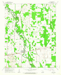
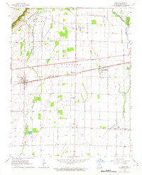
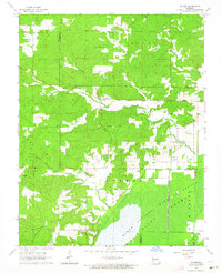
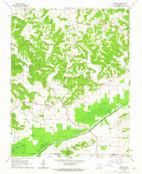
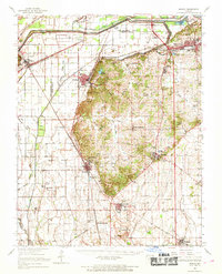
 1962 Acorn Ridge1963 Print · USGSStoddard County in the early 1960s shows a landscape of reclaimed swampland and rural farming communities. Genealogists can trace family landmarks like Elliot Cem and West Mt Pleasant Ch near the historic settlements of Acorn Ridge and Leora.2 unique versions available
 - 1963 Map of Clines Island, 1964 Print
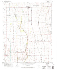
 1963 Clines Island1964 Print · USGSSoutheast Missouri farming life is captured here in the early sixties, as the St Louis Southwestern Railroad served a network of rural hamlets. Genealogists can locate family landmarks like Palmer Cem, Garden Ridge Ch, and the site of Beech Grove Sch.
 - 1963 Map of Essex, 1964 Print
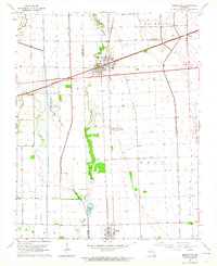
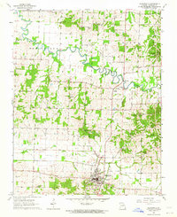
 1963 Essex1964 Print · USGSStoddard County's agricultural heartland is captured in the early sixties, as rail lines converged on the shipping hubs of Essex and Grayridge. Researchers can locate vanished rural landmarks like South Richland Sch, Taylor Ch Cem, and the tracks of the Missouri Pacific.
 - 1963 Map of Vanduser, 1964 Print
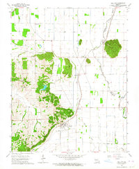
 1963 Vanduser1964 Print · USGSIn the Missouri Bootheel during the early 1960s, the landscape around Vanduser was defined by its rail-line settlements and complex drainage works. Researchers can trace family roots at Carpenter Cem and explore the rail corridor through Crowder and Tanner.2 unique versions available
 - 1963 Map of Advance, 1964 Print
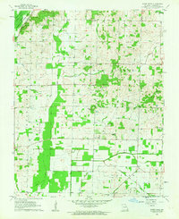
 1963 Advance1964 Print · USGSStoddard County in the early 1960s shows a landscape of rail-connected towns and drainage engineering. You can trace family history through sites like St Joseph Cem and Pleasant Grove Ch or follow the St Louis - San Francisco line through Brownwood.
 - 1963 Map of McGee, 1964 Print
 1963 McGee1964 Print · USGSIn the early 1960s, the McGee area of Wayne County was a landscape of small rural congregations and remote cemeteries. Researchers can trace family history through sites like Mt Pleasant Cem, Wilfong Cem, and the McGee Sch.2 unique versions available
 - 1963 Map of Morehouse, 1964 Print
 1963 Morehouse1964 Print · USGSThe Missouri Bootheel's rail and river landscape comes into focus during the early sixties, showing a region defined by agricultural drainage and competing rail lines. Trace the development of Morehouse and Canalou, or locate rural landmarks like New Bethel Ch and the Castor River.2 unique versions available
 - 1963 Map of Whitewater, 1964 Print
 1963 Whitewater1964 Print · USGSWhitewater and the surrounding river bottoms are captured here in the early sixties as massive hydrologic projects reshaped the land. Genealogists can trace family roots through locations like Passover Ch, Frazier Cem, and the rural School No R 5.2 unique versions available
 - 1963 Map of Sturdivant, 1964 Print
 1963 Sturdivant1964 Print · USGSBollinger County and the edge of the Mingo wetlands are captured here in the early sixties as a landscape of river sloughs and quiet rail stops. Researchers can trace family history through sites like Sturdivant Cem, Kinder Chapel, and the small settlement of Arab.2 unique versions available
 - 1963 Map of Oran, 1964 Print
 1963 Oran1964 Print · USGSOran and the surrounding Missouri lowlands appear in this early 1960s survey at the meeting of the ridge and the rail. Genealogists can trace family sites at Guardian Angel Cemetery and New Home Church or locate the intersection at Brooks Junction.
 - 1963 Map of Dongola, 1964 Print
 1963 Dongola1964 Print · USGSSoutheast Missouri in the early sixties reveals a landscape of upland ridges and managed wetlands along the Bollinger and Stoddard county line. Genealogists and researchers can locate old rural landmarks like New Sylvan Ch, Kellion Cem, and the village of Dongola.2 unique versions available
 - 1963 Map of Bloomfield, 1964 Print
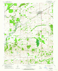
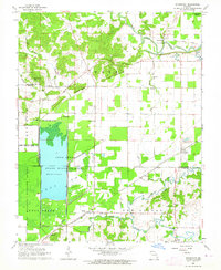
 1963 Bloomfield1964 Print · USGSBloomfield and the surrounding Missouri lowlands appear here in the early sixties as a landscape of rural cemeteries, country churches, and evolving drainage systems. Researchers can trace the path of the Old Railroad Grade and locate family sites like Walker Cem or the Philadelphia Ch.3 unique versions available
 - 1963 Map of Dexter, 1964 Print
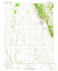
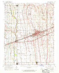
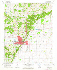 1963 Dexter1964 Print · USGSThe town of Dexter was a bustling rail and regional hub in the early 1960s. Genealogists and local historians can trace family sites from Gilead Hills Ch to Sadlers Cem and the Dexter Municipal Airport.3 unique versions available
 - 1963 Map of Bell City, 1964 Print
 1963 Bell City1964 Print · USGSSoutheast Missouri’s bottomlands and rail corridors are captured here in the early 1960s, showing a landscape shaped by drainage and topography. Researchers can trace the St Louis Southwestern railroad through Bell City or locate rural sites like Troth Cem and Bird Hill.2 unique versions available
 - 1963 Map of Bloomfield, 1967 Print
 1963 Bloomfield1967 Print · USGSStoddard County in the early sixties showcases the managed landscapes of the Missouri Bootheel as the area transitioned into an agricultural powerhouse. Genealogists and historians can trace family locations near Dexter, identify rural landmarks like St Joe Ch, or locate the St Louis Southwestern Railroad tracks.
 - 1963 Map of Morley, 1968 Print
 1963 Morley1968 Print · USGSScott County in the early 1960s was a landscape defined by industrial rail lines and significant drainage works like the Headwater Diversion Channel. Researchers can trace rural family roots at Guardian Angel Ch or locate mid-century landmarks like the Cape Girardeau Municipal Airport and Marquette Lakes.
 - 1963 Map of Sikeston, 1968 Print
 1963 Sikeston1968 Print · USGSSikeston and the surrounding Missouri lowlands are captured here in the mid-sixties, showcasing a landscape shaped by drainage engineering and railroads. Researchers can trace family sites at Silent Hill Cem, find the Pharris Ridge Sch, or locate the old Drive-in Theater.
 - 1964 Map of Paducah
 1964 Paducah1964 Print · USGSThe river-and-rail corridor of Southern Illinois and Western Kentucky is captured here during the height of the mid-century industrial era. Genealogists and researchers can trace local landmarks across several counties, from the rail yards of Paducah to the waters of Crab Orchard Lake and Kentucky Reservoir.2 unique versions available
 - 1966 Map of Rolla
 1966 Rolla1966 Print · USGSThe Missouri Ozarks are revealed here in the mid-1960s, showing the intersection of heavy industry and sprawling national forests. Trace the development of the Lead Belt near Flat River or locate family roots in vanished hamlets like Enough and Howes Mill.
Showing maps 1-25 of 28
Top cities of Stoddard County
- Dexter historical maps
- Bloomfield historical maps
- Bernie historical maps
- Advance historical maps
- Puxico historical maps
- Essex historical maps
See more
Frequently asked questions
- What are the different types of historical maps available for Stoddard County?
- What is the oldest map of Stoddard County?
- Where can I purchase historical maps of Stoddard County for my home or office?
- Where can I download high-res historical maps of Stoddard County?
- Are there historical topographic maps available for Stoddard County?
- Is there historical aerial imagery available for Stoddard County?
- Where are historical maps of Stoddard County sourced from?