Old Maps of Washington County, Missouri for Metal Detecting
Plan your next treasure hunt with 152 historic maps of Washington County. Find old homesites, ghost towns, trails, and gathering spots that may be lost to time — perfect for identifying promising metal detecting locations.
- Locate forgotten sites: Uncover places like long-lost settlements, abandoned rail lines, or gathering spots.
- Plan better hunts: Use map overlays combined with LiDAR or satellite views to narrow in on historically rich areas.
- Made for detectorists: Thousands of hobbyists use these maps to discover relics, coins, and hidden history.
Use these historic maps to boost your research and find new opportunities beneath the surface of Washington County.
Washington County, MO maps
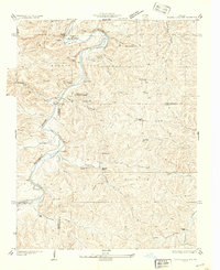
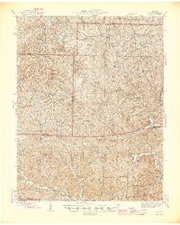
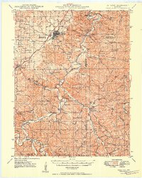
(152)- 1901 Map of De Soto
 1901 De Soto1901 Print · USGSJefferson and Franklin Counties at the turn of the century show a landscape defined by industrial milling and river fords. Genealogists can trace early homesteads near Hillsboro or industrial sites like Vulcan Mine and Byrnes Mill.5 unique versions available
 - 1903 Map of Sullivan
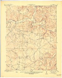
 1903 Sullivan1903 Print · USGSFranklin and Gasconade counties are captured here at the close of the nineteenth century, as the St. Louis and San Francisco railroad spurred growth in timber and mining. Genealogists can trace early homesteads and river crossings like Hughes Ford, Spring Bluff, and Anthonies Mill.3 unique versions available
 - 1905 Map of Bonneterre
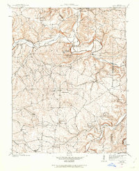
 1905 Bonneterre1905 Print · USGSEastern Missouri's Lead Belt comes into focus during its industrial peak at the turn of the century. Genealogists and rail historians can trace the intricate connections between Bonneterre, Desloge, and Bismarck along the Mississippi River and Bonneterre RR.3 unique versions available
 - 1906 Map of Potosi
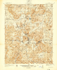
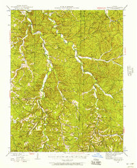
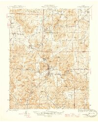
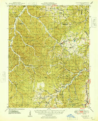
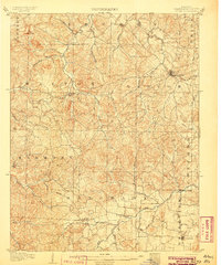 1906 Potosi1906 Print · USGSWashington County at the start of the century shows a landscape of Ozark creek bottoms and rail-connected towns. Genealogists and historians can trace old homesteads and landmarks near Potosi, Hunters Mill, and the community of Caledonia.3 unique versions available
 - 1924 Map of Edgehill, 1962 Print
 1924 Edgehill1962 Print · USGSThe Missouri Ozarks are captured here during the mid-1920s, showing a landscape of remote mountain settlements and small valley farms. Local historians can trace early rural life through landmarks like Maxwells Mill, the Mountainville Store, and the Beulah Land Church.
 - 1926 Map of Edgehill
 1926 Edgehill1926 Print · USGSThe Missouri Ozarks are captured here in the mid-1920s, showing a landscape of remote mountain schools and water-driven industry. Local historians can trace the foundations of Edgehill and Monterey, or locate early landmarks like Maxwells Mill and Council Bluff Church.3 unique versions available
 - 1934 Map of Meramec State Park, 1962 Print
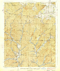
 1934 Meramec State Park1962 Print · USGSThe Meramec River valley in the mid-1930s reveals a region transitioning from isolated settlements to a destination for early 20th-century tourism. Genealogists and historians can trace defunct school districts like Pea Ridge Sch and Zion Sch, locate the CCC Camp, or find old river crossings at Hamilton Ford.2 unique versions available
 - 1937 Map of Fletcher
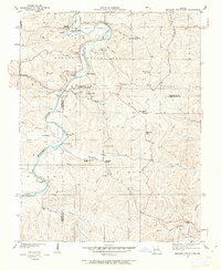
 1937 Fletcher1937 Print · USGSJefferson and Washington counties in the 1930s were defined by the deep loops of the river and scattered rural settlements. Researchers can trace the location of family-named landmarks like McCain Cem, the community at Fletcher, and local schools such as Mammoth Sch.2 unique versions available
 - 1937 Map of Ironton
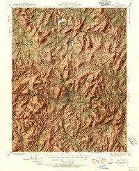
 1937 Ironton1937 Print · USGSThe Arcadia Valley in the late 1930s is documented here during a period of established mining and rail activity. Researchers can trace family roots at Rebel Cem and Algire Cem, or locate rural landmarks like King Sch and the Devils Toll Gate.
 - 1937 Map of Meramec State Park
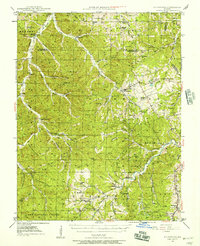
 1937 Meramec State Park1937 Print · USGSThe Missouri Ozarks are captured here in the mid-1930s, showing the early infrastructure of Meramec State Park and its surrounding river communities. Genealogists and hikers can trace old homesteads and local landmarks like Reedville Ch, the CCC Camp, and the historic Sappington Bridge river crossing.
 - 1937 Map of Tiff, 1962 Print
 1937 Tiff1962 Print · USGSThe Missouri Ozarks are captured here in the late 1930s, showing a landscape of small mining outposts and river-valley settlements. Genealogists and historians can trace the foundations of Tiff, locate the Thunderbolt C C C Camp, and find rural landmarks like Cruise Mill.
 - 1938 Map of Fletcher
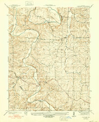
 1938 Fletcher1938 Print · USGSThe Big River loops through Jefferson County in the late 1930s, showing a landscape of small river towns and family farmsteads. Genealogists can trace local roots at McCain Cem, Maness Sch, and the settlements of Fletcher and Frumet.
 - 1939 Map of Tiff
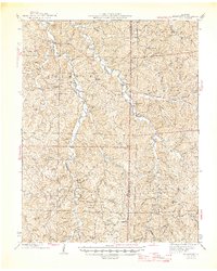
 1939 Tiff1939 Print · USGSWashington County at the end of the Depression era shows a landscape of river-valley settlements and rural industry. Family researchers can locate the Cannon Mines, Cruise Mill, and early burial grounds like Masonic Cem and Pinson Cem.2 unique versions available
 - 1943 Map of Berryman, 1957 Print
 1943 Berryman1957 Print · USGSCrawford and Washington counties are shown during the mid-twentieth century, capturing the rural character of the Clark National Forest. Genealogists can trace family names at the Cherry Valley Mines, Ozark Gospel Center, and various burial sites like Triswell Cem.4 unique versions available
 - 1943 Map of Boss, 1963 Print
 1943 Boss1963 Print · USGSThe Ozark highlands of the early 1940s are revealed here through a network of small family settlements and mountain schools. Genealogists can trace family footprints at Old Mill Lodge, Moses Store, or rural burial sites like Abbott Cem.2 unique versions available
 - 1945 Map of Berryman
 1945 Berryman1945 Print · USGSIn the mid-1940s, this section of the Missouri Ozarks remained a landscape of timbered hollows and fire lookouts. Researchers can trace rural lineages through numerous community landmarks like Gibbs Cem, Czar Ch, and the remote settlement at Quaker.2 unique versions available
 - 1945 Map of Ironton, 1955 Print
 1945 Ironton1955 Print · USGSThe Arcadia Valley and the iron mining district of the St. Francois Mountains are captured here in the mid-1940s. Trace the path of the Missouri Pacific railroad through Pilot Knob and Ironton, or locate family sites like Schwab Cem and Flatwoods Sch.6 unique versions available
 - 1946 Map of Boss
 1946 Boss1946 Print · USGSThe Missouri Ozarks are captured here just after the war, showing the deep hollows and timberlands of the eastern Courtois Hills. Genealogists and researchers can locate family landmarks like Moses Store, the Webb Cem, and numerous rural schoolhouses such as Barton Sch.2 unique versions available
 - 1946 Map of Ironton
 1946 Ironton1946 Print · USGSThe Arcadia Valley and the high peaks of the St. Francois Mountains are captured here in the post-war era. Researchers can trace the Missouri Pacific rail line through historic Ironton or locate family sites like Rebel Cem and Hogan Sch.2 unique versions available
 - 1946 Map of Richwoods, 1957 Print
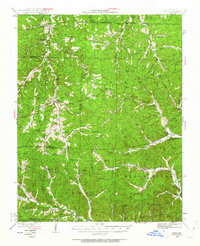
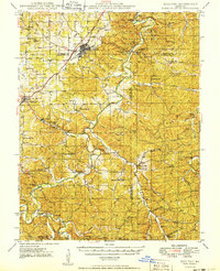
 1946 Richwoods1957 Print · USGSThe Missouri Ozarks are captured here at the end of the Second World War, showing the rural communities of Washington County. Genealogists can locate family-named landmarks and institutions like Old Mines, Souls Chapel, and the Ebo Sch schoolhouse.3 unique versions available
 - 1947 Map of Sullivan
 1947 Sullivan1947 Print · USGSIn the Missouri Ozarks during the late 1940s, this area shows the growth of river tourism and the railroad corridor. You can trace family roots through numerous local landmarks like Anthonies Mill, Pea Ridge Sch, and Reeds Defeat Cem.3 unique versions available
 - 1948 Map of Richwoods
 1948 Richwoods1948 Print · USGSIn the mid-1940s, this area of Washington County remained a landscape of rural schoolhouses and family-named hollows. Researchers can trace the layout of early communities like Richwoods, locate the historic Souls Chapel, or find remote school sites such as Hulsey Sch and Clifton Sch.
 - 1949 Map of Saint Louis
 1949 Saint Louis1949 Print · USGSGreater St. Louis and its surrounding river valleys are captured here just after the war, showing the metropolitan core and the rural Ozark fringe. Researchers can trace the sprawling rail network of the Wabash RR or locate landmarks like Meramec Caverns Airport and Scott Air Force Base.2 unique versions available
 - 1949 Map of Sullivan
 1949 Sullivan1949 Print · USGSSullivan and Bourbon emerge as key railroad towns in the northern Ozarks during this post-war era. Researchers can locate numerous vanished rural schools like Reeds Defeat Sch and explore the historic cave network including Onondaga Cave and Fisher Cave.
 - 1949 Map of Rolla, 1950 Print
 1949 Rolla1950 Print · USGSThe Missouri Ozarks are captured here just after the war, showing a landscape of deep river valleys and emerging reservoir projects. Genealogists and historians can trace the mining towns of Bonne Terre and Potosi or follow the early route of U.S. Highway 66.
Showing maps 1-25 of 152
Top cities of Washington County
- Potosi historical maps
- Irondale historical maps
- Mineral Point historical maps
- Caledonia historical maps
Frequently asked questions
- What are the different types of historical maps available for Washington County?
- What is the oldest map of Washington County?
- Where can I purchase historical maps of Washington County for my home or office?
- Where can I download high-res historical maps of Washington County?
- Are there historical topographic maps available for Washington County?
- Is there historical aerial imagery available for Washington County?
- Where are historical maps of Washington County sourced from?