Old Maps of Macon County, Missouri
Explore 41 old maps of Macon County, spanning from 1903 to today. These high-resolution historic maps reveal how streets, neighborhoods, landmarks, and natural features evolved over time — perfect for genealogy, metal detecting, research, and local history exploration.
What you can do with these maps:
- See how Macon County changed over time: Compare historical maps to modern-day views to trace roads, homesites, rail lines & more.
- View detailed metadata: Each map includes creators, publishers, year, scale, and archive source.
- Overlay maps with satellite & LiDAR: Visualize the past alongside modern tools to explore terrain & human change.
- Trusted historical sources: Maps sourced from the USGS, Library of Congress, and other archives.
- Access maps your way: View online, download high-res files, or order prints for personal or research use.
Start exploring old maps of Macon County to uncover forgotten places, hidden landmarks, and the deep history beneath your feet.
Macon County, MO maps
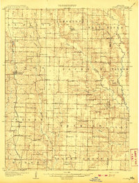
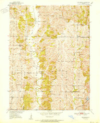
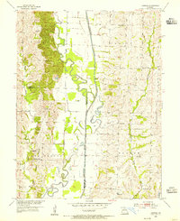
(41)- 1903 Map of Edina
 1903 Edina1903 Print · USGSCovers Macon County, including Memphis, La Plata, and other nearby areas2 unique versions available
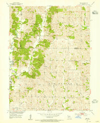
 - 1908 Map of Atlanta
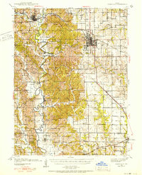
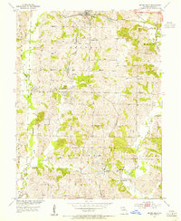
 1908 Atlanta1908 Print · USGSCovers Macon County, including Macon, Clarence, and other nearby areas2 unique versions available
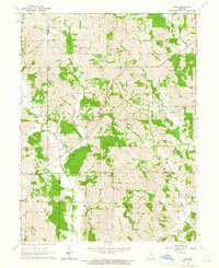
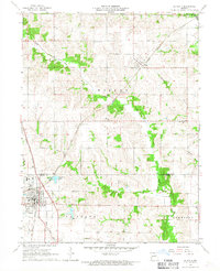
 - 1908 Map of Macon, 1965 Print
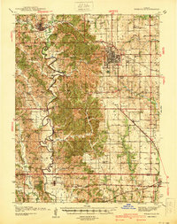
 1908 Macon1965 Print · USGSCovers Macon County, including Macon, Clarence, and other nearby areas
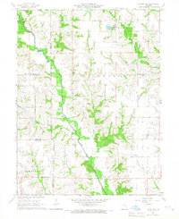
 - 1910 Map of Macon
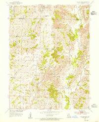
 1910 Macon1910 Print · USGSCovers Macon County, including Macon, Clarence, and other nearby areas
 - 1937 Map of Elmer
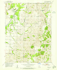
 1937 Elmer1937 Print · USGSCovers Macon County, including Macon, Bevier, and other nearby areas
 - 1938 Map of Kirksville
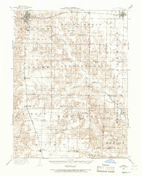
 1938 Kirksville1938 Print · USGSCovers Macon County, including Kirksville, La Plata, and other nearby areas2 unique versions available
 - 1940 Map of Kirksville
 1940 Kirksville1940 Print · USGSCovers Macon County, including Kirksville, La Plata, and other nearby areas
 - 1942 Map of Elmer
 1942 Elmer1942 Print · USGSCovers Macon County, including Macon, Bevier, and other nearby areas3 unique versions available
 - 1950 Map of New Cambria West
 1950 New Cambria West1950 Print · USGSCovers Macon County, including Bucklin, New Cambria, and other nearby areas2 unique versions available
 - 1951 Map of New Boston
 1951 New Boston1951 Print · USGSCovers Macon County, including Benson, New Boston, and other nearby areas2 unique versions available
 - 1953 Map of Moberly
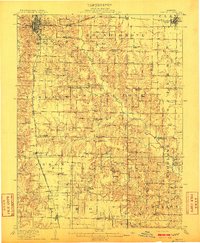
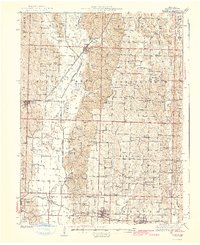
 1953 Moberly1953 Print · USGSCovers Macon County, including Columbia, Moberly, and other nearby areas
 - 1953 Map of Bevier South, 1955 Print
 1953 Bevier South1955 Print · USGSCovers Macon County, including Macon, Bevier, and other nearby areas2 unique versions available
 - 1953 Map of College Mound, 1955 Print
 1953 College Mound1955 Print · USGSCovers Macon County, including Darksville, College Mound, and other nearby areas2 unique versions available
 - 1953 Map of Prairie Hill, 1955 Print
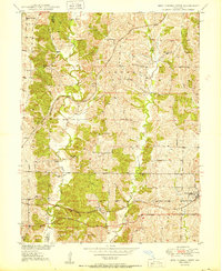
 1953 Prairie Hill1955 Print · USGSCovers Macon County, including Thomas Hill, Hubbard, and other nearby areas2 unique versions available
 - 1953 Map of Lagonda, 1955 Print
 1953 Lagonda1955 Print · USGSCovers Macon County, including Lagonda, Barryville, and other nearby areas2 unique versions available
 - 1953 Map of Wien, 1955 Print
 1953 Wien1955 Print · USGSCovers Macon County, including Heuer, Wien, and other nearby areas2 unique versions available
 - 1954 Map of Centerville, 1967 Print
 1954 Centerville1967 Print · USGSCovers Macon County, including Ottumwa, Kirksville, and other nearby areas3 unique versions available
 - 1954 Map of Moberly, 1969 Print
 1954 Moberly1969 Print · USGSCovers Macon County, including Columbia, Moberly, and other nearby areas3 unique versions available
 - 1957 Map of Moberly
 1957 Moberly1957 Print · USGSCovers Macon County, including Columbia, Moberly, and other nearby areas
 - 1957 Map of Centerville
 1957 Centerville1957 Print · USGSCovers Macon County, including Ottumwa, Kirksville, and other nearby areas
 - 1958 Map of Centerville
 1958 Centerville1958 Print · USGSCovers Macon County, including Ottumwa, Kirksville, and other nearby areas
 - 1960 Map of Moberly
 1960 Moberly1960 Print · USGSCovers Macon County, including Columbia, Moberly, and other nearby areas
 - 1963 Map of Nind, 1965 Print
 1963 Nind1965 Print · USGSCovers Macon County, including Loeffler, Nind, and other nearby areas
 - 1965 Map of Locust Hill, 1967 Print
 1965 Locust Hill1967 Print · USGSCovers Macon County, including Locust Hill, Adair County, and other nearby areas
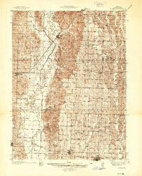
 - 1966 Map of La Plata, 1967 Print
 1966 La Plata1967 Print · USGSCovers Macon County, including La Plata, Gibbs, and other nearby areas
Showing maps 1-25 of 41
Top cities of Macon County
- Macon historical maps
- La Plata historical maps
- Bevier historical maps
- Callao historical maps
- New Cambria historical maps
- Ethel historical maps
See more
Frequently asked questions
- What are the different types of historical maps available for Macon County?
- What is the oldest map of Macon County?
- Where can I purchase historical maps of Macon County for my home or office?
- Where can I download high-res historical maps of Macon County?
- Are there historical topographic maps available for Macon County?
- Is there historical aerial imagery available for Macon County?
- Where are historical maps of Macon County sourced from?