Old Maps of Beaverhead County, Montana for Genealogy
Trace your family roots with 1,001 historic maps of Beaverhead County. These high-res maps reveal old neighborhoods, homesites, landmarks, and streets — helping you uncover where your ancestors lived and how the area evolved over time.
- Explore historic neighborhoods: Identify where your relatives may have lived in the 1800s or 1900s.
- Compare maps over time: Trace the changes in streets, buildings, and landmarks for multi-generational research.
- Perfect for genealogy & ancestry research: Used by family historians and researchers to map out lineage and migration.
These maps are an incredible resource for exploring your personal connection to Beaverhead County's past.
Beaverhead County, MT maps
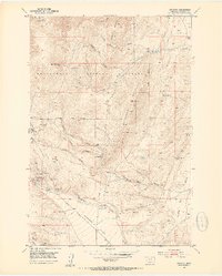
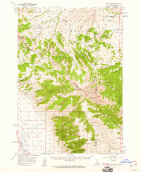
(1,001)- 1893 Map of Dillon
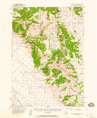
 1893 Dillon1893 Print · USGSSouthwestern Montana’s mountain ranges and river basins were being reshaped by the mining and rail boom in the late nineteenth century. Genealogists and historians can trace the early layout of Dillon and vanished camps like Hecla, Rochester, and Argenta.5 unique versions available
 - 1950 Map of Lower Red Rock Lake, 1954 Print
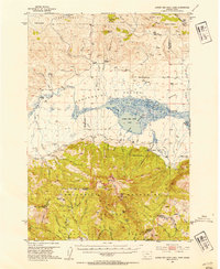 1950 Lower Red Rock Lake1954 Print · USGSThe high Centennial Valley comes to life in the early fifties, where ranching and conservation meet along the Continental Divide. Genealogists and historians can trace family locations like the Goble Ranch, the Doyle School, and the remote Landon Camp.5 unique versions available
 - 1950 Map of Monument Ridge, 1954 Print
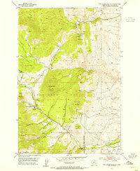
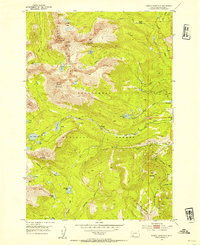
 1950 Monument Ridge1954 Print · USGSThe high basins of the Madison and Beaverhead counties border come alive in the mid-1950s, showing a landscape of forest service stations and seasonal camps. Genealogists and historians can locate remote outposts like Three Forks Cow Camp and the Black Butte Ranger Station or trace the early Standard Creek Road.4 unique versions available
 - 1950 Map of Upper Red Rock Lake, 1954 Print
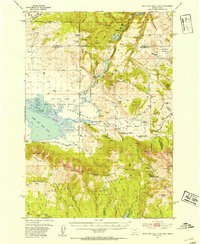 1950 Upper Red Rock Lake1954 Print · USGSThe Centennial Valley and the Continental Divide are documented here in the early fifties, featuring the expansive Upper Red Rock Lake. Researchers can trace old family holdings like the Hanson Ranch and Cook Sheep Ranch or locate the Selby Resort and early forest campgrounds.3 unique versions available
 - 1952 Map of Twin Adams Mountain, 1954 Print
 1952 Twin Adams Mountain1954 Print · USGSBeaverhead National Forest in the early fifties shows a mountain landscape shaped by mining and water management. Researchers can trace historic extraction sites like the Greenstone Mine and Indian Queen Mine or locate the Birch Creek Ranger Station.3 unique versions available
 - 1952 Map of Argenta, 1954 Print
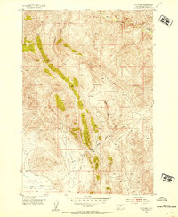
 1952 Argenta1954 Print · USGSThe mining district around Argenta is captured here in the early fifties, showing a landscape defined by silver and lead claims. You can trace the Site of Saltman Smelter or locate historic family landmarks like the Argenta Cemetery and Fabac Ranch.6 unique versions available
 - 1952 Map of Bannack, 1954 Print
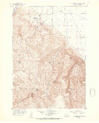
 1952 Bannack1954 Print · USGSBannack served as the first territorial capital of Montana, and by the early fifties, it remained a landscape defined by its mining roots. Researchers can trace historic claims like the Hope Placer Mine and find landmarks such as Road Agents Rock and the town Cemetery.6 unique versions available
 - 1952 Map of Burns Mountain, 1954 Print
 1952 Burns Mountain1954 Print · USGSHigh-country ranching life in Beaverhead County comes to life in this mid-century survey. Genealogists and historians can locate specific family holdings like Tenmile House, John Shaffner Ranch, and the isolated Christensen Ranch.4 unique versions available
 - 1952 Map of Torrey Mountain, 1954 Print
 1952 Torrey Mountain1954 Print · USGSBeaverhead County’s high alpine backcountry is captured here in the early fifties, showing a remote landscape of glacial lakes and peaks. Researchers can trace historic mountain activity through labels like Winkley Camp, the Mast Ditch, and a solitary Mine near the timberline.5 unique versions available
 - 1952 Map of Eli Spring, 1954 Print
 1952 Eli Spring1954 Print · USGSBeaverhead County is shown in the early fifties as a landscape of isolated homesteads and high-elevation mining. Genealogists and historians can locate family landmarks like Frenchie Place and the industrial activity at the Strip Mine or Eli Spring.4 unique versions available
 - 1952 Map of Dalys, 1954 Print
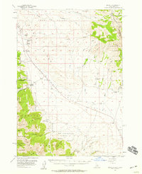
 1952 Dalys1954 Print · USGSBeaverhead County ranching and rail operations are captured here during the early 1950s. Trace the paths of the Union Pacific and family-named landmarks like Mooney Ranch, the settlement of Grayling, and the Dalys Quarry.4 unique versions available
 - 1952 Map of Gallagher Mountain, 1954 Print
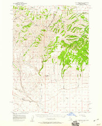
 1952 Gallagher Mountain1954 Print · USGSBeaverhead County ranching life is well-documented in this early 1950s survey of the high mountain drainages. Researchers can locate specific family lands such as the Crampton Ranch and Conover Ranch or trace the Union Pacific Railroad corridor.2 unique versions available
 - 1952 Map of Ermont, 1954 Print
 1952 Ermont1954 Print · USGSBeaverhead County was a center of mineral activity in the early 1950s, where active claims shared the landscape with established ranch lands. Researchers can trace historic operations at the Yellow Band Mine, the Ermont Mill, and the Coke Kiln.5 unique versions available
 - 1955 Map of Dubois
 1955 Dubois1955 Print · USGSThe high desert and mountain passes of eastern Idaho and western Montana are captured here during the mid-fifties. Researchers can trace the Union Pacific rail line through Dubois or locate the National Reactor Testing Station.4 unique versions available
 - 1955 Map of Ashton, 1967 Print
 1955 Ashton1967 Print · USGSThe Greater Yellowstone ecosystem is captured here during the mid-1950s, showing the high plateaus and remote gateway towns of Idaho and Montana. Researchers can trace the Union Pacific line to Ashton or locate small settlements like Squirrel and Grainville.4 unique versions available
 - 1955 Map of Dillon, 1978 Print
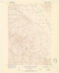
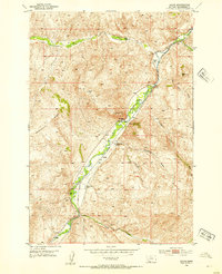
 1955 Dillon1978 Print · USGSSouthwest Montana at the dawn of the interstate era reveals a landscape of high-mountain ranching and historic mining camps. Trace the routes of the Union Pacific through Dillon and Armstead, or locate early settlements like Bannack and Wisdom.2 unique versions available
 - 1956 Map of Morrison Lake, 1958 Print
 1956 Morrison Lake1958 Print · USGSThe high Lemhi Valley and the Bitterroot Range come into focus during the mid-fifties, mapping the remote border between Idaho and Montana. Researchers can trace early mountain access via the Continental Divide Trail and locate sites like Gilmore and the Shaft near the headwaters of Medicine Lodge Creek.3 unique versions available
 - 1956 Map of Nicholia, 1959 Print
 1956 Nicholia1959 Print · USGSIn the mid-1950s, the Lemhi Valley landscape preserved the physical remnants of earlier mining and transport. You can trace the Old RR Grade across the flats and locate historic points like Hahn (Site), the Nicholia settlement, and various kilns.3 unique versions available
 - 1956 Map of Goldstone Mtn, 1960 Print
 1956 Goldstone Mtn1960 Print · USGSThe Lemhi Valley and Continental Divide high country are captured here during the mid-fifties as mining and ranching shaped the Idaho-Montana border. Genealogists and researchers can trace local landmarks like the Sandy Creek School, the Goldstone Mine, and the settlement of Baker.2 unique versions available
 - 1957 Map of Dillon
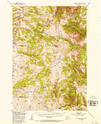
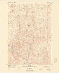
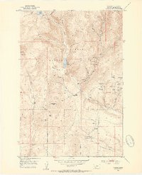
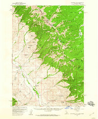
 1957 Dillon1957 Print · USGSSouthwest Montana and Idaho in the mid-fifties reveal a high-country landscape of mountain ranges and ranching valleys. Genealogists can trace family holdings and rail stops along the Union Pacific Railroad, from Dillon to historic Virginia City and Twin Bridges.
 - 1957 Map of Paul Reservoir, 1959 Print
 1957 Paul Reservoir1959 Print · USGSThe high peaks of the Beaverhead Mountains meet the Idaho-Montana border in the late fifties, showcasing a landscape defined by the Continental Divide. Researchers can trace remote ranching outposts like Gleed Cow Camp. and find local landmarks such as Paul Reservoir and the solitary Coal Mine.2 unique versions available
 - 1957 Map of Scott Peak, 1959 Print
 1957 Scott Peak1959 Print · USGSThe high Beaverhead Mountains along the Idaho-Montana border are shown here in the late fifties, featuring the dramatic Continental Divide. Researchers can locate the settlement of Nicholia, a local Cem, and old mining activity near Smelter Gulch.3 unique versions available
 - 1957 Map of Edie Ranch, 1959 Print
 1957 Edie Ranch1959 Print · USGSThe Idaho-Montana borderlands come alive in this mid-century survey of the high Divide. Researchers can trace the remote Edie Ranch and find mountain landmarks like Heart Mtn and the Warm Sprs. Ranger Sta.4 unique versions available
 - 1958 Map of Dubois
 1958 Dubois1958 Print · USGSThe high divide between Idaho and Montana comes alive in this mid-century survey, from the mining camps of the Lemhi Range to the ranchlands of Centennial Valley. Trace historic operations at the Copper Queen Mine, the route of the Union Pacific RR, and the scientific work at the Sheep experimental station.2 unique versions available
 - 1958 Map of Ashton
 1958 Ashton1958 Print · USGSGreater Yellowstone and the eastern Idaho borderlands appear here in the mid-1950s as rail and road networks connected remote mountain basins. Trace the Union Pacific route through Ashton or locate early outposts like Last Chance, Squirrel, and West Yellowstone.
Showing maps 1-25 of 1,001
Top cities of Beaverhead County
Frequently asked questions
- What are the different types of historical maps available for Beaverhead County?
- What is the oldest map of Beaverhead County?
- Where can I purchase historical maps of Beaverhead County for my home or office?
- Where can I download high-res historical maps of Beaverhead County?
- Are there historical topographic maps available for Beaverhead County?
- Is there historical aerial imagery available for Beaverhead County?
- Where are historical maps of Beaverhead County sourced from?