1990s Maps of Beaverhead County, Montana
Explore 102 historic maps of Beaverhead County from the 1990s. These maps offer a rare glimpse into what life looked like during the 1990s — showing old roads, neighborhoods, homes, and landmarks that have changed or disappeared over time.
Whether you're researching your family's past, planning a metal detecting trip, or studying how Beaverhead County's landscape evolved across the 1990s, these high-resolution maps are a powerful tool for exploring the history of this region.
- Focus on a specific era: All maps on this page are from the 1990s, giving you a focused view of this time period.
- See what’s changed: Compare century-old streets, trails, and buildings to today's modern landscape using overlays and satellite layers.
- Research with precision: Use these maps for genealogy, historical research, land use analysis, or educational projects.
- View, download, or print: Maps are fully viewable online in high resolution, and can be downloaded or printed for your own records.
Start exploring Beaverhead County's history through authentic maps from the 1990s. This is your window into the past.
Beaverhead County, MT maps
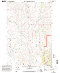
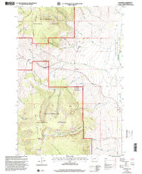
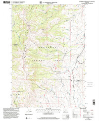
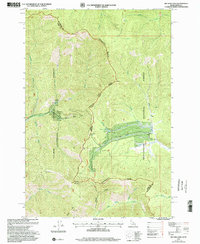
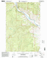
(102)- 1992 Map of Lima, 1993 Print
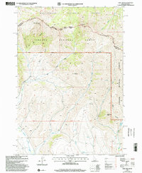
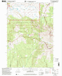
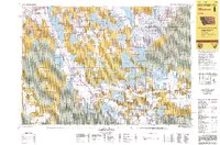 1992 Lima1993 Print · USGSThe high Divide country of Beaverhead County comes into focus in the early nineties, centered on the rail-and-ranching corridor through the Tendoy Mountains. Genealogists and historians can trace the Union Pacific line through Lima, Dell, and Monida, or locate the Silver Queen Mine and Kidd along the historic valley routes.
 - 1993 Map of Hebgen Lake
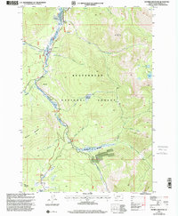
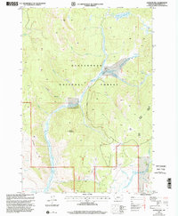
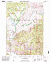
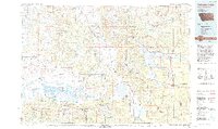 1993 Hebgen Lake1993 Print · USGSThe high mountain passes and vast river basins of the Montana-Idaho border come into focus in the early nineties. Genealogists and historians can trace the remote settlement of Lakeview and the development of West Yellowstone near the Red Rock Lakes National Wildlife Refuge.2 unique versions available
 - 1994 Map of Wisdom
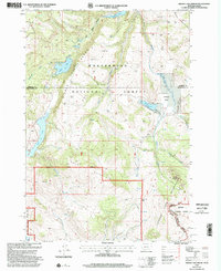
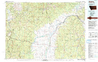 1994 Wisdom1994 Print · USGSThe high mountain valleys of Southwest Montana and East Idaho come alive in the mid-1990s as the Big Hole River meanders toward the Continental Divide. Trace the grounds of the Big Hole National Battlefield or locate remote settlements like Wisdom and Gibbonsville.2 unique versions available
 - 1997 Map of Maverick Mountain, 2001 Print
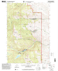
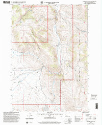
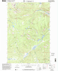
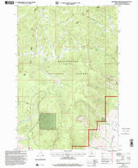 1997 Maverick Mountain2001 Print · USGSBeaverhead County during the late nineties captures a high-elevation landscape between the Big Hole and Grasshopper drainages. Outdoor enthusiasts and local historians can trace the development of the Maverick Mountain Ski Area or follow the paths of Grasshopper Creek and Old Tim Creek.
 - 1997 Map of Swamp Creek, 2001 Print
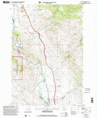
 1997 Swamp Creek2001 Print · USGSThe Montana high country of the late nineties is documented here, showing the intersection of wild forest and managed range. Trace topographic details near the Notch Guard Station, the high peaks of the Snowcrest Range, and the waters of Swamp Creek.
 - 1997 Map of Tash Peak, 2001 Print
 1997 Tash Peak2001 Print · USGSThe high timber and alpine basins of the Beaverhead National Forest are documented here in the late nineties. Genealogists and researchers can trace the drainages of Grasshopper Valley and locate landmarks like the Circle-S Ranch or Harrison Lake.
 - 1997 Map of Lower Miner Lakes, 2001 Print
 1997 Lower Miner Lakes2001 Print · USGSThe Beaverhead National Forest high country remains a wilderness of alpine waters and remote meadows during the late nineties. Researchers can trace the drainages of Miner Creek and Berry Creek, or locate high-altitude landmarks like Englejard Lake and Berry Meadows.
 - 1997 Map of Stewart Mountain, 2001 Print
 1997 Stewart Mountain2001 Print · USGSThe high country of the Beaverhead National Forest comes into sharp focus in this late-nineties survey of the Pioneer Mountains. Researchers can locate remote mining claims like the Maynard Mine and Arnold Mine or trace backcountry routes to Stewart Lake and the Steel Creek Guard Station.
 - 1997 Map of Stonehouse Mountain, 2001 Print
 1997 Stonehouse Mountain2001 Print · USGSThe high Snowcrest Range in the late nineties serves as a intersection for wilderness trails and high-country watersheds. Researchers can trace the boundary of Madison Co Beaverhead Co or locate remote sites like the Divide Creek Guard Station and Honeymoon Park.
 - 1997 Map of Maurice Mountain, 2001 Print
 1997 Maurice Mountain2001 Print · USGSThe Beaverhead mountains of Montana come into focus during the late nineties, showing a landscape defined by high peaks and forest management. Researchers can locate the Maurice Cem and trace the alpine drainage of the Pioneer River past Jacobson Meadows.
 - 1997 Map of Storm Peak, 2001 Print
 1997 Storm Peak2001 Print · USGSBeaverhead National Forest in the late 1990s shows a landscape defined by high-altitude mining and remote ranching. Trace early industrial footprints at the Open Pit Mine and Mine Shaft, or locate isolated homesteads like Grose Ranch and Spritzer Ranch.
 - 1997 Map of Melrose, 2002 Print
 1997 Melrose2002 Print · USGSThe high country surrounding Melrose in the late nineties was a landscape shaped by river irrigation and hard-rock mining. Genealogists and researchers can trace local landmarks like the Melrose Cem and historic workings at the Old Glory Mine or Maiden Rock Mine.
 - 1997 Map of Edie Creek, 2002 Print
 1997 Edie Creek2002 Print · USGSThe high-altitude border between Idaho and Montana comes into sharp focus during the late 1990s as it traverses the Continental Divide. Researchers can trace the rugged headwaters of Medicine Lodge Creek and the remote high-country terrain around Horse Mountain and Middle Creek Butte.
 - 1997 Map of Caboose Canyon, 2002 Print
 1997 Caboose Canyon2002 Print · USGSBeaverhead County during the late nineties shows a landscape of deep canyons and high forest service lands. Genealogists and researchers can trace the Peterson Ranch, remote mining Prospects, and essential water sources like Caboose Spring.
 - 1997 Map of Elkhorn Hot Springs, 2002 Print
 1997 Elkhorn Hot Springs2002 Print · USGSBeaverhead County’s high Pioneer Mountains are captured here in the late 1990s as a landscape of historic mining and modern recreation. Researchers can trace the layout of the Old Elkhorn Mine, the settlement at Coolidge, and the alpine waters of Sawtooth Lake.
 - 1997 Map of Goldstone Mountain, 2002 Print
 1997 Goldstone Mountain2002 Print · USGSThe Continental Divide serves as the high border between Idaho and Montana in the late nineties, where the Salmon and Beaverhead National Forests meet. Researchers can trace old mining efforts via a Mine Shaft and several Prospects, alongside historic routes like the Lewis and Clark Backcountry Byway.
 - 1997 Map of Big Hole Pass, 2002 Print
 1997 Big Hole Pass2002 Print · USGSThe Continental Divide serves as a natural boundary between Idaho and Montana in this late-nineties forest survey. Local history researchers can trace the ridgeline along Big Hole Pass and identify historic mining sites like those found at Nugget Creek or near Morgan Mountain.
 - 1997 Map of Jackson Hill, 2002 Print
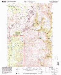
 1997 Jackson Hill2002 Print · USGSBeaverhead County terrain is detailed in the late nineties, documenting a landscape of high-altitude grazing and mining. Researchers can trace historic land use through the Clemow Cow Camp, Carney Mine, and the old Jardine Ditch.
 - 1997 Map of Butch Hill, 2002 Print
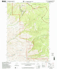
 1997 Butch Hill2002 Print · USGSBeaverhead County ranching and forestry are captured here in the late 1990s, where complex irrigation networks meet the national forest. Trace the history of high-country land use through family-named sites like Hairpin Ranch, Prines Cabin, and the Gloss Place.
 - 1997 Map of Warren Peak, 2002 Print
 1997 Warren Peak2002 Print · USGSThe Anaconda Pintler Wilderness during the late 1990s is captured here, centered on the high granite spine of the Continental Divide. Backcountry travelers and researchers can trace the Hi Line Trail past Warren Peak and explore the remote Pintler Meadows area.
 - 1997 Map of Mount Jefferson, 2002 Print
 1997 Mount Jefferson2002 Print · USGSThe Montana and Idaho borderlands come into focus in the late nineties, centered on the high-altitude Centennial Mountains. Researchers can trace the path of the Continental Divide Scenic Trail across peaks like Mount Jefferson and Nemesis Mountain.
 - 1997 Map of Lincoln Gulch, 2002 Print
 1997 Lincoln Gulch2002 Print · USGSThe high mountain ranches of Deer Lodge County remained active in the late nineties, positioned where the forest meets the valley floor. Genealogists and historians can locate legacy properties like Rousch Ranch or Johnson Ranch and trace drainages from Lincoln Gulch to the Big Hole River.
 - 1997 Map of Hidden Lake Bench, 2002 Print
 1997 Hidden Lake Bench2002 Print · USGSThe Montana-Idaho borderlands are captured here in the late nineties, showing the high-elevation terrain where the Continental Divide meets the Hidden Lake Bench. Researchers can locate the Orr Ranch and trace the alpine waters of Elk Lake and Cliff Lake.
 - 1997 Map of Odell Lake, 2002 Print
 1997 Odell Lake2002 Print · USGSBeaverhead County’s high basins are shown in the late nineties, showcasing a landscape of alpine lakes and mining history. Researchers can locate the Ibex Mine, trace the Pioneer Loop National Recreation Trail, and find remote outposts like Cow Camp.
 - 1997 Map of Dickie Hills, 2002 Print
 1997 Dickie Hills2002 Print · USGSBeaverhead County terrain is captured here in the late nineties, documenting the high-country landscape where the Big Hole River cuts through the Dickie Hills. Researchers can locate family landholdings like Dace Ranch and trace the paths of Alder Creek or the Pioneer Mountains Scenic Byway.
Showing maps 1-25 of 102
Top cities of Beaverhead County
Frequently asked questions
- What are the different types of historical maps available for Beaverhead County?
- What is the oldest map of Beaverhead County?
- Where can I purchase historical maps of Beaverhead County for my home or office?
- Where can I download high-res historical maps of Beaverhead County?
- Are there historical topographic maps available for Beaverhead County?
- Is there historical aerial imagery available for Beaverhead County?
- Where are historical maps of Beaverhead County sourced from?