1900s (20th Century) Maps of Big Horn County, Montana
Explore 167 historic maps of Big Horn County from the 1900s (20th Century). These maps offer a rare glimpse into what life looked like during the 1900s — showing old roads, neighborhoods, homes, and landmarks that have changed or disappeared over time.
Whether you're researching your family's past, planning a metal detecting trip, or studying how Big Horn County's landscape evolved across the 1900s, these high-resolution maps are a powerful tool for exploring the history of this region.
- Focus on a specific era: All maps on this page are from the 1900s, giving you a focused view of this time period.
- See what’s changed: Compare century-old streets, trails, and buildings to today's modern landscape using overlays and satellite layers.
- Research with precision: Use these maps for genealogy, historical research, land use analysis, or educational projects.
- View, download, or print: Maps are fully viewable online in high resolution, and can be downloaded or printed for your own records.
Start exploring Big Horn County's history through authentic maps from the 1900s. This is your window into the past.
Big Horn County, MT maps
(167)- 1901 Map of Rosebud
 1901 Rosebud1901 Print · USGSSouthern Montana ranching and rail life are documented here during the final decade of the nineteenth century. Genealogists and historians can trace early holdings like Yellow Weasel Ranch and Sand Hills Ranch along the Burlington and Missouri River R. R.4 unique versions available
 - 1901 Map of Dayton
 1901 Dayton1901 Print · USGSSheridan County and the Montana borderlands are captured here at the turn of the century as the railroad reshapes the valley. Researchers can trace early settlements and ranching outposts like Slack, Beckton, and the Morrow Ranch along the Tongue River.5 unique versions available
 - 1901 Map of St. Xavier
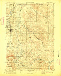
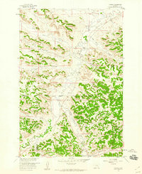
 1901 St. Xavier1901 Print · USGSBig Horn County at the turn of the century shows a frontier landscape shaped by military history and the early years of the Crow Reservation. Researchers can trace the path of the Old Bozeman Military Road past the Site of Old Fort C. F. Smith and the St. Xavier Mission.4 unique versions available
 - 1909 Map of Sheridan, 1954 Print
 1909 Sheridan1954 Print · USGSSheridan and the surrounding northern Wyoming ranchlands are captured here in the first decade of the twentieth century. Genealogists can trace family holdings at Wagoner Ranch or Big Red Ranch, and locate early rail stations like Verona and Ulm.2 unique versions available
 - 1911 Map of Sheridan
 1911 Sheridan1911 Print · USGSSheridan and the surrounding northern Wyoming ranchlands are captured here during a period of rapid railroad expansion. Researchers can trace the Chicago Burlington and Quincy RR through Dietz and Verona, or locate early homesteads like Wagoner Ranch.2 unique versions available
 - 1915 Map of Spenceville, 1947 Print
 1915 Spenceville1947 Print · USGSThe foothills of the Sierra Nevada are captured here in the early twentieth century as a landscape of large ranchos and winding river canyons. Genealogists and historians can trace the paths of Dry Creek and locate historical transit points like McCourtney Crossing and the Johnson Rancho.
 - 1954 Map of Billings, 1963 Print
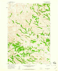
 1954 Billings1963 Print · USGSThe Yellowstone valley during the mid-fifties shows a landscape of thriving rail towns and high-mountain outposts. Genealogists and historians can trace old homesteads and mining routes near Red Lodge, Bearcreek, and along the Bighorn River.4 unique versions available
 - 1954 Map of Hardin, 1964 Print
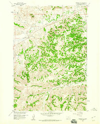
 1954 Hardin1964 Print · USGSSoutheastern Montana is documented here during the mid-fifties, showing the vast tribal lands and historic battle sites before modern highway expansion. Researchers can trace the Chicago Burlington and Quincy rail line through Hardin or locate the Custer National Cemetery and Museum.2 unique versions available
 - 1954 Map of Forsyth, 1966 Print
 1954 Forsyth1966 Print · USGSThe Yellowstone River valley and the northern high plains are captured here in the mid-1950s during a period of expanding energy and rail infrastructure. Genealogists and historians can trace rail sidings and cattle-country outposts like Ingomar, Vananda, and Angela.3 unique versions available
 - 1955 Map of Cody, 1969 Print
 1955 Cody1969 Print · USGSThe Bighorn Basin and Absaroka Range meet in the mid-fifties, capturing a landscape defined by mountain wilderness and burgeoning oil fields. Trace family roots in Cody or Meeteetse, and locate industrial landmarks like the Elk Basin Oil and Gas Field and the Chicago Burlington and Quincy RR.2 unique versions available
 - 1955 Map of Sheridan, 1973 Print
 1955 Sheridan1973 Print · USGSThe Bighorn Mountains meet the Powder River Basin in the 1950s, a period when cattle ranching and coal mining defined the regional economy. Genealogists and historians can trace local landmarks like the Fort Mackenzie Veteran Hospital, the Monarch Coal Mine, and legacy operations such as the Beckton Stock Farm.2 unique versions available
 - 1957 Map of Hardin
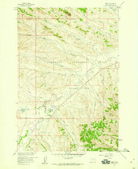
 1957 Hardin1957 Print · USGSSoutheastern Montana in the mid-fifties reveals a landscape shaped by tribal lands and the historic Bighorn river valleys. Researchers can trace the Chicago Burlington and Quincy RR through Hardin and locate the National Cemetery and Custer Battlefield Monument.
 - 1957 Map of Forsyth
 1957 Forsyth1957 Print · USGSSouth-central Montana in the late fifties is captured here through its dual-river geography and emergent energy economy. Researchers can trace the path of the Northern Pacific through Forsyth, locate the Ragged Point Oil Field, and find early sidings like Ahles Siding.
 - 1957 Map of Billings
 1957 Billings1957 Print · USGSThe Yellowstone River valley and the rugged Beartooth Mountains meet in the mid-1950s near the growing hub of Billings. Genealogists and researchers can trace rail and ranching history through river towns like Columbus, the mining heritage of Red Lodge, and the vast Crow Indian Reservation.
 - 1958 Map of Billings
 1958 Billings1958 Print · USGSMid-century Montana comes alive in this survey of the Yellowstone Valley as the regional rail and road networks reached their peak. Trace family roots and old routes near Billings, the Crow Indian Reservation, and the heights of the Beartooth Mountains.2 unique versions available
 - 1958 Map of Cody
 1958 Cody1958 Print · USGSNorthwestern Wyoming at the peak of the mid-century energy and ranching boom shows a land of high peaks and oil basins. Researchers can trace the Chicago Burlington and Quincy rail lines through Greybull or locate the sprawling Elk Basin Oil and Gas Field.
 - 1958 Map of Forsyth
 1958 Forsyth1958 Print · USGSMid-century Montana comes alive along the Yellowstone River and the competing transcontinental rail lines. Local historians can trace the legacy of the Northern Pacific through Forsyth or explore early oil developments at the Ragged Point Oil Field.
 - 1958 Map of Hardin
 1958 Hardin1958 Print · USGSSoutheastern Montana in the mid-fifties presents a landscape defined by significant tribal lands and national monuments. Researchers can trace the geography of the Little Bighorn at Custer Battlefield National Monument and locate settlements like Lame Deer and Birney.
 - 1958 Map of Sheridan
 1958 Sheridan1958 Print · USGSThe Bighorn Mountains meet the high plains in the mid-1950s, revealing a landscape of large-scale ranching and mineral extraction. Trace the legacy of early settlements and industry through the Kleenburn Coal Tipple, Beckton Stock Farm, and the Hidden Dome Oil & Gas Field.2 unique versions available
 - 1958 Map of Chalky Point, 1960 Print
 1958 Chalky Point1960 Print · USGSBig Horn and Rosebud counties are captured in the late fifties, dominated by the ridge-lines of the Little Wolf Mountains. Researchers can trace the Northern Cheyenne Indian Reservation Boundary and map old water sources like Williams Spring and Water Hole Creek.
 - 1958 Map of Painted Hill, 1960 Print
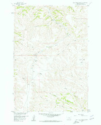
 1958 Painted Hill1960 Print · USGSBig Horn County's high-plateau drainages are meticulously detailed in the late fifties as ranching and water management shaped the land. Researchers can trace remote routes like the Jeep Trail system connecting Two Moon Reservoir, Muddy Springs, and Painted Hill.2 unique versions available
 - 1958 Map of Bull Creek Lookout, 1960 Print
 1958 Bull Creek Lookout1960 Print · USGSBig Horn County ranching and rugged drainages are captured here in the late fifties. Researchers can trace remote water sources and early access routes near Bull Creek Lookout, Brown Camp, and the distinctive Hardrobe Water Gap.2 unique versions available
 - 1958 Map of Jimtown, 1960 Print
 1958 Jimtown1960 Print · USGSThe Northern Cheyenne Indian Reservation boundary and the ranching country of Rosebud County are detailed here in the late fifties. Researchers can trace family sites like McKay Ranch, the settlement of Jimtown, and local landmarks including a Sawmill and Cem.2 unique versions available
 - 1958 Map of Black Spring, 1960 Print
 1958 Black Spring1960 Print · USGSSoutheastern Montana during the late fifties shows a landscape defined by the Northern Cheyenne Indian Reservation Boundary. Researchers can trace old routes and water sources like the Jeep Trails and Indian Coulee Spring.2 unique versions available
 - 1958 Map of Busby, 1960 Print
 1958 Busby1960 Print · USGSBig Horn County comes into focus during the late fifties, centered on the community of Busby within the Northern Cheyenne Indian Reservation. Genealogists and historians can locate the Busby Boarding Sch, the Historical Monument (Indian Chief Two Moons), and family sites near Rosebud Creek.3 unique versions available
Showing maps 1-25 of 167
Top cities of Big Horn County
- Hardin historical maps
- Busby District historical maps
- Pryor historical maps
- Lodge Grass historical maps
- Garryowen historical maps
Frequently asked questions
- What are the different types of historical maps available for Big Horn County?
- What is the oldest map of Big Horn County?
- Where can I purchase historical maps of Big Horn County for my home or office?
- Where can I download high-res historical maps of Big Horn County?
- Are there historical topographic maps available for Big Horn County?
- Is there historical aerial imagery available for Big Horn County?
- Where are historical maps of Big Horn County sourced from?