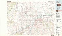
1970s Maps of Big Horn County, Montana
Explore 21 historic maps of Big Horn County from the 1970s. These maps offer a rare glimpse into what life looked like during the 1970s — showing old roads, neighborhoods, homes, and landmarks that have changed or disappeared over time.
Whether you're researching your family's past, planning a metal detecting trip, or studying how Big Horn County's landscape evolved across the 1970s, these high-resolution maps are a powerful tool for exploring the history of this region.
- Focus on a specific era: All maps on this page are from the 1970s, giving you a focused view of this time period.
- See what’s changed: Compare century-old streets, trails, and buildings to today's modern landscape using overlays and satellite layers.
- Research with precision: Use these maps for genealogy, historical research, land use analysis, or educational projects.
- View, download, or print: Maps are fully viewable online in high resolution, and can be downloaded or printed for your own records.
Start exploring Big Horn County's history through authentic maps from the 1970s. This is your window into the past.
Big Horn County, MT maps
(21)- 1970 Map of O T O Ranch, 1973 Print
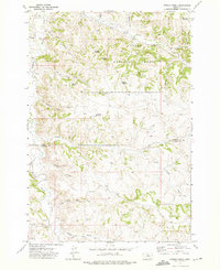
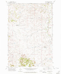
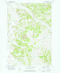
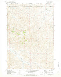 1970 O T O Ranch1973 Print · USGSThe Montana and Wyoming state line bisects this ranching landscape during the early 1970s, showing the high-country drainages of the Badger Hills. Researchers can trace the boundaries of the 77 Ranch and OTO Ranch near Spring Creek.2 unique versions available
 - 1970 Map of Cedar Canyon, 1973 Print
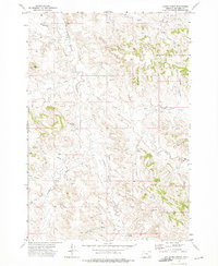
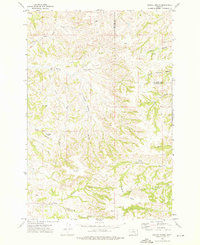
 1970 Cedar Canyon1973 Print · USGSThe high plains along the Montana-Wyoming border appear here in the early seventies, detailing a landscape defined by ranching and resource extraction. Researchers can locate remote landmarks like X Bar Ranch, trace the path of Cedar Canyon, or find early mineral exploration sites like the Drill Hole.
 - 1970 Map of Burgess Junction, 1979 Print
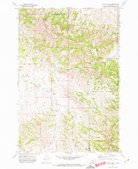
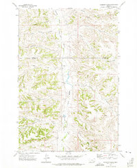
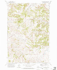
 1970 Burgess Junction1979 Print · USGSThe Bighorn Mountains meet the Tongue River valley in the late 1970s, showcasing a landscape of high-altitude forest and foothill settlements. Genealogists and historians can trace the rail towns of Monarch and Ranchester or locate old mountain landmarks like Steamboat Point and Burgess Junction.
 - 1971 Map of Roundup Draw, 1974 Print
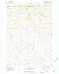
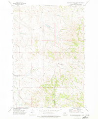
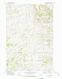
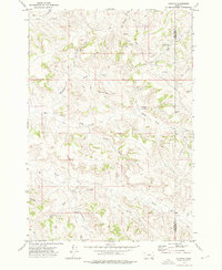
 1971 Roundup Draw1974 Print · USGSThe high plains along the Montana-Wyoming border appear here in the early 1970s, showcasing a remote ranching landscape defined by seasonal draws and ridges. Researchers can trace land use through features like Antelope Res and family-named landmarks such as David Tiner Draw and Weltner Prong.
 - 1971 Map of Sarpy School, 1974 Print
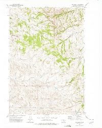
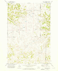
 1971 Sarpy School1974 Print · USGSBig Horn and Rosebud Counties meet in this Montana cattle country during the early seventies, where the Little Wolf Mountains rise above the plains. Researchers can locate the Sarpy School and trace the paths of Black Hank Creek and East Fork Sarpy Creek.
 - 1971 Map of Box Elder Draw, 1975 Print
 1971 Box Elder Draw1975 Print · USGSAlong the Montana and Wyoming border in the early seventies, this landscape reveals a complex network of seasonal ranching drainages. Genealogists and historians can trace family-named landmarks like Dooley Draw, Grenell Draw, and Seventysix Creek.2 unique versions available
 - 1972 Map of The Dugout, 1975 Print
 1972 The Dugout1975 Print · USGSBig Horn County rangeland in the early seventies shows the intersection of tribal lands and energy development. Researchers can trace the Crow Indian Reservation Boundary and locate isolated features like The Dugout and scattered Oil Wells.
 - 1972 Map of Stroud Creek, 1975 Print
 1972 Stroud Creek1975 Print · USGSHigh plains ranching and the northern edges of the Custer National Forest define this landscape in the early seventies. Researchers can trace remote homesteads like OW Ranch and named terrain such as Circle Bar Draw and Gloomy Glenn.2 unique versions available
 - 1972 Map of Hammond Ranch, 1975 Print
 1972 Hammond Ranch1975 Print · USGSBig Horn and Treasure counties in the early 1970s showcase a landscape of isolated Montana ranching and intricate prairie drainages. Genealogists and local historians can trace family land holdings near Hammond Ranch, Redding Ranch, and the perennial waters of Tullock Creek.
 - 1972 Map of Forks Ranch, 1975 Print
 1972 Forks Ranch1975 Print · USGSBig Horn County ranchlands in the 1970s are defined by the remote cattle operations and drainage networks of the Montana high plains. Researchers can trace the legacy of local land use through features like Forks Ranch, Old Corral, and Hellers Peak.
 - 1972 Map of Minnehaha Creek South, 1975 Print
 1972 Minnehaha Creek South1975 Print · USGSBig Sky ranching country at the Big Horn and Treasure county line is captured here in the early seventies. Trace family-named landmarks like Wilson Ranch and Hays Ranch alongside the rugged path of the Burlington Northern Road.
 - 1972 Map of Iron Spring, 1975 Print
 1972 Iron Spring1975 Print · USGSBig Horn and Treasure counties are captured here in the early seventies, showing a landscape of sprawling coulees and ranching infrastructure. Trace the Burlington Northern rail line along Sarpy Creek or locate landmarks like the Red Hills and Iron Spring.
 - 1972 Map of Padlock Ranch, 1975 Print
 1972 Padlock Ranch1975 Print · USGSBig Horn County ranching country is captured here in the early seventies, centered on the operations of Padlock Ranch. Researchers can trace the Crow Indian Reservation Boundary alongside landmarks like Dawes Spring and Red Hills Draw.
 - 1972 Map of Iron Spring SW, 1975 Print
 1972 Iron Spring SW1975 Print · USGSBig Horn County in the early seventies shows a landscape shaped by reservation boundaries and rural industry. Researchers can trace the Crow Indian Reservation Boundary and locate local landmarks like the Spring Creek School or Iron Spring.
 - 1972 Map of Hamilton Draw, 1976 Print
 1972 Hamilton Draw1976 Print · USGSSoutheastern Montana ranching country is documented here in the early seventies, spanning the borders of Rosebud, Big Horn, and Powder River counties. Researchers can locate remote water improvements and livestock infrastructure like Hamilton Draw Reservoir, Round Cow Reservoir, and Handley Spring.2 unique versions available
 - 1972 Map of Wolf School, 1976 Print
 1972 Wolf School1976 Print · USGSBig Horn and Treasure counties are captured in the early seventies during a period of industrial expansion. Researchers can trace the development of the Sarpy Creek Mine alongside local landmarks like the Wolf School and the Burlington Northern rail line.
 - 1972 Map of Quietus, 1976 Print
 1972 Quietus1976 Print · USGSBig Horn and Powder River counties are shown here in the early 1970s, characterized by a sparse ranching and mineral exploration landscape. You can trace family-named landmarks and remote sites like 76 Camp, The Pyramid, and the namesake settlement of Quietus.
 - 1972 Map of Dudley Spring, 1976 Print
 1972 Dudley Spring1976 Print · USGSThe Big Horn County ranchlands are captured here in the early 1970s, showing a landscape defined by seasonal coulees and deep-set springs. Researchers can locate the Old Ford Place and trace water features like the Flowing Well (Hot) and Dudley Spring.
 - 1979 Map of Sheridan
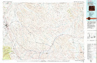 1979 Sheridan1979 Print · USGSSheridan and the surrounding ranching country are captured in the late seventies as the region balanced its frontier heritage with new energy development. Researchers can trace the path of the Burlington Northern railroad and locate historic landmarks like Massacre Hill and Lodge Trail Ridge.
 - 1979 Map of Hysham
 1979 Hysham1979 Print · USGSBig Sky cattle country and river-fed valleys define this 1970s Montana landscape at the junction of two major rivers. Genealogists and historians can trace rail-side towns like Hysham, Myers, and Sanders, or locate family landmarks near Pease Bottom and Bull Mtn.
 - 1979 Map of Burgess Junction
 1979 Burgess Junction1979 Print · USGSSheridan County and the Bighorn front are captured in the late seventies as the region balanced mountain wilderness with industrial growth. Local researchers can trace early transportation routes like the Burlington Northern rail line and locate old sites at Kleeburn and Monarch.
End of results
Showing maps 1-21 of 21
Top cities of Big Horn County
- Hardin historical maps
- Busby District historical maps
- Pryor historical maps
- Lodge Grass historical maps
- Garryowen historical maps
Frequently asked questions
- What are the different types of historical maps available for Big Horn County?
- What is the oldest map of Big Horn County?
- Where can I purchase historical maps of Big Horn County for my home or office?
- Where can I download high-res historical maps of Big Horn County?
- Are there historical topographic maps available for Big Horn County?
- Is there historical aerial imagery available for Big Horn County?
- Where are historical maps of Big Horn County sourced from?