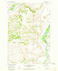
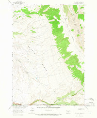
1960s Maps of Big Horn County, Montana
Explore 104 historic maps of Big Horn County from the 1960s. These maps offer a rare glimpse into what life looked like during the 1960s — showing old roads, neighborhoods, homes, and landmarks that have changed or disappeared over time.
Whether you're researching your family's past, planning a metal detecting trip, or studying how Big Horn County's landscape evolved across the 1960s, these high-resolution maps are a powerful tool for exploring the history of this region.
- Focus on a specific era: All maps on this page are from the 1960s, giving you a focused view of this time period.
- See what’s changed: Compare century-old streets, trails, and buildings to today's modern landscape using overlays and satellite layers.
- Research with precision: Use these maps for genealogy, historical research, land use analysis, or educational projects.
- View, download, or print: Maps are fully viewable online in high resolution, and can be downloaded or printed for your own records.
Start exploring Big Horn County's history through authentic maps from the 1960s. This is your window into the past.
Big Horn County, MT maps
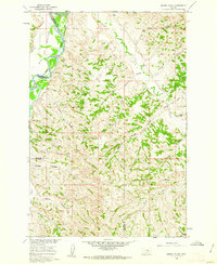
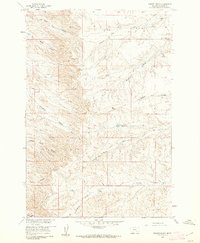
(104)- 1960 Map of Foster, 1962 Print
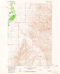
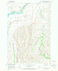
 1960 Foster1962 Print · USGSIn the Big Horn valley during the early sixties, the local economy relied on the river's waters and the heavy rail traffic through the plains. Genealogists and researchers can locate several rural schoolhouses, including Sorrel Horse Sch and Fairview Sch, along with the Two Leggins Canal and the siding at Foster.2 unique versions available
 - 1960 Map of Ninemile Point, 1962 Print
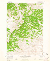
 1960 Ninemile Point1962 Print · USGSBig Horn County in the early sixties reveals a landscape of industrial agriculture and river-valley ranching. Genealogists and historians can trace family properties like Miller Ranch, locate the Nine Mile Sch, and study the rail-side Sugar Refinery at Whitman.2 unique versions available
 - 1960 Map of Chimney Creek, 1962 Print
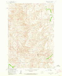
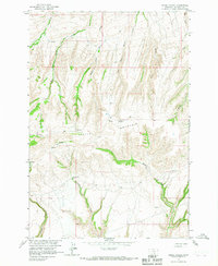
 1960 Chimney Creek1962 Print · USGSBig Horn County agriculture and natural drainages are captured here in the early sixties. Researchers can trace the irrigation path of Two Leggins Canal and family-named landmarks like Lone Tree Coulee and Chimney Creek.
 - 1960 Map of Schick Ranch, 1962 Print
 1960 Schick Ranch1962 Print · USGSBig Horn County ranching life is preserved here as it appeared in the early sixties, showing the remote homesteads of the Missouri River Basin. Genealogists and local historians can trace the foundations of Schick Ranch and Barber Ranch or follow the paths of Rotten Grass Creek and Mission Coulee.2 unique versions available
 - 1960 Map of St Xavier, 1962 Print
 1960 St Xavier1962 Print · USGSBig Horn County irrigation and river life are captured here in the early sixties as the Missouri River Basin project shaped the land. Genealogists can locate the St John Ch in St Xavier and trace the paths of Rotten Grass Creek and the Big Horn Canal.2 unique versions available
 - 1960 Map of Walker Hill, 1962 Print
 1960 Walker Hill1962 Print · USGSThe Bighorn River valley in the early sixties was a landscape of intensive irrigation and rail transport. Researchers can trace local landmarks like Walker Hill, the Chicago Burlington and Quincy railroad, and the Two Leggins Canal.3 unique versions available
 - 1960 Map of St Xavier NE, 1962 Print
 1960 St Xavier NE1962 Print · USGSThe Big Horn County ranching landscape comes into focus in the early sixties, showing the remote breaks and coulees of the Missouri River Basin. Trace the paths of Shoulder Blade Camp, East Dipping Vat Coulee, and Bear-in-Middle Creek.
 - 1960 Map of Hardin, 1962 Print
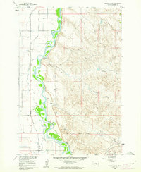
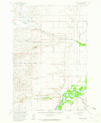
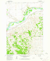
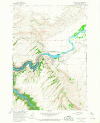
 1960 Hardin1962 Print · USGSHardin and the Bighorn River valley are shown here in the early sixties, a time of established irrigation and rail transport. Researchers can locate the Historical Monument (Site of Fort Custer), trace the Farmers Canal, and find local landmarks like St Joseph Ch.3 unique versions available
 - 1960 Map of Marsh Coulee, 1962 Print
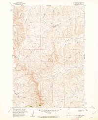
 1960 Marsh Coulee1962 Print · USGSThe Yellowstone River valley and the high ranch lands of Treasure and Big Horn counties are captured here in the early sixties. Genealogists and historians can trace local landmarks like Tullock Creek Sch, the Big Ox Bottom, and the Fountain of Youth.2 unique versions available
 - 1960 Map of Lemon Ranch, 1962 Print
 1960 Lemon Ranch1962 Print · USGSThe Big Horn County ranchlands are documented here in the early sixties, showing a landscape defined by timbered ridges and deep coulees. Researchers can trace remote routes like the Sorrel Horse Trail and find the namesake Lemon Ranch.2 unique versions available
 - 1960 Map of Mission Coulee, 1962 Print
 1960 Mission Coulee1962 Print · USGSThe ranching landscapes of Big Horn County are captured here in the early sixties, showing a world of remote homesteads and rugged drainages. Genealogists can locate family holdings like Siemion Ranch and Wolf Ranch alongside landmarks like Rattlesnake Butte.2 unique versions available
 - 1960 Map of Waco, 1962 Print
 1960 Waco1962 Print · USGSThe Yellowstone river valley in the early sixties was a landscape of rail-fed ranching and rugged coulees. Researchers can trace the path of the Northern Pacific through Waco or locate family landmarks like the Kemph Ranch and Bergum Coulee.2 unique versions available
 - 1960 Map of Prante Ranch, 1962 Print
 1960 Prante Ranch1962 Print · USGSBig Horn County ranching country is captured here in the early sixties, showing a landscape defined by seasonal water and remote trails. You can trace early family-named landmarks like Prante Ranch and the winding paths of Good Horse Coulee or Onion Creek.
 - 1960 Map of Mission Creek, 1962 Print
 1960 Mission Creek1962 Print · USGSThe Yellowstone and Bighorn rivers met in 1960 at a critical junction of rail and ranching. Genealogists and local historians can trace the irrigation networks of the Waco Custer Canal or find family landmarks like Steele Ranch and Wolfe Ranch.3 unique versions available
 - 1960 Map of Hardin SW, 1962 Print
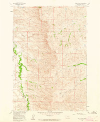
 1960 Hardin SW1962 Print · USGSBig Horn County in the early 1960s is defined by the braided Bighorn River and the rugged coulees of south-central Montana. Genealogists and local historians can locate early ranching landmarks like Prante Ranch, Kopac Camp, and Wild Horse Spring.2 unique versions available
 - 1962 Map of Sheridan
 1962 Sheridan1962 Print · USGSThe Big Horn Mountains and Powder River country are captured here in the early sixties as energy production and ranching shaped northern Wyoming. Researchers can locate specific sites like the Kleenburn Coal Tipple, Eaton Bros Ranch, and the Fort McKenzie Veteran Hospital.
 - 1962 Map of Cody
 1962 Cody1962 Print · USGSBig Horn Basin energy and agriculture define this mid-century look at Wyoming’s northern frontier. Local historians can trace the irrigation and rail networks connecting Cody and Powell to major energy sites like the Oregon Basin Oil Field.
 - 1964 Map of Two Point, 1966 Print
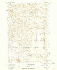
 1964 Two Point1966 Print · USGSThe high country along the Montana-Wyoming state line was a wilderness of ridges and canyons in the mid-1960s. Trace the Crow Indian Reservation Boundary and the steep descents into Garvin Basin or Devil Canyon.2 unique versions available
 - 1964 Map of Peyote Point, 1967 Print
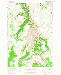 1964 Peyote Point1967 Print · USGSBig Horn County, Montana, is shown here in the mid-1960s as the creation of the Yellowtail Reservoir began reshaping the Bighorn Canyon. Trace local history through landmarks like Absaloka Youth Camp, Hunter Cabin, and the ancient Soldier Trail.
 - 1964 Map of Mountain Pocket Creek, 1967 Print
 1964 Mountain Pocket Creek1967 Print · USGSThe Crow Indian Reservation in Big Horn County during the mid-1960s reveals a landscape of industrial development and irrigation. Trace the energy and water infrastructure of the era through the Soap Creek Field, Bighorn River, and Flowing Well.2 unique versions available
 - 1964 Map of Ranchester, 1967 Print
 1964 Ranchester1967 Print · USGSRanchester and the surrounding Tongue River valley are shown in the mid-1960s, where the railroad and irrigation systems define the local landscape. Researchers can trace the path of the Chicago Burlington and Quincy railroad and find local landmarks like Mikado, City Park, and the complex Wolf Ditch network.2 unique versions available
 - 1964 Map of Big Ice Cave, 1967 Print
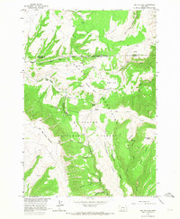 1964 Big Ice Cave1967 Print · USGSThe Pryor Mountains during the mid-1960s are shown in detail, documenting the high-country ranching and geology of the Montana-Wyoming border. Trace the location of family landmarks like Greenough Ranch and geological curiosities like Big Ice Cave and Crater Ice Cave.2 unique versions available
 - 1964 Map of Little Finger Ridge, 1967 Print
 1964 Little Finger Ridge1967 Print · USGSBig Horn County is captured here in the mid-1960s as the recently filled Yellowtail Reservoir reshaped the canyon floor. Researchers can trace the Crow Indian Reservation Boundary across landforms like The Buffalo Pasture and the Natural Bridge.
 - 1964 Map of Yellowtail Dam, 1967 Print
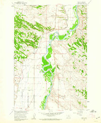
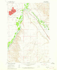
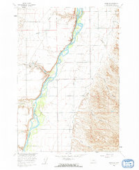
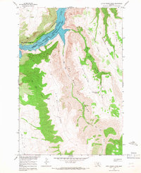
 1964 Yellowtail Dam1967 Print · USGSBig Horn County was undergoing a major industrial shift in the mid-sixties as the newly completed dam reshaped the canyon floor. Researchers can locate the Fort Smith Ruins, trace the Big Horn Canal, and see the early footprint of Fort Smith.2 unique versions available
 - 1964 Map of Horse Coulee, 1967 Print
 1964 Horse Coulee1967 Print · USGSBig Horn County during the mid-1960s was a landscape of remote drainages and mountain springs within the Crow Indian Reservation. Genealogists and historians can trace the intricate water networks of Pitchfork Creek, Hoodoo Creek, and the high reaches of Little Mountain.
Showing maps 1-25 of 104
Top cities of Big Horn County
- Hardin historical maps
- Busby District historical maps
- Pryor historical maps
- Lodge Grass historical maps
- Garryowen historical maps
Frequently asked questions
- What are the different types of historical maps available for Big Horn County?
- What is the oldest map of Big Horn County?
- Where can I purchase historical maps of Big Horn County for my home or office?
- Where can I download high-res historical maps of Big Horn County?
- Are there historical topographic maps available for Big Horn County?
- Is there historical aerial imagery available for Big Horn County?
- Where are historical maps of Big Horn County sourced from?