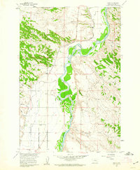
1960 Map of Foster
USGS Topo · Published 1962About this map
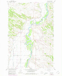
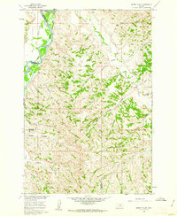
The Bighorn River carves a complex, braided path through this Big Horn County landscape, defining the local irrigation and transport networks of the early 1960s. The Chicago Burlington and Quincy Line runs parallel to the river valley, supporting small sidings and settlements like Foster and Kingley. This region is characterized by a high concentration of rural education sites, including the Sorrel Horse Sch, Fairview Sch, and Community Sch, which served the outlying ranching and farming homesteads. Water management is central to the area's layout, evidenced by the Two Leggins Canal and the Two Leggins Tunnel, which divert water to the terrace lands above the river bottom. To the east, the terrain rises into dissected coulees and ridges, drained by the North Cottonwood Creek and the South Cottonwood Creek, while landmarks like Wagon Box Coulee name the local topography.
Find a feature on this map
24 named features on this map. Tap any name to fly to it.
Don’t see what you’re looking for? This feature index may not catch every label — zoom into the map to look around manually.
Map Details
Editions of this 1960 Foster Map
2 editions found
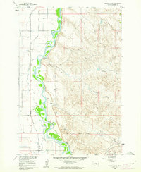
Other maps of this area

1894 · Fort Custer
USGS Topo · 1:125,000

1954 · Hardin
USGS Topo · 1:250,000

1954 · Forsyth
USGS Topo · 1:250,000

1957 · Hardin
USGS Topo · 1:250,000

1957 · Forsyth
USGS Topo · 1:250,000

1958 · Forsyth
USGS Topo · 1:250,000

1958 · Hardin
USGS Topo · 1:250,000
1960 · Ninemile Point
USGS Topo · 1:24,000
1960 · Chimney Creek
USGS Topo · 1:24,000
1960 · Marsh Coulee
USGS Topo · 1:24,000