1960s Maps of Blaine County, Montana
Explore 22 historic maps of Blaine County from the 1960s. These maps offer a rare glimpse into what life looked like during the 1960s — showing old roads, neighborhoods, homes, and landmarks that have changed or disappeared over time.
Whether you're researching your family's past, planning a metal detecting trip, or studying how Blaine County's landscape evolved across the 1960s, these high-resolution maps are a powerful tool for exploring the history of this region.
- Focus on a specific era: All maps on this page are from the 1960s, giving you a focused view of this time period.
- See what’s changed: Compare century-old streets, trails, and buildings to today's modern landscape using overlays and satellite layers.
- Research with precision: Use these maps for genealogy, historical research, land use analysis, or educational projects.
- View, download, or print: Maps are fully viewable online in high resolution, and can be downloaded or printed for your own records.
Start exploring Blaine County's history through authentic maps from the 1960s. This is your window into the past.
Blaine County, MT maps
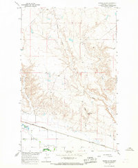
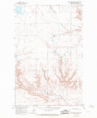
(22)- 1964 Map of Ragland Bench, 1966 Print
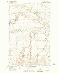
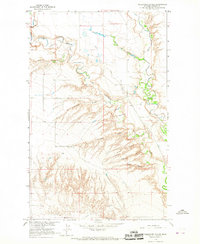
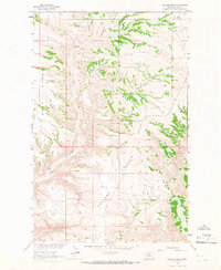 1964 Ragland Bench1966 Print · USGSBlaine County in the mid-1960s was a landscape defined by sharp plateaus and deep drainage channels during the Missouri River Basin development era. Researchers can trace the sprawling elevations of Ragland Bench and Golf Bench alongside the winding Black Coulee.
 - 1964 Map of Chase Hill, 1966 Print
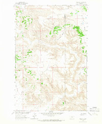 1964 Chase Hill1966 Print · USGSNorth-central Montana's high-plain benchlands are captured in the mid-1960s at the intersection of Chouteau and Blaine counties. Local historians can trace the drainage patterns of Wolf Coulee and Black Coulee between landmarks like Greens Bench and Chase Hill.
 - 1964 Map of Threemile Reservoir, 1967 Print
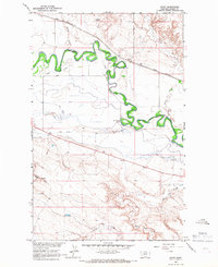
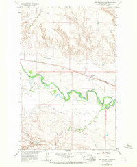
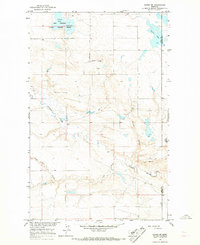
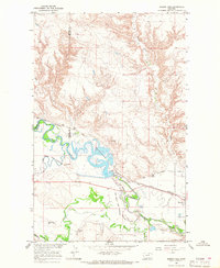
 1964 Threemile Reservoir1967 Print · USGSNorth of the Milk River in the mid-sixties, this area of Blaine County shows the development of the Missouri River Basin. Genealogists and historians can trace the Fort Belknap Indian Reservation boundary and locate the Sacred Heart Ch near Threemile Reservoir.
 - 1964 Map of Wayne Creek SE, 1967 Print
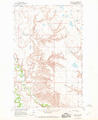
 1964 Wayne Creek SE1967 Print · USGSBlaine County's coulee country is captured in the mid-1960s during a period of Missouri River Basin development. Researchers can trace land use through features like Wayne, Mud Lake, and the winding paths of Wayne Creek and Savoy Creek.
 - 1964 Map of Coburg, 1967 Print
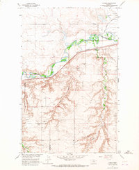
 1964 Coburg1967 Print · USGSThe rural plains of northern Montana are captured here in the 1960s, centered on the railroad siding of Coburg. Genealogists and historians can trace the Great Northern rail line and locate the Horn Cem near the banks of the Milk River.
 - 1964 Map of Fort Belknap Agency, 1967 Print
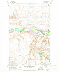
 1964 Fort Belknap Agency1967 Print · USGSThe Fort Belknap Indian Reservation in the mid-sixties is centered on the Fort Belknap Agency along the winding Milk River. Researchers can trace the path of the Old Railroad Grade and locate landmarks like Snake Butte and the local Cem.
 - 1964 Map of Big Coulee, 1967 Print
 1964 Big Coulee1967 Print · USGSBlaine County ranchlands and the western edge of the reservation appear in the mid-sixties as part of the Missouri River Basin project. Researchers can trace the Fort Belknap Indian Reservation Boundary and locate local landmarks like Snake Butte and the Snake Butte Sch.
 - 1964 Map of Grable Coulee, 1967 Print
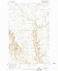
 1964 Grable Coulee1967 Print · USGSBlaine County's river valley and northern prairie are captured in the mid-1960s as irrigation and rail infrastructure shaped the plains. Researchers can trace the path of the Great Northern railroad and locate water sources like Thirtymile Reservoir and Grable Coulee Spring.
 - 1964 Map of Savoy, 1967 Print
 1964 Savoy1967 Print · USGSThe Milk River valley and the Fort Belknap Indian Reservation are shown in the mid-1960s, a period of managed irrigation and rail-side growth. Trace old property lines near Savoy, the Great Northern railroad, and the Fort Belknap Cem.
 - 1964 Map of Rabbit Hills, 1967 Print
 1964 Rabbit Hills1967 Print · USGSBlaine County in the mid-sixties shows a landscape shaped by water management and resource extraction in the Missouri River Basin. Researchers can trace the rugged topography of Rabbit Hills and locate specific sites like the Mines and Twin Reservoir.
 - 1964 Map of Telescope Coulee, 1967 Print
 1964 Telescope Coulee1967 Print · USGSNorth-central Montana ranching country is shown here in the 1960s, defined by its intricate coulees and early irrigation works. Researchers can trace land use through features like the Milk River Mine, the settlement of Yant, and the Fort Belknap Canal.
 - 1964 Map of Weigand Reservoir, 1967 Print
 1964 Weigand Reservoir1967 Print · USGSThe northern Montana prairie comes into focus during the 1960s, showing the intersection of the Fort Belknap Indian Reservation and the county line. Trace the local hydrology through landmarks like Weigand Reservoir, Old Woman Lake, and a rural Mine.
 - 1964 Map of Fort Belknap Siding, 1967 Print
 1964 Fort Belknap Siding1967 Print · USGSBlaine County ranching and rail transport are centered along the Milk River in the mid-1960s. Trace the irrigation network of the Fort Belknap Canal and the operations at Fort Belknap Siding on the Great Northern line.
 - 1964 Map of Havre SE, 1967 Print
 1964 Havre SE1967 Print · USGSThe Milk River valley in Hill County was a critical corridor for the Great Northern railway during the mid-sixties. Local historians can trace early prairie infrastructure like the Davey Sch, the Roadside Park, and several wells scattered across the coulees.2 unique versions available
 - 1964 Map of Lohman SE, 1967 Print
 1964 Lohman SE1967 Print · USGSBlaine County in the mid-1960s shows a landscape of river-valley agriculture and high-prairie coulees. Genealogists and historians can locate the North Yantic Sch, burial sites at St Gabriel Cem, and the path of the Great Northern railroad.
 - 1964 Map of Harlem, 1967 Print
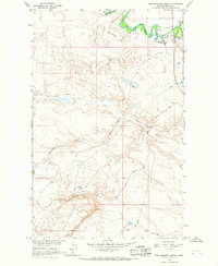
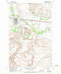
 1964 Harlem1967 Print · USGSThe northern Milk River valley comes into focus during the mid-sixties, showing the intersection of the Fort Belknap Indian Reservation and the town of Harlem. Researchers can trace the path of the Great Northern railway, find the town Cem, and locate the Rodeo Ground.
 - 1964 Map of Reservoir Coulee, 1967 Print
 1964 Reservoir Coulee1967 Print · USGSBlaine County ranchlands are documented in the mid-1960s, showing a landscape defined by the deep erosion of the Missouri River Basin. Researchers can trace the winding paths of Lodge Creek and the dramatic relief of Reservoir Coulee across the plains.
 - 1964 Map of Lohman, 1967 Print
 1964 Lohman1967 Print · USGSNorthern Montana river valley life in the mid-sixties centers on the rail-and-water corridor of the Milk River. Trace rural education and energy development through landmarks like Miewald Sch, the Great Northern rail line, and a Gas Compressor Station.
 - 1964 Map of Chinook, 1967 Print
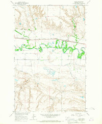
 1964 Chinook1967 Print · USGSChinook and the Milk River valley thrive in the mid-1960s as a center of Montana rail and irrigation. Researchers can trace the town's industrial footprint through the Oil Refinery, locate family landmarks like the East Chinook Sch, or follow the Great Northern line.
 - 1964 Map of Havre NE, 1967 Print
 1964 Havre NE1967 Print · USGSNorthern Montana prairie and the Thibadeau Lake National Wildlife Refuge appear here in the mid-1960s. Trace the seasonal waters of Martin Lake or follow the deep drainage of Redrock Coulee and Coal Coulee across the plains.
 - 1964 Map of Zurich, 1967 Print
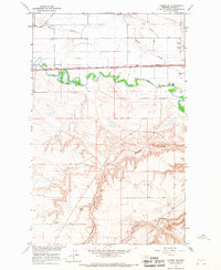
 1964 Zurich1967 Print · USGSMilk River irrigation and the Great Northern railroad corridor dominate this Blaine County landscape in the mid-1960s. Researchers can trace the path of the Great Northern through Zurich, locate the North Fork Sch, and study the intricate network of the Fort Belknap Canal.
 - 1964 Map of Dodson Dam, 1968 Print
 1964 Dodson Dam1968 Print · USGSPhillips County in the mid-1960s was a hub for Milk River irrigation and Great Northern rail traffic. Researchers can trace the Fort Belknap Indian Reservation Boundary, locate the Cem at Graveyard Hill, and follow the Dodson North Canal.
End of results
Showing maps 1-22 of 22
Top cities of Blaine County
Frequently asked questions
- What are the different types of historical maps available for Blaine County?
- What is the oldest map of Blaine County?
- Where can I purchase historical maps of Blaine County for my home or office?
- Where can I download high-res historical maps of Blaine County?
- Are there historical topographic maps available for Blaine County?
- Is there historical aerial imagery available for Blaine County?
- Where are historical maps of Blaine County sourced from?